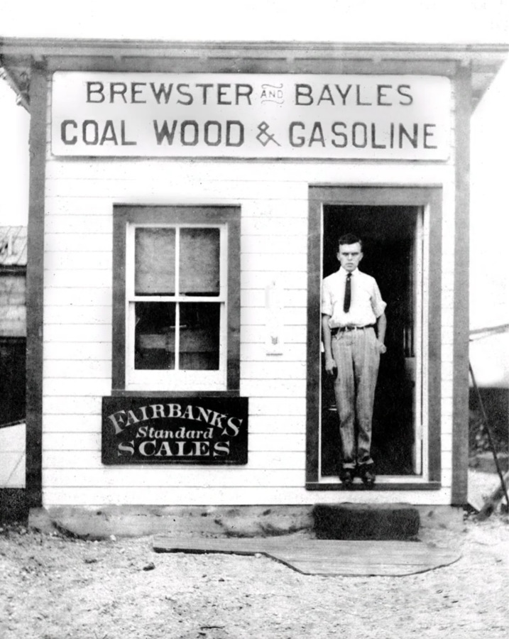
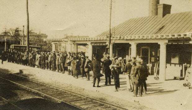
The rise of automobiles led to less of a need for railroads and eventually the abandonment in 1928 of the Marlborough Street Railway Line. This led to the improvement of roads across the city and a rising of auto-related facilities such as gas stations and auto-shops throughout Marlborough. These roads still exist today.
The establishment of railroads in the 1850s allowed for Marlborough’s agricultural and shoe-industry products to reach new markets. With easier access to trade, Marlborough's growth during the 19th century was exponential.
After the Queen Anne’s War in 1713, farming in Marlboro began to reach new markets. The settlers grew out of subsistence methods and started using nature to their advantage for economic gains. The most prominent farming activity in Marlborough was focused on apple orchards. Cider and brandy became Marlborough’s largest exported goods throughout the 18th century and sparked the market revolution in Marlborough.
In 1675, the Marlborough meeting house was the subject of an attack from the Indians during the King Phillip War. Though no one was killed, the Indians destroyed much of the infrastructure of the town, as well as burned the crops and killed the livestock of the town inhabitants. The King Phillip War ended a year later in 1676 and although the town was able to recover, the attack on the Marlborough meeting house caused tensions to rise between the Colonists and the Indians from the surrounding areas.
In May of 1656, a group of men from Sudbury, led by John Howe, Edmund Rice, and John Ruddocke went to the Massachusetts General Court to petition for more land. They received a grant of 6 sq. miles of land southwest of Sudbury and named it Whipsufferadge, after the Indian Hill Whipsuffenicke. This land would later go on to be known as Marlborough. The environment of this area would forever be changed.
In 1944 a massive hurricane struck the island causing millions of dollars in damage and killing two individuals. Unsurprisingly, homes near the outwash and on the water were the hardest hit and some were even washed away. As the island rebuilt in the wake of these storms, its layout was altered to better equip it for future disasters. These precautions helped it to combat damage sustained during Hurricane Sandy in 2012.
Beginning in 1835, hundreds of Methodists traveled to Edgartown each summer to repent at “campground meetings;” living originally in nine improvised tents around a speaker’s platform, that was made of driftwood, the Methodists found the island’s surroundings to be uplifting. Held each year, the meetings rapidly gained popularity. The island’s first true tourists, many of the Methodists at first rented houses before becoming property owners. This contingency would go on to build 318 gingerbread house type homes in Oak Bluffs that together were called, “Cottage City.” To support these homes, many of which still exist to this day, shops and restaurants were built and slowly the Oak Bluffs of today was born.
Cleveland E. Dodge buys the factory site for Dodge Fibers, a Teflon/plastics producing company. After this point, the factory site would forevermore be used as a plastics company, which played a major role in the PFOA crisis.
Walter A. Wood Mowing and Reaping Machine Co. was bought. This company employed 2,000 people by 1890 and was developing approximately 90,000 machines. This was one of the most successful companies Hoosick Falls had seen and left a lasting impact on the town.
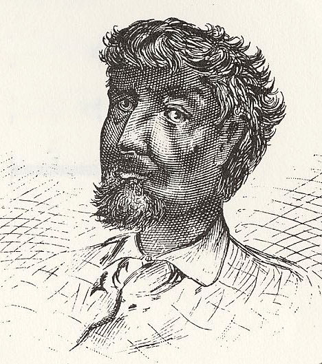
Jean Baptiste Point du Sable was the first non-native settler of Chicago. Du Sable set up a successful fur trading post which involved interaction between settlers and the indigenous Potawatomi tribe who hunted beaver. Du Sable built his home at the mouth of the Chicago river.
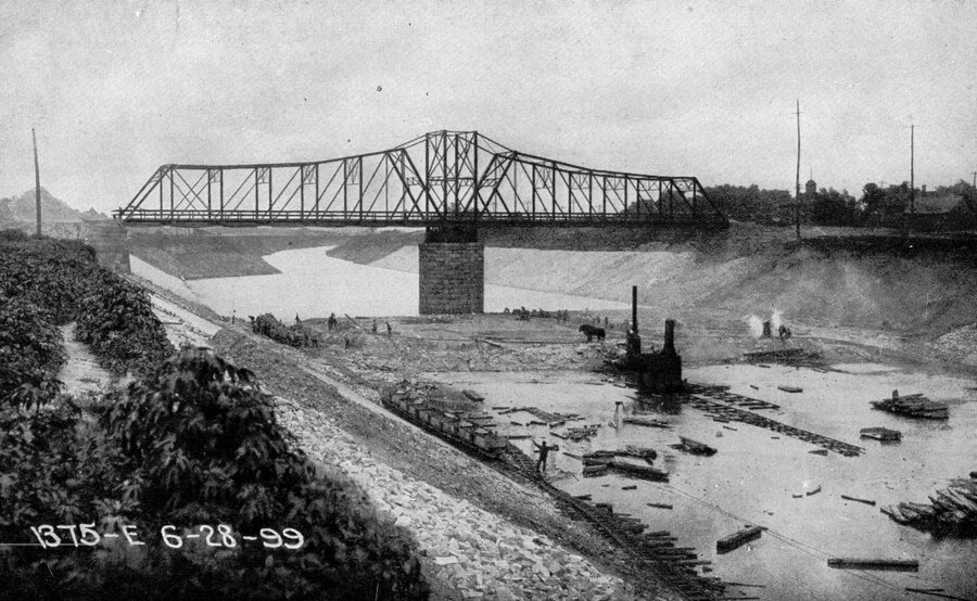
Prior to the canal's construction, nearly all of the city's sewage was pumped directly into the lake. This posed a problem once the water cribs were built because drinking water came from the lake through these water cribs. Fears of Typhoid and Cholera led the city to construct a massive drainage canal to divert sewage all the way to the Des Plaines River in order to preserve drinking water.
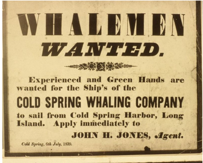
An act of incorporation, allowed the opening of the Cold Spring Harbor whaling company. This set up a thriving whaling industry in Cold Spring Harbor, that operated as the epicenter of the village's economy. This whaling period flourished in Cold Spring Harbor until 1862, when the last of the 9 whaling voyages that left from Cold Spring Harbor occurred.
In 1907, the John C. Walters' property was divided into 38 plots and 3 streets were laid out. These roads made transportation through the village easier, and the plots of lands had homes built on them and promoted migration to Cold Spring Harbor. This is the first subdivision of land in Cold Spring Harbor that is classified as suburbanization.
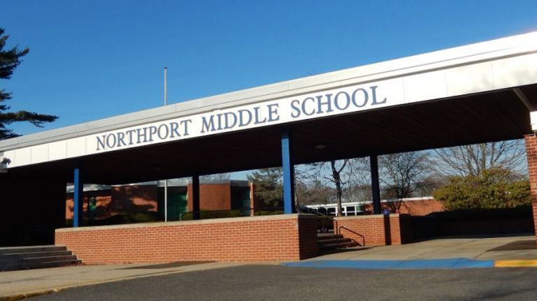
Due to high levels of mercury and other toxins in the waters, Northport Middle School was shut down. The Northport Power Station is suspect, however they claim that they have not found any evidence of toxins in the air. This is up for debate as to whether their claim can be given any weight, as they have in the past hidden their pollution of the environment from the public.
Steers and Steers Gravel Company was contracted to mine gravel in Northport. This gravel was to be used for construction in New York City. Due to the mining going unchecked for years, a large depression was carved into the land. The mining only ceased once the residents became unhappy with how expansive the depression had become.
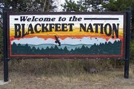
In 1895, the Blackfeet Indigenous Tribe sold the western part of their land to the United State Government for 1.5 Million dollars. This is the land we now know today as Glacier National Park. In addition to monetary settlement the Blackfeet were also supposed to be able to hunt, fish and cut down timber for domestic purposes to sustain their tribe. This part of the agreement was no longer honored by the US government when the park was established in 1910, as the land was no longer considered public. This was a huge blow to the success of the tribe, and still deeply effects them today. Since the creation of the park the Blackfeet have made numerous claims to the Government asking for the rights to hunt and fish on the land that is theirs. To date, the only change that has been made is that Indigenous peoples do not need to pay to enter the park.
The decline of shipbuilding brought the increase of a number of minor industries. The biggest of these two were rubber and cordwood, which obviously had a number of environmental tolls. The rubber factory was placed on the shore and likely dumped in the Long Island Sound. The cordwood demand brought local deforestation and was aided by rail road expansion, which allowed more would to be brought in. This period of random industry died out in favor of wealthier suburbia by the early 1900s.
In the late 1800s the rail road would expand to eastern long island and connect locations like the Three Village area to New York City. This facilitated increased industrialization and then later increased suburbanization of the area. It also required the flattening of land, especially close to the hilly North Shore.
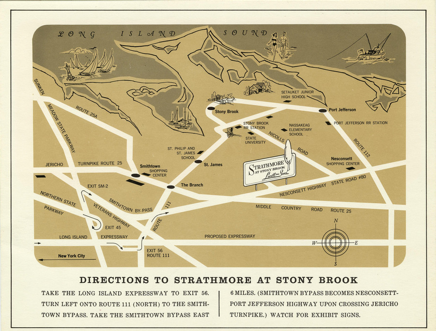
After the success of Levittown, Levitt and Sons, Inc. began looking for other places to construct planned communities. The Strathmore was one of these smaller planned communities, which they built in Stony Brook because they saw the growing popularity of suburbanization in the area. This likely brought mush of the same environmental toll that the original Levittown brought.
In winters in the pre-automobile era, New England towns would often compact the snow on town roads to make it easier for sleighs and sledges to travel.
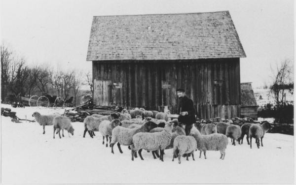
This photo is from the early 20th century, but reflects the dominant role that sheep played in Vermont in the 1830s and 1840s, when there were over one million sheep in the state.
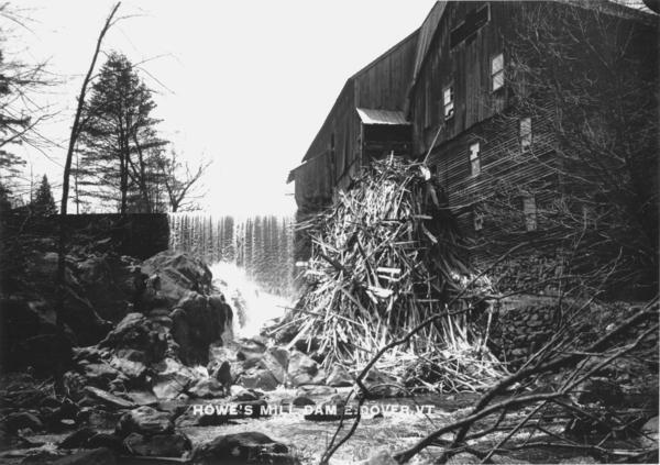
A sawmill operated on this site on the falls of the Rock River since 1792, and was the origins of the settlement of East Dover. This water-powered mill cut timber for construction, and also boards for tubs and for chairs, up until it burned in 1936. At that time it was the only "industry" in the town, employing 12 men.
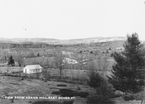
Compare the picture to the satellite view on the map below; the fields in the foreground and background have been abandoned, for the most part, and the forest that had been cleared has regrown. The building in the foreground was a one-room schoolhouse.
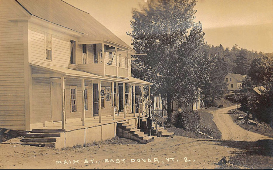
This is the center of town in East Dover, Vermont, most likely in the 1920s. Up until the late 1940s, there were no paved roads in the town, which produced nearly impassable roads in the spring "mud season" when frozen roads thawed. As the gasoline pump indicates, cars and trucks were in increasingly wide use. The post office is still in this building nearly a century later.