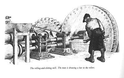
Because of Rome’s connection to the world through natural waterways, man made waterways, and by this point railroads, the city of Rome became a city focused oh heavy industry. In 1924 Rome produced 10% of all the copper manufactured in the United States. The Revere Copper Company, Rome Manufacturing Company, and Rome Steel and Iron company dominated the industry in the city. Obviously, this had detrimental effects to the landscape, particularly the water quality.
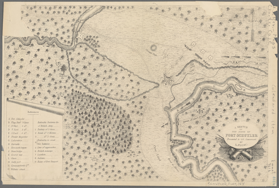
The original name for the area to become the city of Rome New York was De-o-wain-sta, translated as “carrying place”. The local American Indians from the Six Nations names the area “carrying place” because the area was used as a portage between the Mohawk River and Wood Creek. The Mohawk River runs through central NY into the Hudson then to the Atlantic Ocean. Wood Creek ran in a different direction instead flowing west ultimately flowing into Lake Ontario. This portage, about a mile long, effectively connected the Great Lakes waterway to the Atlantic Waterway. This strategic importance led to the construction of Fort Stanwix, a canal connecting Woods Creek and the Mohawk, and the modern city.
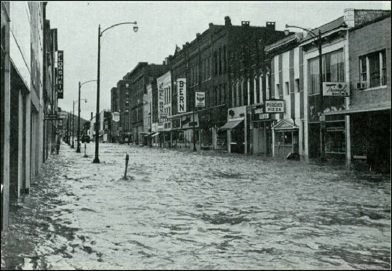
Hurricane Agnes hit the northeast, especially New York, hard because of the earlier storms having already affected the area, and then the hurricane made all of the runoff even worse. This led to devastating floods all over the Northeast, with the water levels being the record levels in places like Chemung River and Susquehanna River.
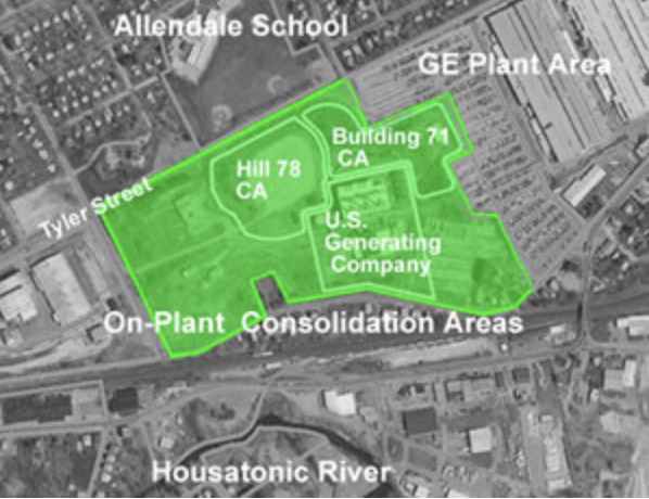
Hill 78 is an On Plant Consolidation area used by General Electric as a dumpsite for PCB contaminated river sediment. In 1999 General Electric was ordered by the EPA to remediate a small section of the Housatonic River that they had previously contaminated. GE dredged the contaminated sediment from the river bottom and constructed this OPCA for the containment of 134,500 cubic yards of materials. The area encompasses 6 acres which adjoin a high traffic road and Allendale Elementary School.
"The lake has become a cesspool." This was said of Madison's Lake Monona by Alexius Baas of the Clean Lakes association. On a summer night in 1931, citizens gathered at a meeting hosted by the association to demand that Madison clean up Lake Monona, which over the past decades had served as a reservoir for sewage and wastewater effluent. Namely, the Burke sewage treatment plant was blamed for this pollution-- a plant which had been primarily receiving heavily polluted and toxic wastewater from the Oscar Mayer meat packing company and discharging it into the lake. Baas even reported that the city had permitted the plant to pour "raw sewage into Monona without even sending it through the inadequate treatment of the plant" and also claimed that "3,200,000 gallons of effluent is being dumped into Lake Monona daily." The lake was described several times as having a "stench." 80 people attended the meeting, with the purpose of calling on the city to shut down the Burke treatment plant and address the pollution affecting the lake.
In 1936, the first addition of a new sewage treatment plant, Nine Springs, was completed, and that development allowed for the Burke plant to be shut down.
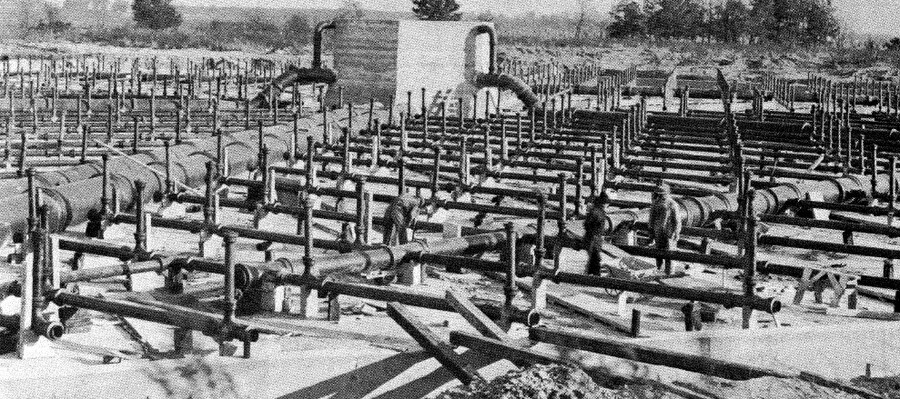
The picture attached features Burke sewage treatment plant's 'trickling filters,' built in 1916, which were credited as the first to be built in the country.
In 1954, Dutch elm disease was first identified in Madison, WI, after having been introduced to the United States in the 1930s. As the disease continued to spread, more elm trees began to die off, causing Madison to seek out a solution. At the time, most affected areas in the country had instated sanitation programs where DDT was sprayed on the affected acres. However, when this solution was being considered for Madison in 1962, professors at UW-Madison had found in their research that the spraying of DDT caused high levels of bird loss. Additionally, Rachel Carson's "Silent Spring" had just been released. This sparked a lot of public discourse on the issue. On October 28, 1962, a newspaper article was published which highlighted different opinions on the spraying of DDT. One professor of entomology at UW-Madison said, "If elms are lost in our particular neighborhood, they would be more sorely missed than robins, I'm sorry to say." Another professor, one that had participated in the bird study, said "We don't necessarily have to treat between robins and elms." He went on to explain that there are alternatives to spraying and that he hopes will be thoroughly explored before resorting to DDT.
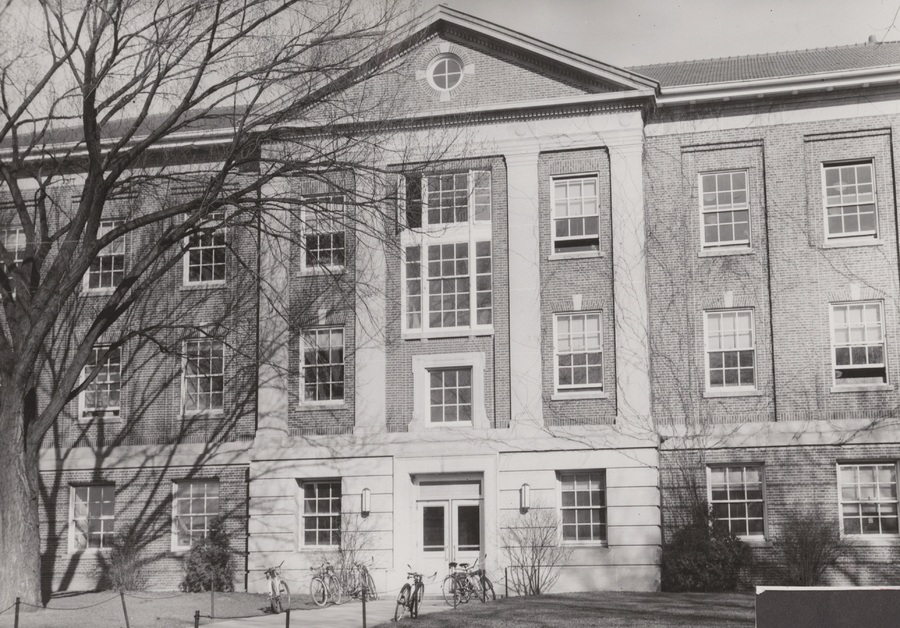
In 2018, the disease killed a 140-year-old tree on UW-Madison's campus which had been lovingly nicknamed "Elmer." The picture below is from around the 1950s and shows Elmer on the left.
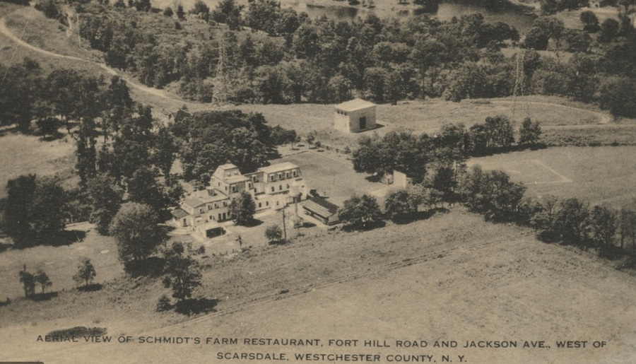
Prior Scarsdale's role as a suburban neighborhood, it was a rural area in which the majority of the inhabitants worked on farms. However, the farming industry was not too successful, compared to neighboring towns, because Scarsdale was not in close proximity to a navigable water way. Therefore, trading and selling crops to New York City dwellers was a bit challenging for these farmers because the transportation system during this time period was subpar. Many of the Scarsdale farmers would grow and cultivate for themselves, their family and community members.
After the second World War concluded, men finally returned to their wives on the American home front and wanted to start a family. Large cities were crowded with people and there was really a push to move to the suburbs, where the quality of life may be better. As a result, many families from all over, but primarily from New York City, settled Scarsdale, because they were attracted to its close proximity to NYC and its space. Because of the sudden population growth, the town constructed many house and public infrastructure building in order to account for all of the people and future generations. All of the new building created an affluent neighborhood, where upper class individuals could enjoy the luxuries of suburban life, including an esteemed school district and many places to worship.
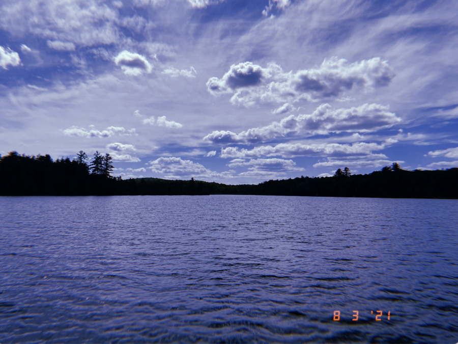
The shoreline of Canada Lake is separated by private and state land. There is a large portion of the shoreline on the west side of the lake and into Lily Lake that is completely untouched. This untouched land is protected under the Forever Wild clause and so nothing can be built on that land. There is no more private land available on the lake, so no new houses can be built, only houses built in existing sites are allowed. There are also some campsites on the state land which are only accessible by boat which bring visitors into the area.
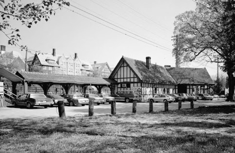
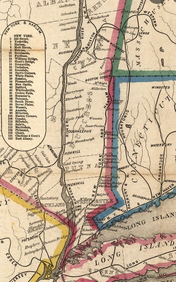
At the end of 1844, the construction of the railroad to Scarsdale, NY was finally completed. This crucial development in transportation allowed for New York City dwellers to come to the suburbs more often and efficiently. While Scarsdale was initially a place where New Yorkers had their summer home in, it eventually evolved into an affluent suburban neighborhood where workers would live and commute to the city for employment. The completion of this railroad not only boosted the economy, but it accounted for the success of the growth of Scarsdale.
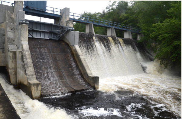
The dam at Stewart's Landing was first built of stone to generate power for a saw mill. It has more widely used to control the water level of Canada Lake and the connecting lakes, which has a history of flooding and wrecking cabins. In 1897, a "flow line" was drawn on a map indicating the height at which the water should not pass. When a large storm is coming the dam can be opened to let water out in preparation. The construction of the dam on state land is a small obstruction of the natural beauty, but it brings people to the lake. Before the dam there was no way to get to Canada Lake directly from the west, but a road was added connecting Stewarts Landing and Stratford. The dam is also accessible by roughly 40 or less horsepower engines after navigating a winding, rocky path. The dam has become a local hot spot during the summer months for those who don't have camps on the lake, who come to swim in the water on the opposite side when the dam is closed.
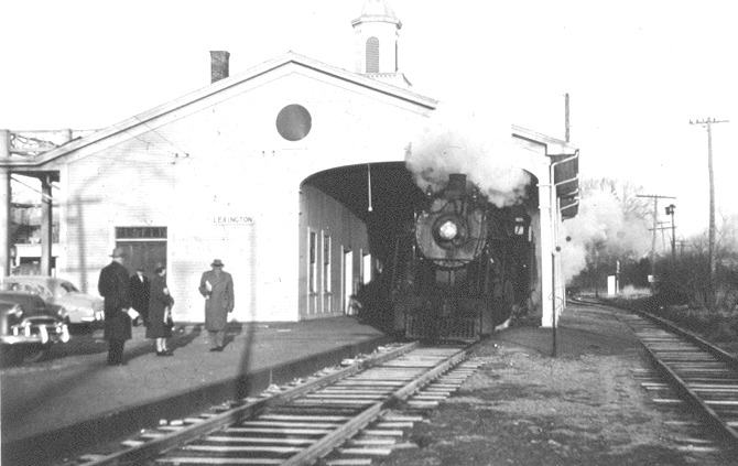
Railroads were first introduced in Arlington, Massachusetts on March 24, 1845, with the creation of the Lexington and West Cambridge Branch Railroad. (Arlington was originally called West Cambridge until it was changed on April 13, 1867). The railroad was first opened for public travel in August of 1846. With the creation of this railroad, the people of Arlington had transportation to Boston and the other important cities, for the first time. Prior to the building of railroads, the only means of transportation to Boston from suburban towns would have been by stagecoach. The introduction of the railroads allowed for a faster, more efficient, mode of transportation for all people in the Greater Boston area. By this time, numerous other railroads had been built around Boston, and the towns and suburbs surrounding Boston were now interconnected to each other. All the suburban towns around the outskirts of Boston began to have large commuter populations and soon were coined the name "railroad suburbs". (O'Connell, pg 42) The Lexington and West Cambridge Branch Railroad allowed Arlington to become one of the many railroad suburbs in the Boston area. Nowadays, the railroad is no longer in use. However, some of the tracks are still displayed in the same position as they were built in 1845, in the center of town. This railroad will forever be a piece of Arlington's history.
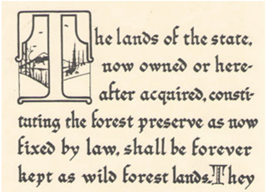
In 1894 the "Forever Wild" clause was added to the New York State constitution which protected land owned by the state in the Adirondacks. The Adirondacks, while called a park, is not a national park, it is however divided into private and state land. Out of 6 million acres of land, 3.4 million acres of it is privately owned. The rest of the land was subject to harsh deforestation by the logging and timber industry, so the clause was added to protect against this. The clause states that the cutting and sale of trees within the protected land is strictly prohibited. Unlike many restriction clauses, this clause was strictly enforced where it could be.
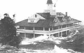
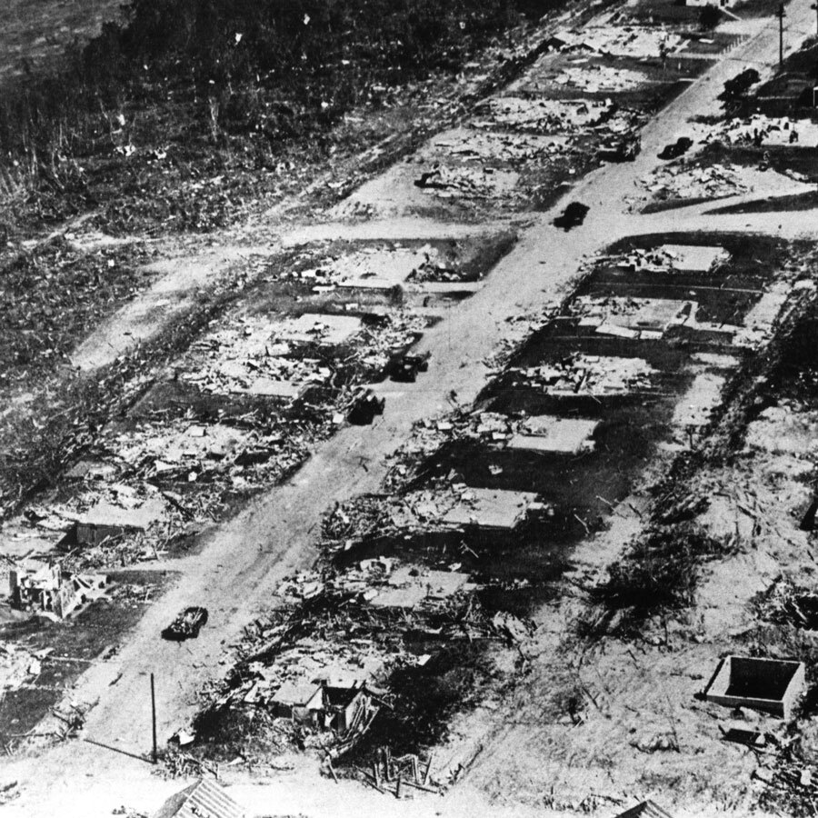
One of the deadliest tropical cyclones to hit New England. A category 5 hurricane that traveled from the coast of Africa and landed on Long Island as a category 4 hurricane on September 21. The estimated property losses were 57,000 homes and around $347 to $410 million in property damage ($4.7 billion by 2018). The effects of this hurricane on nature and the surrounding terrain could still be seen by 1951 in the form of mangled trees and shattered buildings.
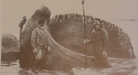
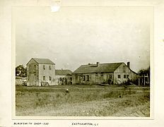
East Hampton was originally an agricultural settlement which soon was replaced with whaling around 1652. Settlers discovered beached whales often appeared on the shore and would harvest the oil and meat. Eventually residents would no longer be content with harvesting from beached whales and begin hunting whales that came too close to the shore. At the height of the whaling industry in 1847, around 60 ships would be docked at Sag Harbor which is referenced in Moby Dick. After 1847, the industry fell off due to the rise of fuel products.
Lion Gardiner purchased Gardiner’s Island in 1639 from the Montaukett people. This would become the first English settlement in NY. In June 12, 1640; nine puritan families from Massachusetts landed in present day Conscience Point and migrated to East Hampton eventually settling in 1649.
The Worcester tornado was the strongest tornado to ever hit New England, traveling for nearly 46 miles with wind speeds of almost 300mph. This tornado devastated the city of Worcester, killing 94 people and leaving over $53,000,000 in property damage. The tornado was particularly devastating in newer areas of the city, where postwar suburban expansion led to such a high demand for houses that many neighborhoods were built on slabs without basements.
In 2020, the Chesapeake Bay Foundation along with the Maryland Watermen's Association, Anne Arundel County, and a few Virginia cattle farmers, sued the EPA for renouncing its responsibilities under the Clean Water Act. Separate lawsuits were also filed by the Attorney Generals of Maryland, Virginia, Delaware, and the District of Columbia. The EPA failed to make sure the Bay jurisdictions were fulfilling their obligations of meeting their pollution reduction commitments by the 2025 deadline. This was found to be a violation of the Clean Water Act, Administrative Procedure Act, and the 2014 Chesapeake Bay Agreement.
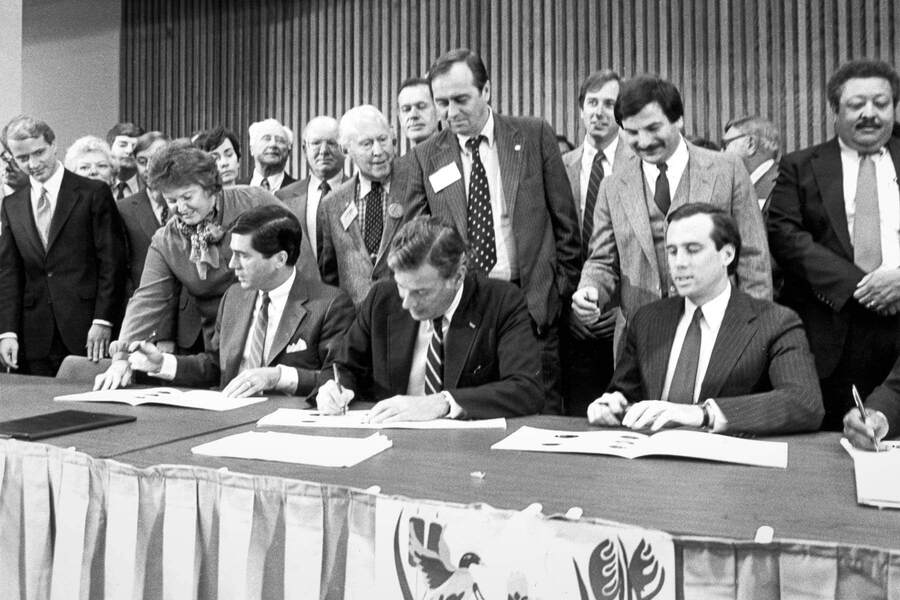
In june of 2014 the Chesapeake Bay Watershed Agreement was signed. Here was the first time New York, West Virginia, and Delaware committed to the Bay program. This agreement established 10 goals and 31 outcomes with regards to habitat restoration, clean water, conservation, and having communities become more engaged. The agreement also contains the Chesapeake Clean Water Blueprint which includes the TMDL and WIP.
In 2010, the 2000 Chesapeake lawsuit filed against the EPA for not setting science based pollution limits, was settled with an historic agreement. In this agreement the EPA establishes the Chesapeake Bay Total Maximum Daily Load (TMDL). The TMDL sets limits on how much sediment and nutrients can enter the Bay in order to meet the desired water quality. The seven Bay jurisdictions created the Watershed Implementation Plan (WIP) that outlines detailed steps that the jurisdiction will take in order to meet the pollution reductions agreed to by 2025.
The 1987 Chesapeake Bay Agreement was the first agreement to set numeric goals in order to reduce pollutants in the bay and restore the ecosystems. More specifically, the agreement was targeted at nitrogen and phosphorus entering the bay, aiming to reduce those pollutants by 40% by 2000. Establishing actual numeric goals was unprecedented so this agreement became a hallmark of the Chesapeake Bay Program.
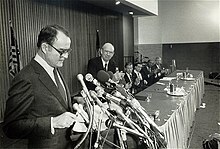
The First Chesapeake Bay Agreement was signed in 1987 by the Environmental Protection Agency, a one page agreement recognizing that there needs to be efforts to address the Chesapeake Bay’s pollution issues. States that signed on were Maryland, Pennsylvania, Virginia, and the District of Columbia. These signatories became the Chesapeake Executive Council. Though this agreement was formed with future general goals, no requirements or timelines were established. The Chesapeake Bay Program was also established before this agreement after studies showed bay pollutants coming from excess nutrients.
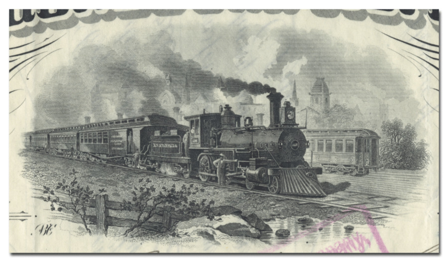
The Providence and Worcester Railroad began operation in 1844 and dramatically decreased shipping time and costs for goods between Worcester and Providence. This form of transportation was much more efficient than the use of waterways, so the Providence and Worcester Railroad was able to replace the recently built Blackstone Canal which was previoudly used to transport goods between the two cities. This railroad allowed for quicker travel between Massachusetts and Rhode Island, but it also led to increased consumption of fossil fuels and contributed to the industrial pollution of New England during this time.
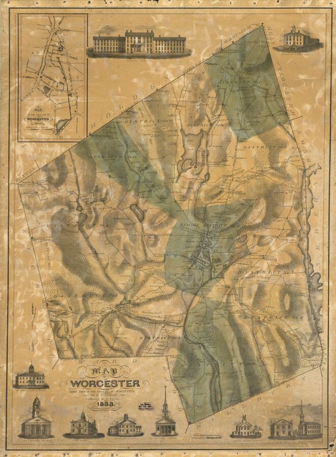
In 1673, Daniel Gookin purchased eight square miles of land from the Nipmuck tribe living in this area and created the Quinsigamond Plantation. When the Nipmuck became aware that the Europeans were not going to share the land, they attacked and drove the settlers away. This area was then settled and abandoned several times throughout the next 40 years due to conflict with Native tribes and was eventually established as a town in 1722.