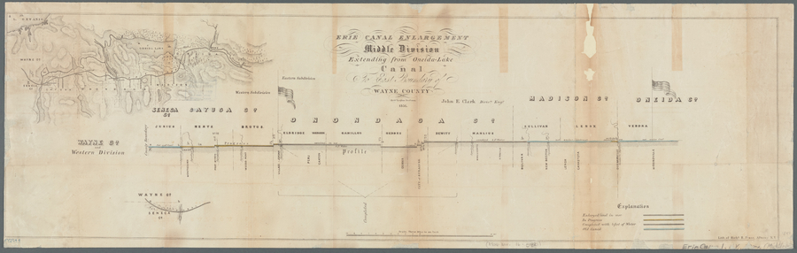
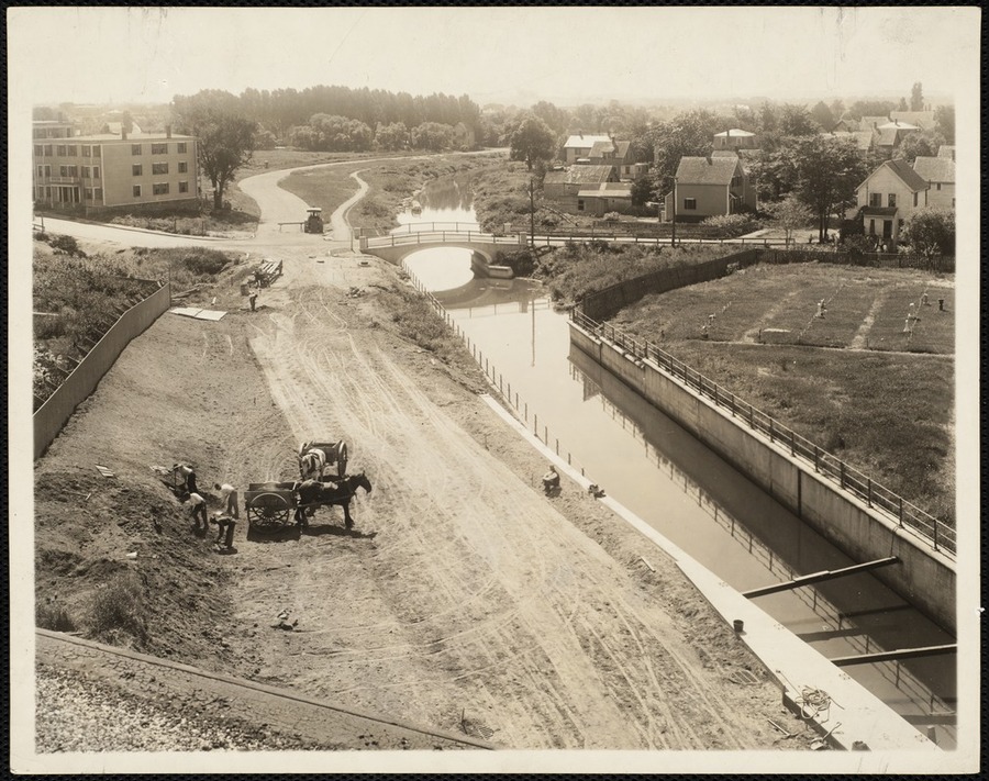
The Erie Canal started construction in Rome, New York in 1817. This massive infrastructure porject sought to connect Lake Erie with the Hudson River, connecting all of Central New York to the City of New York. This canal opened up trade and allowed for many central New York towns to engage in heavy industry.
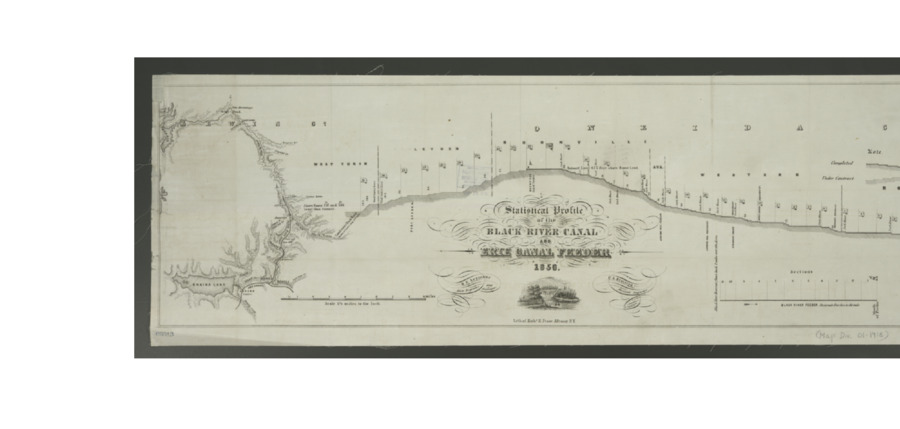
The Black River Canal was supposed to connect the northern part of New York, west of the Adirondacks to the Eire Canal. This canal was expensive, steep and short, totaling only 35 miles and climbing over a thousand feet. The canal proved fiscally impossible and closed after the railroad opened.
The Clean Air Act of 1970 was a landmark legislation that for the first time proactively set emissions standards and increased the previous enforcement powers of the federal government. This act was amended in 1977 and again in 1990 to further strengthen the bill to regulate toxic waste and emission that erode the ozone layer.
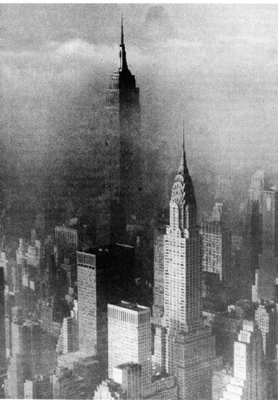
Similar to the levels in the episode in 1952, in 1963, an unusually warm period forced another stagnant air mass to stay trapped in New York City for two weeks. As seen in an image from the Associated Press, the top and a majority of the upper floors of the Empire State Building were not visible because of the thick smoke. It was reported that, “... an estimated 300–405 people died during a two-week smog episode…” – much longer than the 1952 episode.
During the late 1870s, there was growing concern in the town of Arlington over the frequent polluting of the Alewife Brook, which is located on the Arlington and Cambridge border. The pollution was being caused by the city of Cambridge because of the emptying of sewage into the brook. On November 18, 1879, there was a town meeting held in Arlington where people wanted to see action being taken over the heavy increase in the pollution of the Alewife Brook. Roughly a year later, on December 30, 1880, a committee was selected to protect public health and put an end to the emptying of sewage into the Alewife Brook and the connecting Mystic River.
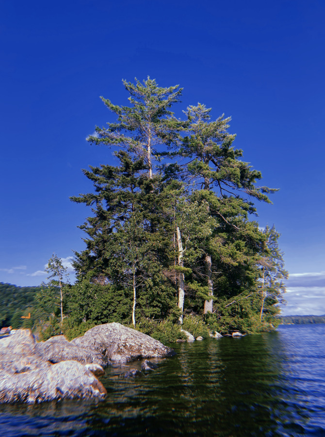
In the center of Canada Lake lays a small island make up of rocks and trees. In 1952 a group of residents on the lake bought the island form Cy Durey, who owned the Stewart's Landing Dam. To this day you can dock your boat at the island and explore. Due to erosion and natural disasters many trees on the island have died and the size of the island is decreasing.
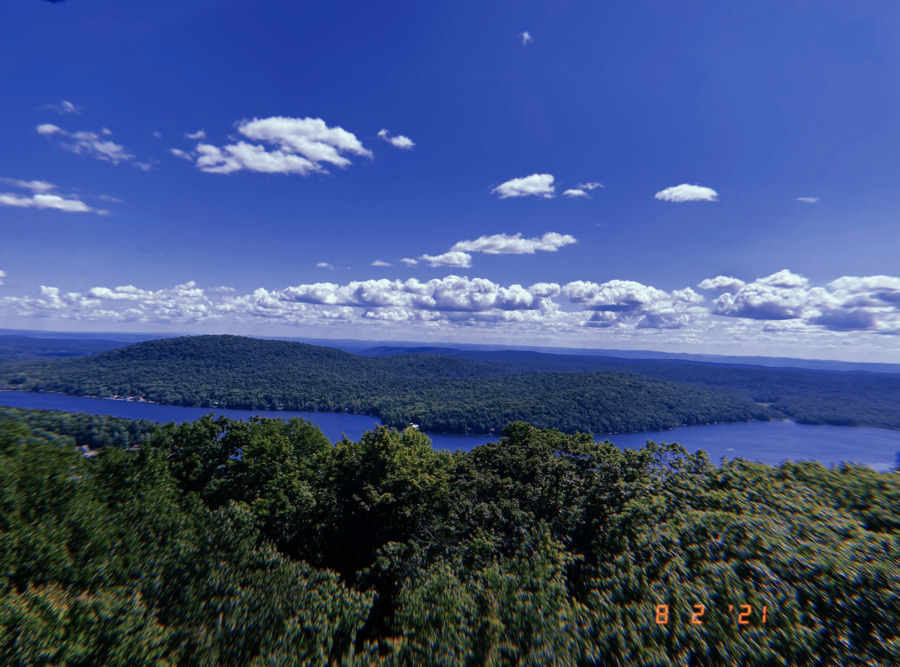
To keep watch for forest fires due to deforestation of the Adirondack Park a fire tower was constructed. The fire tower provides an amazing view of the surrounding area and brings perspective to the lake's location.
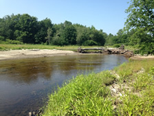
Prior to the arrival of European settlers, Lebanon and the nearby Mascoma valley (named after Mascommah, the Chief of the Squakheag) were the hunting territory of the Squakheag, a subgroup of the Abenaki tribe who largely inhabited New England and Canada. The tribe traveled the fishing waters of the Connecticut River and its branches, including the Mascoma River, which was said to be “almost solid with fish". Native Americans had ceased living in this region, however, possibly as early as 1700.
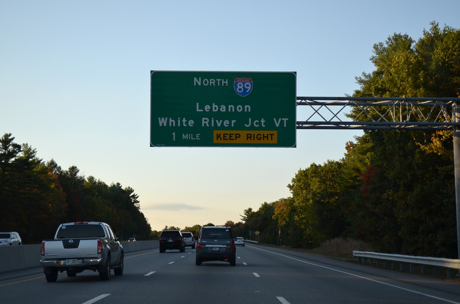
In June of 1956, a new Federal-Aid Highway Act was passed that authorized the construction of a 41,000-mile network of interstate highways through the United States with a budget of $26 Billion. Two of these highways, Interstate 89 (Bow, NH-Canadian Border) and Interstate 91 (New Haven, CT- Canadian Border) were routed through Lebanon, and as all odd numbered primary interstates, they both run north-south. The routing of these interstates helped contribute to Lebanon's economic revival following the end of the mill era.
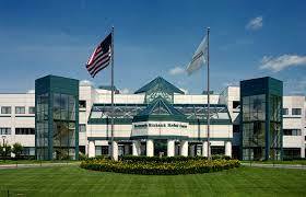
Previously located in Hanover, NH, In 1991, the Dartmouth–Hitchcock Medical Center moved to a new campus just south of the Lebanon-Hanover town line, along with most departments of Dartmouth Medical School. DHMC is New Hampshire's only Level I Trauma Center and it includes New Hampshire's only air ambulance service. A variety of medical and high-tech firms have since opened facilities near the hospitals new location.
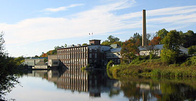
A mill district developed at falls on the Mascoma River in the mid 1800s. The various industries that would exist in the district included: a tannery, a clothing factory, furniture mills, several machine shops, and a woolen textile mill. These industries attracted many French workers from the Quebec province, and this district became the center of town As railroads developed up and down the river, as well as to Boston, Lebanon's success in the textiles industry was solidified. In the mid 1900s the mills closed and the nature of the region changed as the textile industry came under attack from foreign imports and other economic changes.
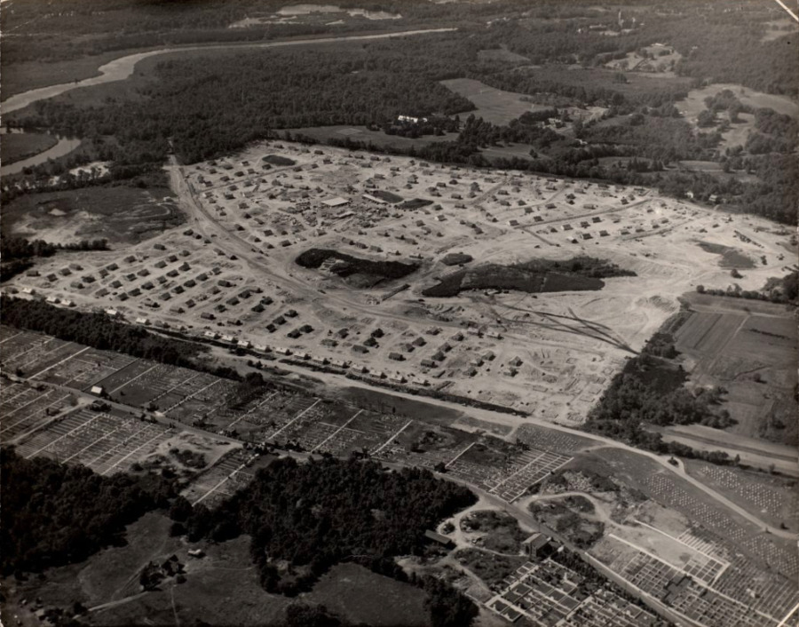
After World War II there was a huge desire for people to move out of the city and into the suburbs. This big rise in population in the late 1940s led to Newton building a new village (Oak Hill Park) full of veteran housing. These houses and neighborhoods were somewhat similar to those in Levittown. Additionally, this area was given a park, shops, a school, and other amenities that a community would need. Newton was working to make this area appealing to families trying to move to the suburbs after the war. As automobiles were also still on the rise during this time, bigger shopping centers were built along the highway only a few miles outside of Newton. All of these new expansions led to the continued growth and success of Newton as a suburb.
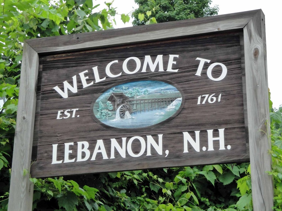
The colonial governor Benning Wentworth chartered Lebanon as a town on July 4, 1761. It was named after Lebanon, Connecticut, as many early settlers had come from there. One of whom was Reverend Eleazar Wheelock, who came in 1770 and would go on to found Dartmouth College. Its location at the convergence of the Connecticut River and the Mascoma River made it a good destination for the transport of resources as well as a good energy resource for running mills, and it was 1 of 16 towns that would be chartered along the Connecticut River
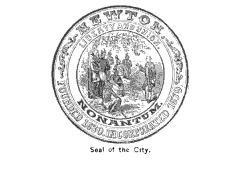
The land for Newton was originally settled by Native Americans until the Europeans came in and began to set up more European-like civilizations. The reason the Europeans wanted a “New Town” in the first place was to make it a fortified town to be separated from the Native Americans. While this fortified land did not become Newton, the idea of building new towns is what eventually led to Newton’s creation. Newton was part of Cambridge, but in 1681 the land south of the Charles River was set aside and renamed Cambridge Village. 10 years later this land was named Newtown. Newton was given the name Newton when one day a town clerk decided to leave out the second “w.”
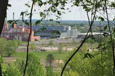
The first proposed remedial actions for the Schenectady GE plant in 2004 described a remedy preferred by the NYSDEC and NYSDOH to address the hazardous waste contamination found around the plant. Some of these suggested remediations included: “excavation and off-site disposal of PCB-contaminated surface and subsurface soil at various locations in the manufacturing areas and former landfills, soil or asphalt covers over surface soils in portions of the manufacturing area, soil and vegetation cover system for surrounding landfills, shallow groundwater treatment for select areas and periodic review of the effectiveness of the completed remedial actions.” The DEC felt that these were the most important changes that needed to occur after investigating GE’s territory. The 2004 estimated total remediation costs were projected to be $45,800,000. This estimate was severely undermined, we now know that the up to date cost of the remediation is at least $78 million.
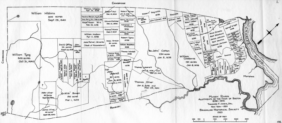
In 1636 the selectmen of Boston allowed for 16 grants along the muddy river, though the town didn’t gain its name until January 8th, 1638, and isn’t incorporated till 1705. By the time the town was incorporated, there were around 50 families throughout the area with zero public buildings or churches. The majority were poor farmers.
Once GE signed off on the agreement with NYS for investigating contamination, the plant became a superfund site. Superfund sites in NY are controlled by the NYSDEC, the agreement allowed the state to take control of the project, paying for the investigation and cleanup. When the state suspects or is aware of immense amounts of hazardous waste that may have been improperly disposed of at a specific location they can discuss with the company responsible to start an investigation. Inactive hazardous sites like the Schenectady GE plant go through a process of investigation, evaluation, cleanup and long term monitoring. The investigation period lasted from 1995 to 2003.
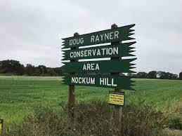
Interest in land conservation began in the late 1900’s. This was mainly due to the 1938 and 1954 that disturbed the coast's fragility. It was also apart of the national conservation movement. In the 1960's, 70 acres on Nockum Hill was set aside and preserved. It's said that the first shots of King Philip's war were shot near by.
On April 27, 2021, the Worcester city council voted to support the Green Worcester Plan. This plan outlines a series of goals designed to make Worcester one of the most sustainable and climate-resilient mid-sized cities in the United States by 2050. The number one goal of the plan is to achieve 100% clean and affordable energy systems within the time frame. Other goals include developing sustainable transportation choices, achieving zero net waste, and developing sustainable local food systems.
The Asian longhorned beetle (ALB) is an invasive species of insect that feeds on hardwood trees and can cause significant damage to tree populations. In 2008, it was discovered that the ALB had infested trees throughout the city of Worcester. Researchers discovered that the species had arrived over a decade before they realized it was there and had been infesting trees for years. This outbreak was the worst in the country and caused around $24 million in damage in Worcester alone, with over 30,000 trees being removed. Worcester was hit particularly hard by the ALB because the city had a very high amount of tree cover and most of these trees were Norway maples which were a main part of the ALB diet. This crisis changed the way that Worcester managed its forests and changed the landscape of the city dramatically.
In the 1950s Charles Keeling began recording atmospheric levels of carbon dioxide in an attempt to identify its correlation with climate change. In 1958 he received funding from the IGY to establish a research base at Mauna Loa nearly two miles above sea level. Keeling's research revealed a definitive correlation between increases in CO2 and human activity, leading to the trapping of heat in the atmosphere. His findings contributed to the emerging perspective which emphasized the need for immediate political action targeted towards reducing emissions.
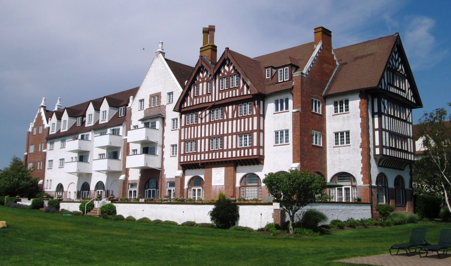
In 1926, Carl G. Fisher purchased a chunk of land in Montauk from the US government after being sold as surplus government property at the end of WW1. He planned on creating an urban Montauk which could serve as “the Miami Beach of the North” where people could travel to the city and save a day's worth of travel. He built the Montauk Improvement Building, which is still the town's tallest occupied structure, the Montauk Manor hotel, and dredged Lake Montauk and opened it to the public. Fisher eventually lost his fortune during the Stock market crash of 1929 and these plans did not pan out.
East Hampton remained largely undeveloped until 1880 when Austin Corbin extended the Long Island Rail Road from Bridgehampton, New York to Montauk. In 1879, Arthur Benson would force an auction in order to purchase 10,000 acres around Montauk and evict the Montaukett native Americans who resided there.
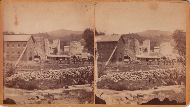
In the early 1800s the first of many mills and foundries were built along the Walloomsac River, starting an industrial legacy lasting until the present day.