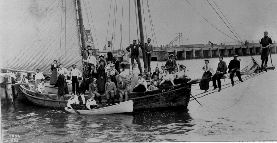
The internationally-known Marine Biological Laboratory (MBL) in Woods Hole was first established through the efforts of Falmouth's Woman's Education Association and scientists and university professors across the country. The site was chosen because it was at the confluence of the ranges of southern, warm-water species and northern cold-water species, and was therefore an ideal location for studying marine life. From the outset its priorities were strictly scientific, valuing primarily the acquisition of knowledge and education and considering economic impact or conservationist efforts to be "secondary." The lab would grow dramatically over the subsequent decades and establish Woods Hole as a bastion for scientific research, with other famous organizations including the Woods Hole Oceanographic Institution joining MBL by the early 20th century. The establishment of MBL is one of countless examples of how Falmouth's marine environment was crucial to its economy and identity, as well as a general trend in American environmental history of the natural environment at this time beginning to be seen as something to be studied and understood.
Cranberry bogs formed a large part of Falmouth's economy in the 19th and early 20th centuries, supported mostly by immigrant labor from Portugal and Cape Verde. In modern times these bogs are no longer in use, and the Coonamessett Greenway Heritage Trail as well as other similar projects in the area represent efforts to restore them back to the ecosystems they were before European colonization. The project was undertaken by the 300 Committee and Coonamessett River land trusts, local privately-funded organizations which purchase land in Falmouth and convert it into conservation land to prevent it from being developed. While not a significant event in the town history, it represents a shift in ideals and a general devaluing of agriculture relative to natural spaces. The fact that it is a publicly accessible walking trail is also indicative of the town's tourist economy. The project aimed to help restore the health of the river ecosystem, which has since been challenged by controversial housing developments upstream.
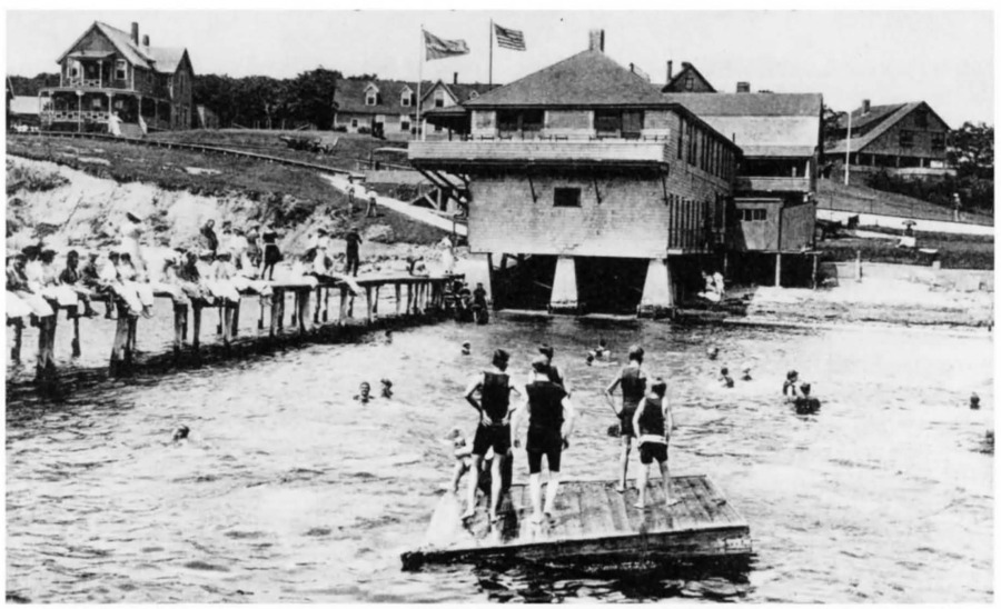
January 7, 1871 marks the incorporation of the Falmouth Heights Land and Wharf Company, a group of developers responsible for the creation of Falmouth Heights, an area of the town envisioned as an ideal location for a summer resort. Coastal real estate in Falmouth during settlement was not highly valued as it was seen as unfit for development. These men, most of whom were from Western Massachusetts, purchased the land from a salt works company and would split it into several lots in a city-like layout that was unusual for the mostly rural setting and would sell the land to developers who would construct rental properties and hotels, mimicking the success of the earlier development projects on Martha's Vineyard. The connection of Woods Hole to the Old Colony Railroad the year after helped immensely to draw tourism to the area. This event marks a shift in Falmouth towards tourism and away from its mostly maritime economy which had been tied to the declining whaling and salt-making industries. This represented a major boon for the town and would lead to a dramatic increase in population in the subsequent decades, but would ultimately lead to a myriad of environmental problems including straining of the wastewater system in the future.
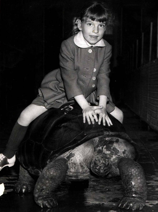
Built in 1914, the Utica Zoo has been around for over 100 years now, and sits on land donated by Thomas R. Proctor in 1909. He hired a famous architect, Fredrick Olmstead Jr, whose father designed Central Park, to plan walkways and scenic areas in the park. The zoo started with just 3 deer, and has expanded over the century to encompass over 99 species of animals.
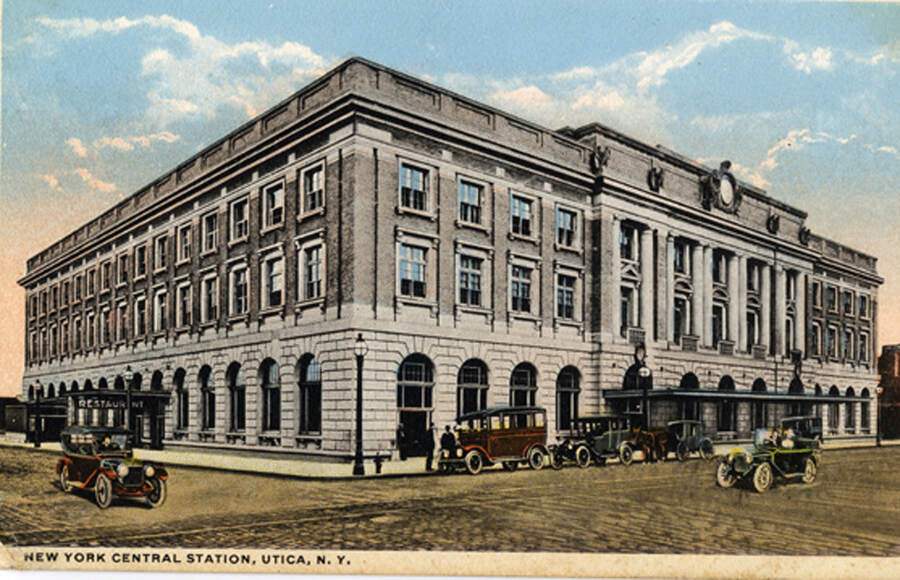
With the construction of the Erie Canal in 1817 came along a wave of early immigrants into Utica, notably Irish immigrants. The production of railroads also led to large immigration into Utica, as Utica was quickly becoming one of the centers for textiles. The industrial development of Utica coincided with the arrival of many new immigrants, including a significant Italian population along with Poles, Greeks, Jews and others from southern and eastern Europe, Syrian-Lebanese, and a host of others, intertwining culture and economic growth.
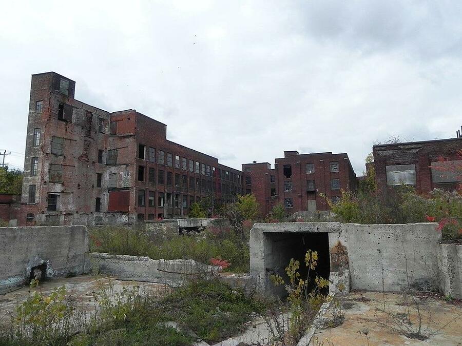
On the border of Utica and Frankfort lies the abandoned, fire-struck Charlestown Mall. Once a gun manufacturing facility, the building has had many uses throughout time, converting to a computer factory and then eventually a mall. In 2020, a fire broke out, and the mall was abandoned. The site was reported to have large amounts of asbestos from the material it was constructed with and other harmful chemicals from its history as a gun manufacturer. During its time as a gun manufacturing site, there was chemical runoff and frequent improper disposal of waste materials, such as asbestos. As a result, the site was considered a hazard by the EPA and named a brownfield site.
This was a newspaper article written in the late 1990s covering the usage of funds and how they would be applied towards the park. A lot of their funds were catered towards the entertainment pieces to draw people in such as concert stands or festivals. Whereas the actual nature aspect kept downgrading throughout the years from storms or other strong weather events. Less of their funding budget went to upkeep the park in good conditions because the main value they saw in it came from their entertainment.
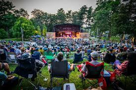
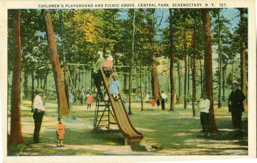
This picture captures this sense of leisure that families would be looking for in parks. This is a callback to one of the readings we did earlier in the term where one of the main attractions for parks was the need for leisurely and large peaceful areas of nature in the aftermath of the post-war thinking.
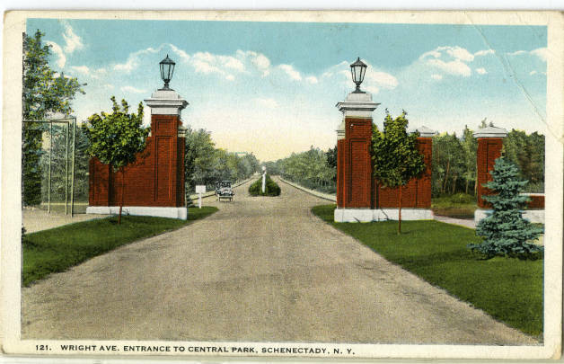
This is a postcard capturing one of the entrances into Central Park during the 1900s. This captures a significant aspect being that the rose garden, which is a popular aspect to the park nowadays actually hadn’t existed before 1960 (when the first bushes were planted). It wasn’t until the early 2000s where talks about restoration came about.
In 2011, Newtown decided to look at itself altogether and develop a Natural Resource Inventory (NRI) with the goal of revising their Plan of Conservation and Development. This meant Newtown could look at biodiversity of both plants and animals, soil resources, watershed management, wetlands, and water quality. This report found that biodiversity supports a healthy and diverse wildlife population, which is a positive indicator of overall environmental quality. Unfortunately, the inventory also reported finding 20 different invasive plant species, including the Norway maple, autumn olive, common reed, and water chestnut. When looking at the soil composition across town, it was determined that there are 6,748 acres of prime farmland soils, 4,707 acres of statewide important farmland soils, and 27 percent of farmland soils within the watershed. Overall, this inventory shows that Newtown has a positive environmental quality and supports a healthy and diverse wildlife population.
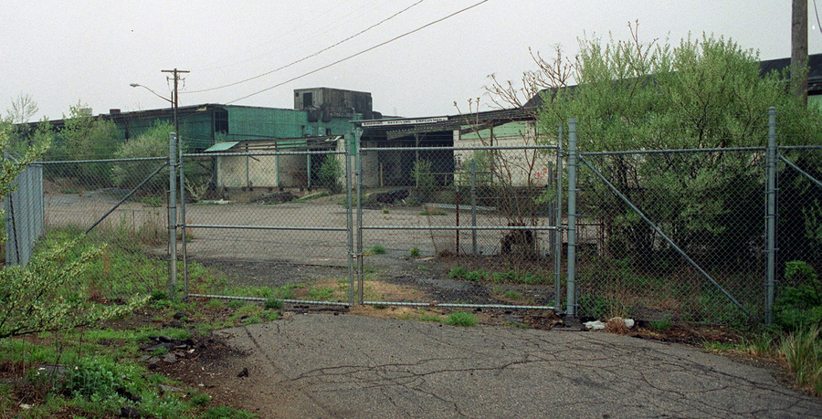
This site is a former aluminum smelting facility that was in operation from 1947 to 1987, but now sits abandoned. The operations of the facility included smelting aluminum and using oil that contained polychlorinated biphenyls (PCBs) while also heating the facility building and running the smelters using volatile organic compounds (VOCs). The EPA was called to start a 2-month project to remove large piles of fine metal waste products that were contaminated with high levels of metal, including cadmium, lead, tin, chromium, copper, zinc, nickel, and PCBs, asbestos-containing roofing shingles, drums, containers, and aboveground storage tanks. Today, the site is marked as a Superfund Site and remains abandoned.
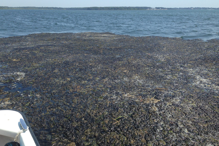
The Cladophora monoculture in the bay has been increasingly noticed by residents of Stonington, Conn., and neighboring Westerly, R.I., for more than a decade, as it continues to foul beaches with piles of smelly, decaying seaweed, and fill the bay itself with floating mats that wash up in the summer on every beach in the area. Even though recently updated wastewater treatment plants are doing a better job of removing nitrogen than before recent upgrades, the nutrient load entering the bay is still too high due to changing conditions there. This, combined with ever warming ocean temperatures, is continuing to fuel the Cladophora explosion on the bottom and surface of the Bay. In addition, natural shifting of the Sandy Point sandbar, the spit of land that was connected the Napatree Point before the 38 Hurricane, has restricted tidal flows into the bay, further fueling the algae growth.
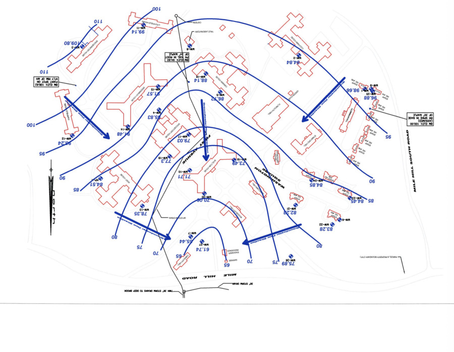
Fairfield Hills State Hospital, which was a psychiatric hospital for anyone over the age of 18 from 1931 until 1995, and at its peak held 4,000 patients, 20 doctors, 50 nurses, and 100 other employees, and was entirely self-sufficient. The hospital was abandoned in 1995, following the trend of deinstitutionalization, and was bought by the town of Newtown in 2001. Around 2008, the town of Newtown requested a Phase I environmental site assessment; they were looking for the presence, or likely presence, of a hazardous substance or petroleum products on the property. Following this report, soil and groundwater that were contaminated with petroleum on the northeast side of campus, tetrachloroethylene from the laundry building, and dieldrin from the main subject property. There is still an ongoing remediation project, which includes the problems of asbestos and lead-based paint.
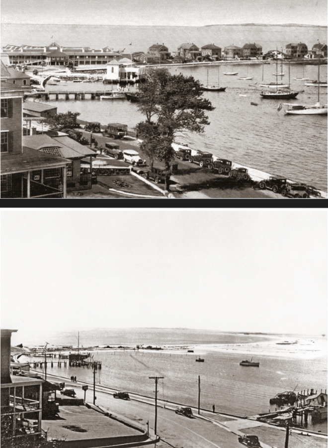
Across Little Narragansett Bay from Stonington lies the small tourist town of Watch Hill. Since the early 1800s, it had been a destination for beach-goers and sightseers. The top half of the photograph shows Napatree Point as it was before the 1938 hurricane, full of 39 pristine beach houses, all the way down to the old military fort at the end of the dunes. The bottom photo shows Napatree as it was in the immediate aftermath of the hurricane. Every single one of the houses, and 15 of their residents, had become victims of the storm's fury.
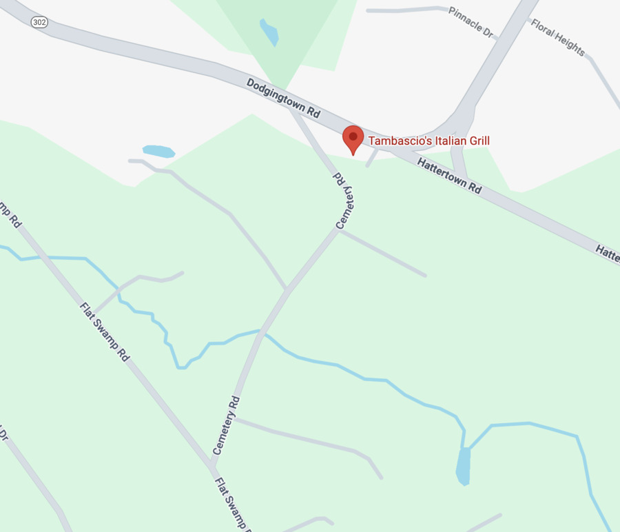
Behind a local restaurant, and down Cemetery Road, a tanker truck crashed along the main road, which spilled more than 9,000 gallons of gasoline into the restaurant parking lot. Reportedly, the truck rolled on its side and hit two utility poles before finally landing in the parking lot on fire, blowing up six cars and sending oil pouring everywhere. About 48 hours after the crash, DEEP was finding high levels of gas in the soil, which seemingly leaked into septic leaching fields. Remediation efforts were made by removing all the contaminated soil and bringing it to a facility in Waterbury.
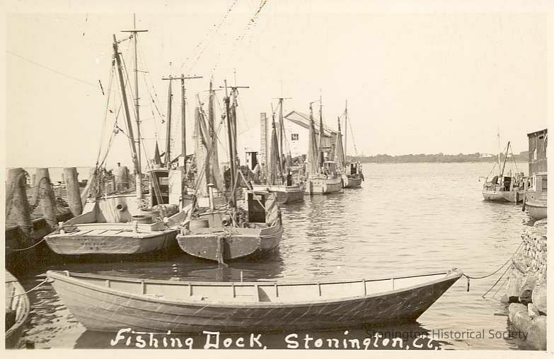
Prior to the introduction of steam trawling in 1906, groundfish off the New England coast were caught exclusively with baited lines, fished from schooners and their smaller dories. Even in a smaller port town like Stonington, the local fishing fleet was the lifeblood of the community. This era of fishing was the last remnant of a pre-industrial society, where mass commodification of natural resources and surpluses in food were things of imagination for most Americans.
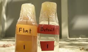
In the 25th of April 2014, the city of Flint switched its drinking water supply from Detroit's system to the Flint River in a cost saving move, this decision unknowingly would cause a lead crisis in the 21st century, as inadequate treatment and testing of the water followed, resulting in a series of major water quality and health issues for the residents of the city. Soon after this switch was implemented, residents started complaining that the water from their taps looked, smelled, and tasted foul, despite these observations from the city's residents, the city officials maintained that the water was safe. When researchers from Virginia Tech conducted a study, they revealed the problem: the water samples that had been collected for study indicated citywide lead levels had spiked, with nearly 17 percent of samples registering above the federal action level of 15 parts per billion. Lead is a heavy metal that had already been infamous in history since its documented use by the Romans for makeup, cookware, and pipes, but what made it infamous is that in large doses, it would cause high blood pressure, heart and kidney disease, and reduced fertility. This event was significant for American Environmental History, because to this day, even after the city had completed its pipe replacement program, Flint's residents still distrust their tap water due to a single decision.
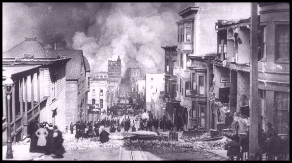
The California earthquake on April 18th, 1906, is one of the most relevant in history when it comes to discussing natural disasters, not only because of its devastating effects, but also the scientific knowledge it brought. The San Andres fault ruptured about 477 km and led to the emergence of the elastic rebound theory. Tremor occurred up to a minute and was felt in regions in Nevada and Oregon. Liquefaction took place in San Francisco, where sediment behaves like liquid during seismic activity, causing buildings to collapse. Fires were later emphasized as the true disaster, making the earthquake look like a minor event, ultimately downplaying seismic risk.
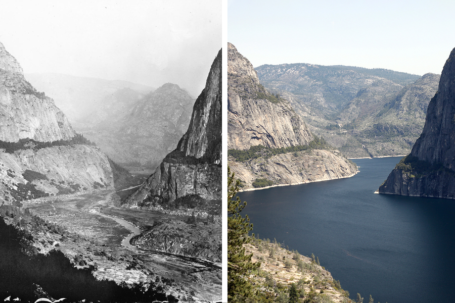
The damming of the Hetch Hetchy Valley in Yosemite following the aftermath of the earthquake and subsequent fires in San Francisco was the last industrial use of a National Park, and many opposed the creation and existence of it prior to its construction and following its completion. The rise of environmentalism in the late 20th and early 21st centuries sparked a genuine debate on whether or not the dam should be taken down, allowing for the natural wildlife and ecosystems of the valley to return to how they were. Many argue that the Dam is essential for energy production and water supply to the city of San Francisco. Others argue that the energy production isn't all that large a factor and point towards new renewable energy projects that are taking place around the San Francisco area. The water supply of San Francisco isn't very diverse and relies heavily on the Tuolumne River, so an expansion of different water sources could relieve the Hetch Hetchy of its purpose as a reservoir. It would take an extremely large effort to properly supply San Francisco with adequate water if the Hetch Hetchy Dam were to be taken down, but the positive environmental impacts if it were to be taken down could be very large as well. The question stands: should the Hetch Hetchy Dam stay, or be destroyed?
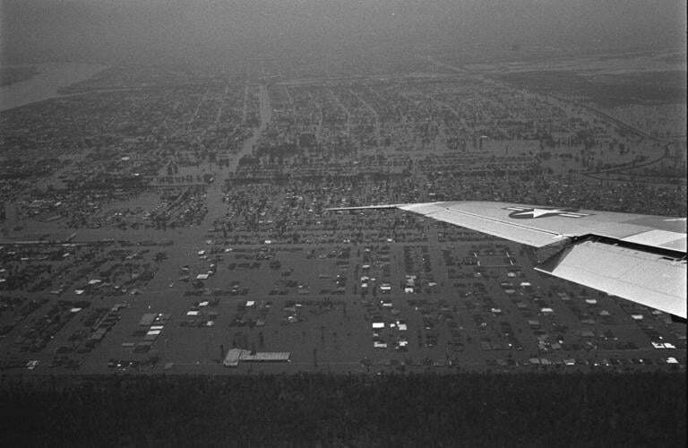
When Hurricane Betsy slammed into New Orleans in 1965, and with it came torrential rainfall and winds up to 150 miles per hour. The amount of flooding that transpired overwhelmed the levees that were supposed to protect the city's lower ninth ward. While the rest of the city sustained minimal damage, the lower ninth ward ward was decimated; Dozens of people lost their lives and thousands were left without a home. The greater amount of damage in the ward compared to the rest of the city roused suspicions amongst some residents of the lower ninth that higher ups had intentionally destroyed the Industrial Canal's levee, in order to sacrifice the lower ninth ward for the sake of the more well off areas of the city. This was fueled by the fact that the lower ninth ward had been neglected for some time. Overall, this is part of a larger trend towards distrusting governments due to their neglect, mismanagement, and broken promises
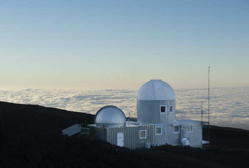
The Mauna Loa Observatory, located nearly 4000 meters high in Hawaii, was created as a way to take atmospheric, solar, and meteorological parameter measurements. In 1958, carbon dioxide measurements started being taken led by Dr. Charles Keeling, and created the Keeling Curve, showing the undeniable evidence of increasing CO2 influencing rising atmospheric temperatures.
The CDC published a report that establishes ties between Field Epidemiologists and how their efforts contribute when disasters hit. Mainly they are almost the ones to help sort through the chaos when all seems to be chaotic. They are the ones who bring the necessities that people need such as the lower class who cannot typically afford to recover from disasters such as earthquakes or even floods or hurricanes when they hit. In a way they act and make the real important decisions that others cannot do so easily. However, it can be argued that because of how fast decisions must be made there would have to be some fault or errors located somewhere in the aftermath of what they choose.
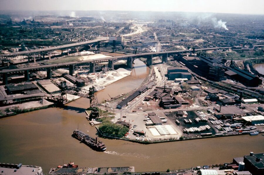
Cleveland was one of the most important cities during the Industrial Revolution. John D. Rockefeller founded Standard Oil in Cleveland, Ohio. Standard Oil operated the biggest oil refineries in Cleveland and would dump its runoff byproduct into the Cuyahoga River, which flowed into Lake Erie. The city of Cleveland would dump its sewage, detergents, and chemicals into the river. The Cuyahoga River was so heavily polluted that it turned a nasty brown color and had suds of soap nested on top of it.
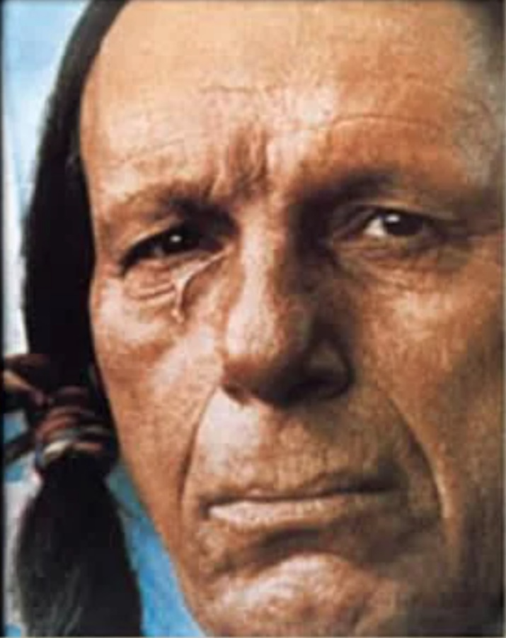
The "Crying Indian" advertisement debuted on Earth Day 1971, created by Keep America Beautiful and the Ad Council. In the ad, actor Iron Eyes Cody portrays a Native American who is deeply saddened by the pollution in the river he paddles his canoe through. The ad end with him shedding a tear as a passing car throws trash at his feet. Keep America Beautiful had produced one of the most famous public service announcements in U.S. history. The PSA was an attempt to help prevent individuals littering habits at a time wrappers and plastics were becoming more popular. This iconic ad, which also faced backlash for shifting blame from corporations to individuals, was all part of the rise of environmental awareness in the early 1970s.