Student Submissions
-
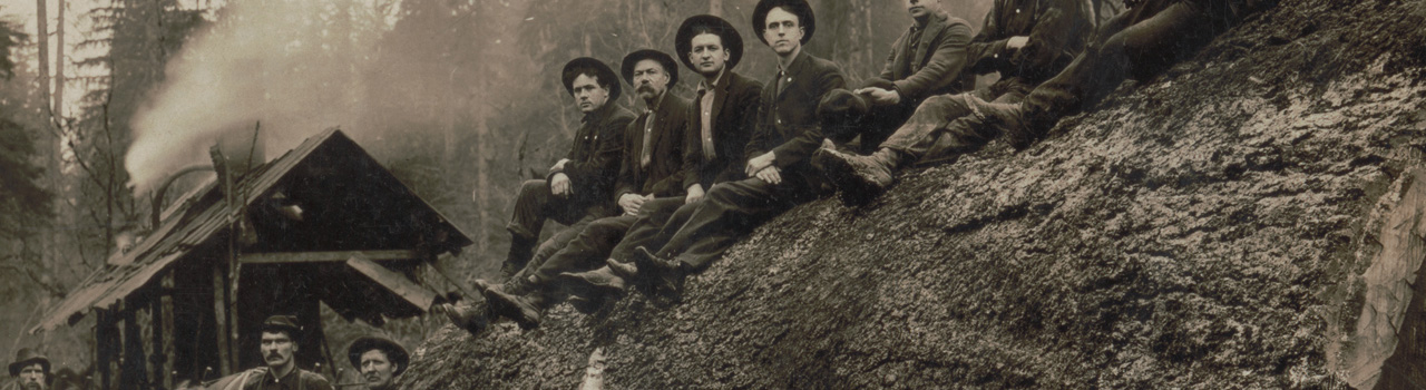
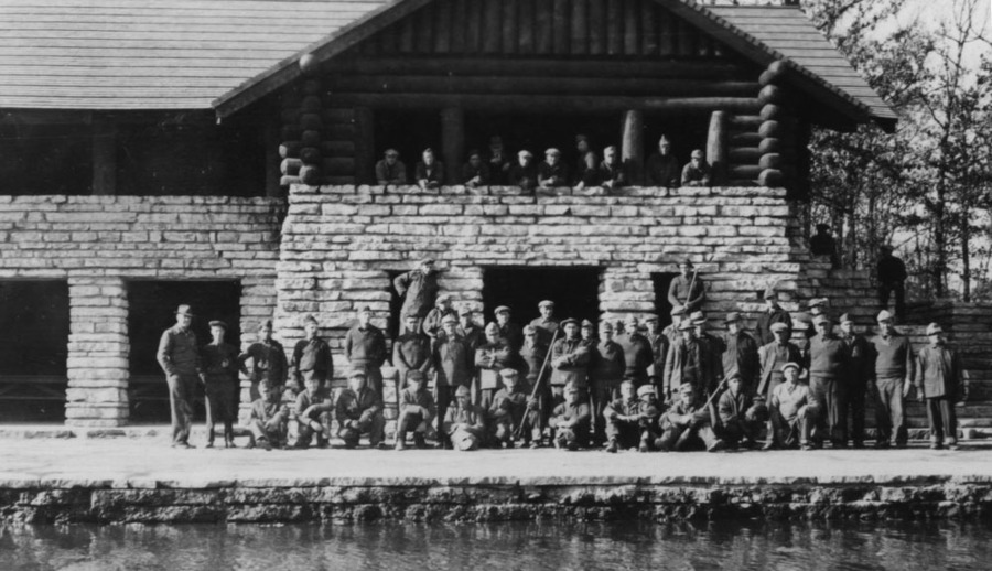
 CCC Schenectady districtThe Civilian Conservation Corps was a program that was a part of Roosevelt’s New Deal agenda to relieve young unemployed men from the depression by paying them to do conservation work around the country. The CCC was founded in 1933 and ended in 1942. CCC workers built trails, roads, campsites and dams, stocked fish, built and maintained fire tower observer's cabins and telephone lines, fought forest fires, and planted nearly 3 billion trees nationwide. This was so important as it really brought the younger generation who may have grown up in the cities to appreciate nature and understand the importance of maintaining the environment. It was also extremely popular with the people as the growing trend for conservation would continue thanks to the experience that a whole generation of young men received from the government.
 -
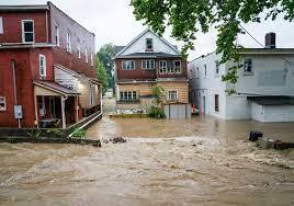
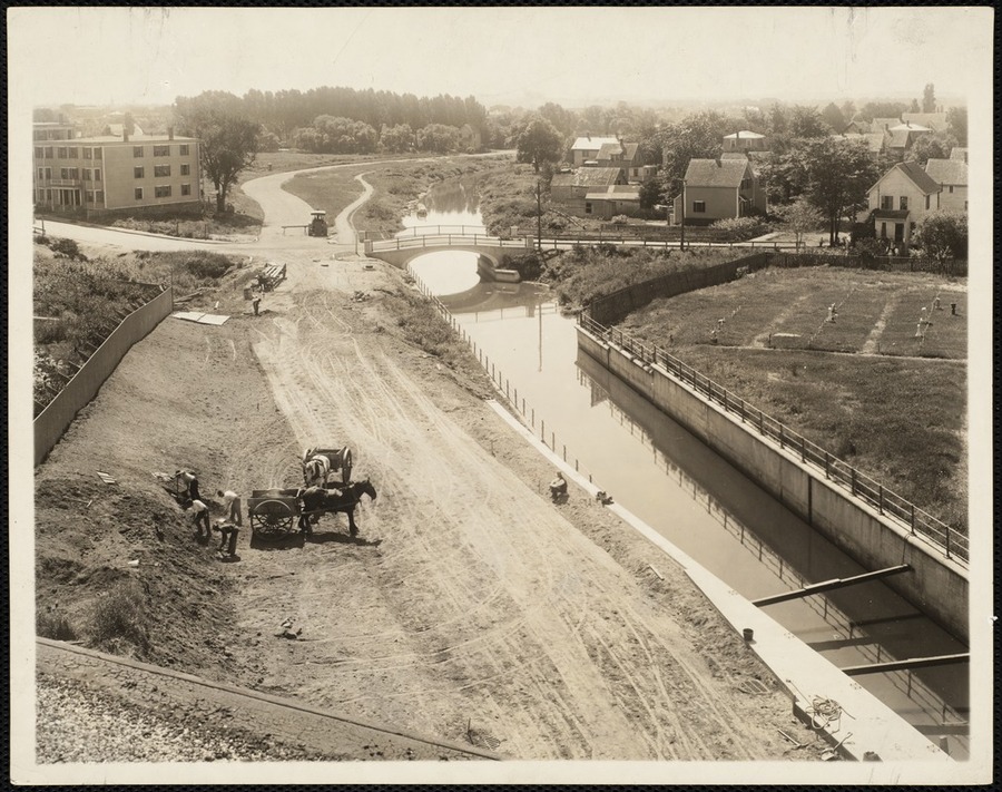
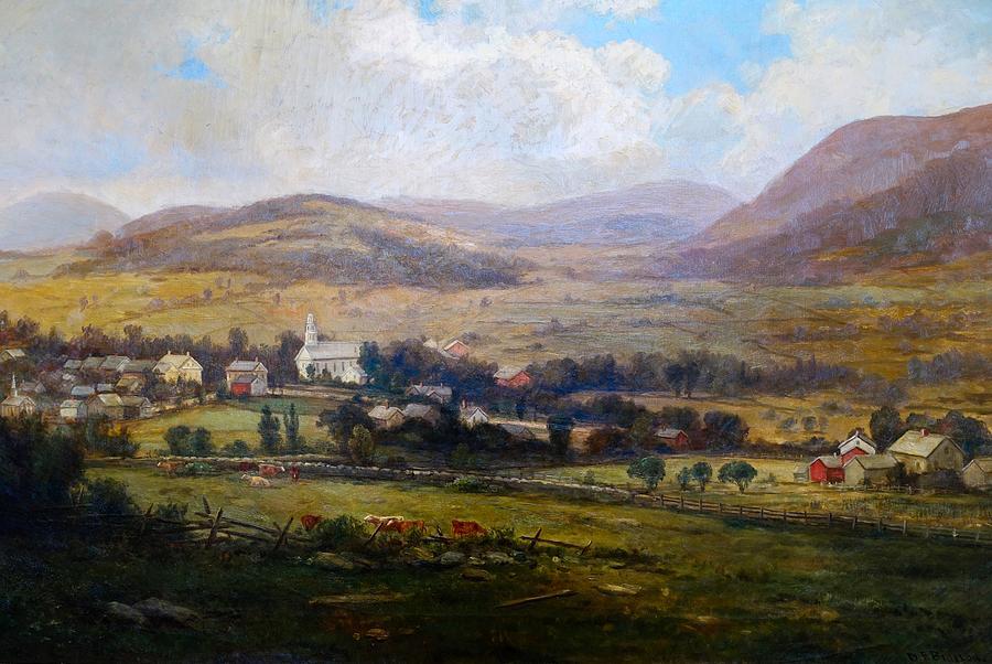
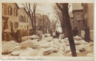 Schenectady's worst flood (1914)During 1914 Schenectady got 32 inches of wet snow in a span of 20 hours. Larry Hart ran a column reporting the flooding that occurred next. On march 24th the flood hit because of melting snow and heavy rainfall. Ice Jams formed on the river and destroyed bridges and flooded industrial areas. Onlookers described the ice slabs as twenty feet high and three feet thick. Workers were called home and had to get back to their houses on rowboats. Damages reached into the millions. However, most of the damages were to houses and local businesses and not the railroad or General Electric companies. There were a few deaths including two out of three workers trying to get cable over the Freemans Toll Bridge; as they hit submerged ice and two went under. Schenectady is prone to flooding due to the river and in recent years have experienced major flooding like during hurricane Irene. Since Schenectady's worst flood happened so long ago I wonder what another unlucky set of natural events would cause today.
 -
 Amoco Research CenterSimilar to Teflon and Love Canal incidents, the Amoco Research Center in Naperville has been involved with death and lawsuits since 1989. Within the center's chemical research building, 19 people have died of brain tumors and cancer. Although at first the company did not acknowledge a threat, after investigations and lawsuits it was deemed a health hazard. The rooms were permanently shut down. Poor ventilation of toxic pollutants and chemicals have been the most plausible conclusion. However, like a lot of corporations, they fund and manage their own personal investigations.
 -
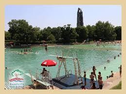 Centennial BeachIn 1833, limestone was first discovered near the edge of Naperville. For the next 80 years, a quarry was created. Steam pumps constantly worked throughout the day to keep out the pure spring water. This limestone was used to create a lot of the building foundations and architecture in the nearby downtown. For a while, it became an important export of the town. 100 years after limestone was first discovered, in the midst of the Great Depression, the quarry was filled with water and renovated to become a downtown beach. Both the town committee and citizens pitched in to help fund the project. Other quarries around the town have also been filled and utilized for recreational activities like kayaking and paddle boating.
 -
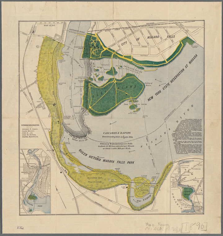 Niagara Falls Parks EstablishedPrior to 1885, the land around Niagara Falls had been privately owned, and in the later half of the 1800's landowners in Niagara aimed to make large profits off of their strategic landownership. Thus, large fences were built along the gorge, preventing people from being able to see Niagara Falls without paying fees. Additionally, industry had set up along the river, which frustrated the public who wanted an unobstructed and unblemished view of the falls. In 1885, New York and Canada purchased a total of 520 acres through eminent domain in order to make the falls a public space for all to see, for free, which reflected the growing conservationist movement that natural wonders and examples of sublimity should be set aside and protected for Americans to see. Additionally, in the 1880s, as a member of the NYS Assembly, conservationist Theodore Roosevelt was a member of the Niagara Falls Association an organization dedicated to promoting public and legislative support for a state park protecting Niagara Falls. Niagara Falls is contested to be the first State Park in the US.
 -
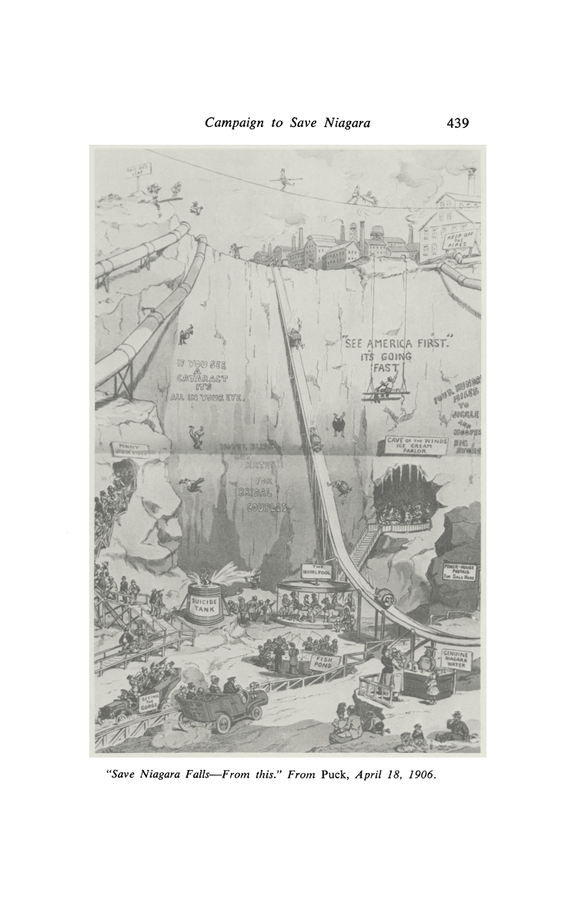 Campaign to Save Niagara FallsDuring the height of the conservation movement, Niagara Falls' tourism industry faced a lot of backlash from both Niagara inhabitants, and national advocates. This political cartoon from 1906, reflects the negative attitude that surrounded how the falls were being treated. The carnivalistic approach and atmosphere around the falls that had grown for the past century was seen as a disservice to the falls' natural beauty and value, and it detracted from the respect that the fall's deserved. During this time period there was a large political movement to protect the falls from this commodification and exploitation, not just from the tourism industry, but also from the newly established power plants. Public frustration grew in Niagara Falls due to the proximity that the power plant had to the falls, in addition to the amount of water that was diverted from the falls; and at the time, no governmental limits had been set that protected the falls from over-diversion of water. While the cartoon mocks the poor taste of the tourism industry, it make a bigger commentary when depicting the falls as completely dried up, with diversion pipes running through the gorge. The political movement to save Niagara Falls from the greed of commodification resulted in a 1909 treaty with Canada that moderately protected the falls from completely running dry by limiting water diversion to 20,000 cubic ft/s for the US, and 36,000 cubic ft/s for Canada, which was more acceptable to conservationists than no limits whatsoever, as the value in producing energy for many people outweighed the desires of the falls' advocates.
 -
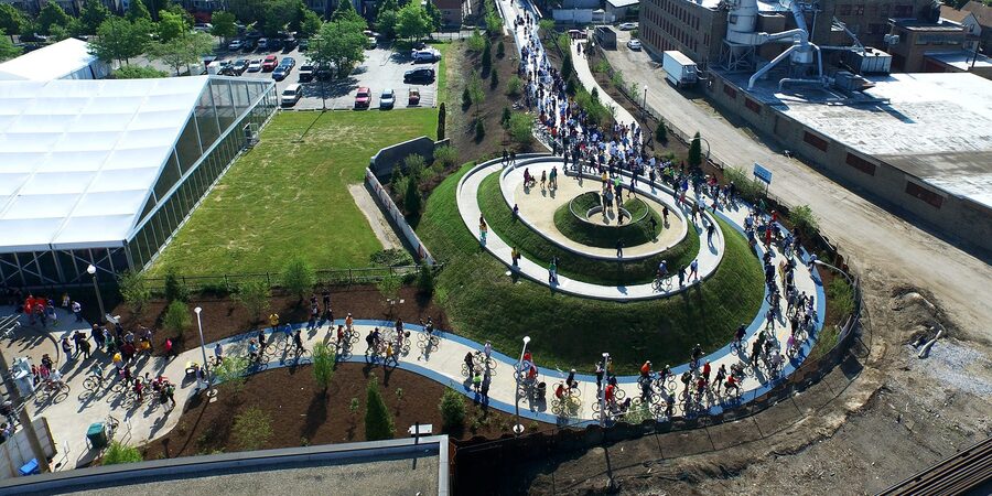 Creation of the 606 TrailA train that once ran through a part of the city became abandoned after it no longer had any reason to run. After it was abandoned nature began to take back over plants and flowers grew all over the tracks and animals began to reclaim it as their home. After a while people began to explore it and also claim it as their own cool nature spot in the city. The city decided to go off of the peoples interest and turn it into an actual trail for people to walk, run, and bike on. After years of renovations and fixing up it is now a highly populated trail that has popularized the neighborhood Logan Square because of its proximity to the trail.
 -
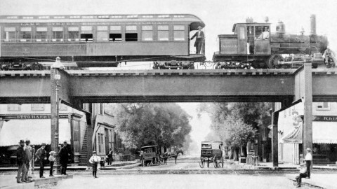 The First "L" TrainThe first "L" train in Chicago was built and ran from 39th to State, Congress, and Wabash. There were train lines prior to this but they all stopped just before the "Loop" which is the center of downtown. Charles Tyson Yerkes solved this problem by building elevated tracks that went above the streets in the Loop, allowing people to be dropped off much closer to their destinations. All of the trains after this until 1940s in Chicago were elevated tracks. This an important part of Chicago's landscape because it is so widely known, it is strange to think of a time where you don't see trains going by above your head. This revolutionized travel in the city and changed the environment because it allowed the people to more efficiently work.
 -
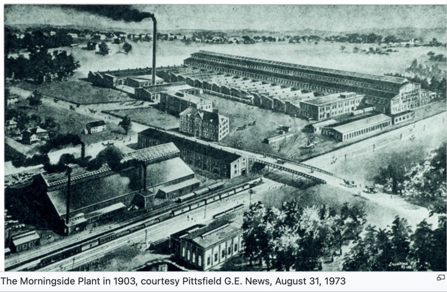
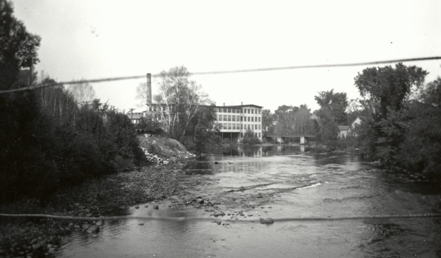 Rise of a Mill TownThe Housatonic River, located in Pittsfield, Massachusetts provided an ideal location for water powered mills enabling the establishment of the wool and paper industries in the region. By the beginning of the Civil War, Berkshire County was home to hundreds of mills situated on the Housic River in the north and Housatonic River in the central and southern regions.
 -
 The Invention of PCBsIn 1932, the Monsanto Chemical Company in conjunction with General Electric developed a synthetic fluid which, “insulating and heat conducting properties similar to mineral oil, but was not flammable” unlike the traditional mineral oil that they had used in most normal transformers. This new substance known as Pyranol, chemically as Polychlorinated biphenyls (PCBs), was put to use in transformers that would be installed in areas where fire would have devastating consequences.
 -
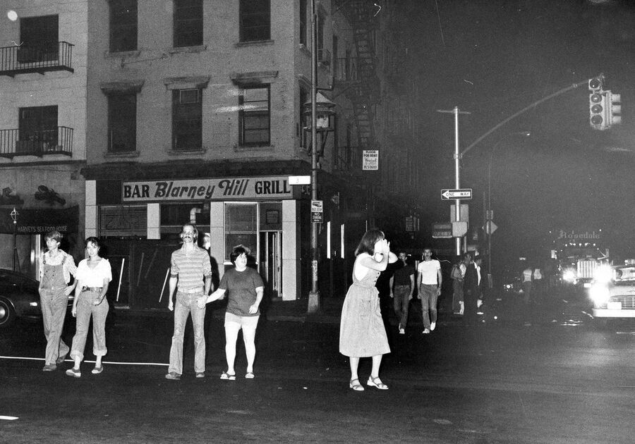 1977 NYC BlackoutDue to social, political, and economic problems, New York City was on a decline in the 1970s. The toll of its problems were especially visible through its deteriorating infrastructure. The toll of all the pressure finally hit when the city blacked out in 1977. For the whole time there was no light, crime ran rampant on the streets of the city. New York City was always struggling infrastructurally, and this seemed to be the city's breaking point. The black out made the news, and it was often said that the city that prides itself finally went dark. The '77 blackout was also a case of the minorities rising up. There were always so much racial tensions in the city, and this blackout showed the results of the minorities, of the underdogs taking a stand up with the opportunity they had.
 -
 Hurricane Ida and Increasing Precipitation LevelsHurricane Ida arrived to New York City during a time where precipitation levels in the Northeast were increasing. Due to climate change, the east coast of the US is getting more precipitation on average, whereas the west coast is getting droughts. This affects the rainfall of hurricanes on the east coast because not only are they becoming stronger because of the warming oceans, but also because there's just more water in the air in general. Hurricane Ida proved to be a hurricane where rainfall was the key, semi uncalled for factor of the ordeal. The amount of rain New York City got devastated the drainage systems, buildings, and the subway system. Everything that wasn't built to take flood damage took most of the hit because of Ida.
 -
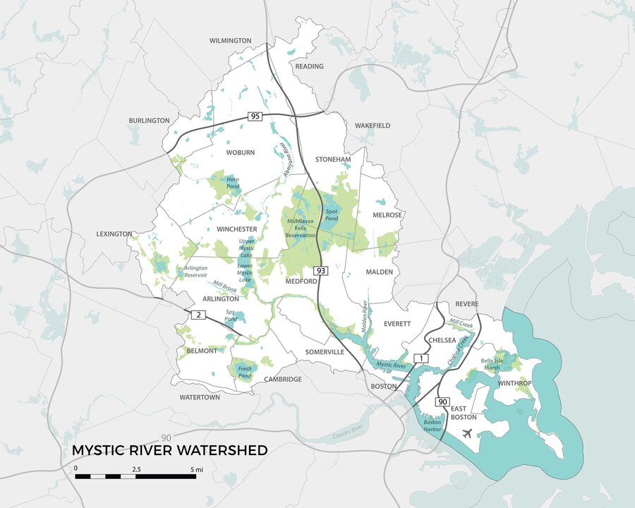 The Preservation of Natural Spaces in the Greater Boston areaIn 1893, Charles Eliot and the Metropolitan Park Commission created a plan with the goal of creating a vast open space network for that suburbs on the outskirts of Boston. Because of this plan, the Mystic Lakes and the Mystic River in Arlington became reservations. The Mystic River was an important area because the river flowed through numerous towns and flowed right into the Boston Harbor. This was a major part of travel in the Greater Boston area before the introduction of railroads and automobiles. Included in this plan were two other destinations that are very close to Arlington, the Middlesex Fells, in Medford, Massachusetts, and Fresh Pond, in Cambridge, Massachusetts. The Middlesex Fells was a large forest preserve that took up roughly 2,000 acres across numerous towns in the Greater Boston area. The Middlesex Fells also was where local water supply reservoirs were located. Fresh Pond, in Cambridge, is a location of great importance to me. I spent a great deal of my childhood here because my grandparents lived a few minutes away. This was an area that was created for its beauty and for public enjoyment.
 -
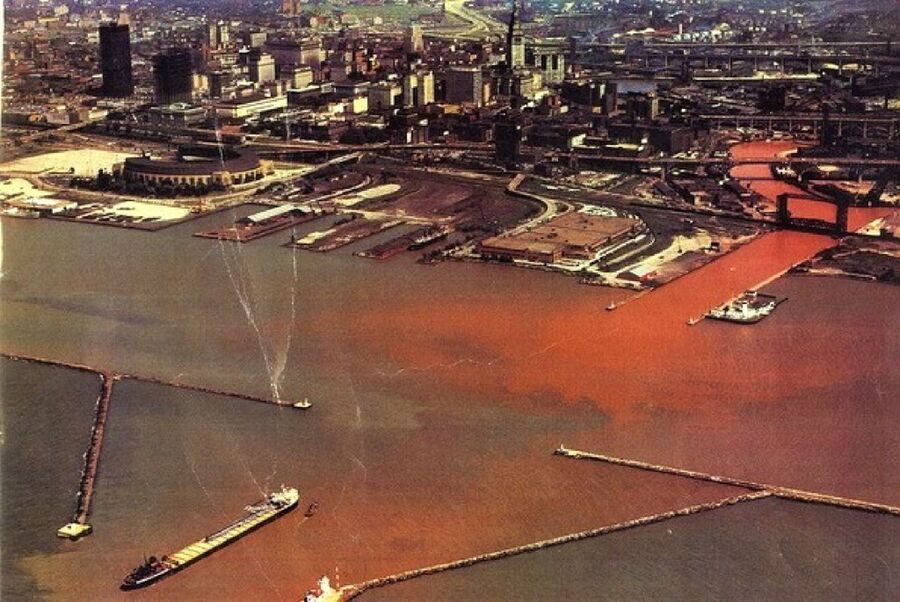 Cuyahoga River Fire of 1969The Cuyahoga River Fire of 1969 caught the attention of the world. It fell perfectly into the time period where environmental disasters like this were not going unnoticed anymore. Although not lasting super long, the fact that a river (water) could catch on fire and grow to five stories brought fourth numerous concerns to environmental protection. Supporting a watershed of 813 square miles, damage to the Cuyahoga would significantly effect millions of animals, wildlife and people. This historical event directly impacted the formation of the Clean Water Act, The Great Lakes Water Quality Agreement and the creation of national and state EPA's.
 -
 Interurbans Connect Geauga County to ClevelandThe Cleveland and Eastern interurban electric railway was established in 1895 and played a crucial role in the dissipation of citizens to the suburbs. With numerous railway lines running for up to 100 miles, people finally found recreation to be feasibly assessable. Geauga Lake, an up-and-coming location for mass recreation just so happened to be located along one of these routes. This was the primary method of transportation until the 1920's when cars began getting mass produced.
 -
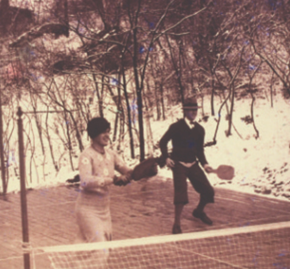 Invention of Paddle Tennis in ScarsdaleThroughout Scarsdale's history, an emphasis on the outdoors and recreational activities have always been stressed amongst town officials. There are spaces scattered around Scarsdale devoted to the health of the environment and leisurely activities. In the fall of 1928, Jimmy Cogswell and Fess Blanchard built a wooden platform, with the intention of playing volleyball or badminton on it. However, the dimensions for those sports didn't really fit the sizing of the platform, so created their own game called paddle tennis, which is essentially smaller tennis using paddles instead of racquets. This game quickly popularized in Scarsdale; many country clubs and parks started building paddle courts for people to enjoy. People had so much fun with the game that it expanded nationwide. Cogswell and Blanchards' positive mistake led them to create a game that is not only a great way to enjoy recreation outside, but is widely played throughout America to this day, especially in suburban areas.
 -
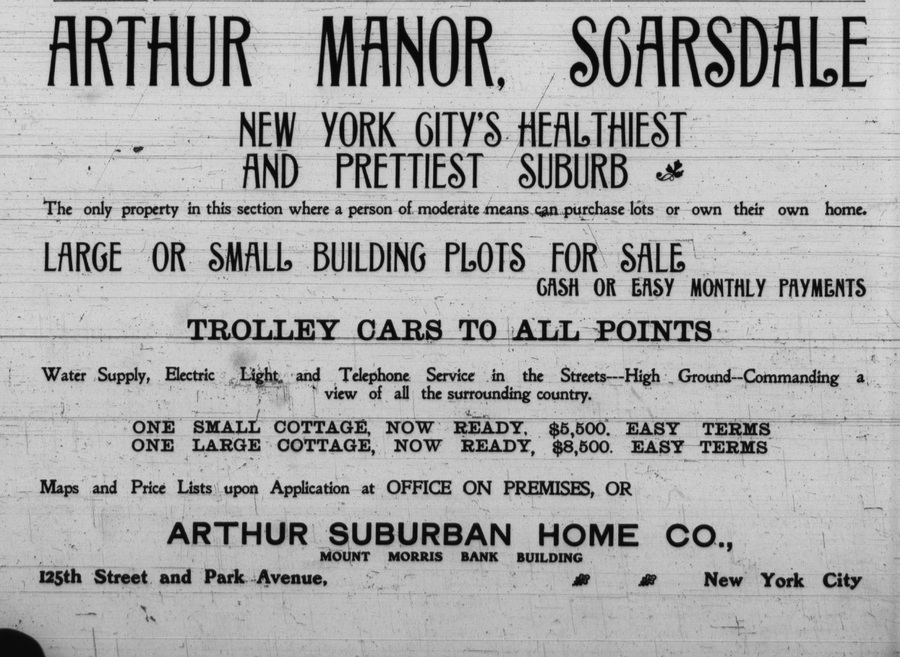 The Arthur Suburban Home CompanyIn 1891, The Arthur Suburban Home Company purchased a 150 acre plot of farm land and began dividing it into individual property plots and constructing homes on it. While all of the houses that were being built looked quite similar to one another (anticipating the neighborhoods inLevittown nearly 60 years later), the company felt the urge to build them quickly to account for the growing populations that wanted to move to Scarsdale. This was a monumental moment in Scarsdale's history because it really transformed the rural country town into a nice suburb. In the building process, the company had to pave the roads, dig holes for the base of the homes and add street lights, which had environmental implications.
 -
 George Bird GrinnellNotably the most important person in the development of Glacier National Park is George Bird Grinnell. Grinnell was from New York, and traveled to the park on a hunting trip in 1885. He saw the sublimity and beauty of the landscape, similar to Pinchot and Roosevelt. From his many visits, he experienced, learned from, and became familiar with the lifestyle of the Blackfeet tribe. He informed the magazines that were publishing his writing in his journals that the mountains were completely uninhabited, and there were animals to hunt roaming freely everywhere. In reality, however, the Blackfeet and other surrounding tribes were struggling because the game they relied on was rapidly being hunted for recreation. While he advocated tremendously to conserve the mountains and lakes of the park, he wanted government control. He was a conservationist, like Roosevelt, Pinchot, Muir, and Cole, but he valued the perception and recreation of the land more than the home it was for the Natives.
 -
 United States vs. Kipp, U.S. District Court for the District of MontanaIn 1974, the Blackfoot people were involved in a legal case regarding their reserved rights within the park. Woodrow Kipp, a member of the Blackfeet, was arrested for entering Glacier National Park without paying the entry fee. The Agreement of 1895 stated that the tribe could freely hunt, fish, and reside on the land as long as it was “public”. Although it is now a U.S. owned National Park, the memorandum of the case stated that the land is still considered “public” under the meaning of the 1895 Agreement, insinuating that the Blackfeet still have the right to access. Judge Donald Smith concluded the case in favor of Kipp. He had not broken any law by entering the park without paying an entrance fee, and he was not charged.
 -
 Nike Missile Site next to Governor Livingston High SchoolAt the end of WWII, and the beginning of the Cold War with the USSR, Bell Labs was commissioned by the United States War Department to begin development on a line of anti-aircraft missiles, which was completed by 1953. The US army ordered 1,000 of the missiles, dubbed Nike Ajax, along with 60 missile launchers. In 1957, the army announced that a missile base would be built in the Watchung Reservation, which is a nature reserve located adjacent to Bell Labs. The construction was heavily protested, but completed in 1958. The base was known as NY-73, and had two parts; the base in the Watchung Reservation, and a radar tracking and control station located directly next to the local high school. The access road that connected the site to Glenside Ave, which runs adjacent to I-78, is now overrun by vegetation and is often used by joggers who live next to the high school. The site of the missile silo is now the location of Watchung Stable, with the stable building being in the exact location of the former underground missile silos. Nike missile silos have been known to contaminate their surrounding area with a chemical known as trichloroethylene, or TCE, which was used to clean the missiles. TCE has been determined to cause massive negative health effects, as per the Department of Health.
 -
 1895 Blackfeet AgreementIn 1895, the Blackfeet tribe sold the western side of their reservation to the U.S. government for 1.5 million dollars. However, they retained the rights to “hunt, fish, and cut timber for domestic and agency purposes on the land for as long as it remained public land of the United States.” When Glacier National Park was officially built, that land was ceded under the Agreement of 1895, no longer making it public land, and revoking the tribes’ freedom.
 -
 Mianus River ParkIn 1901, Robert T. Morris bought 350 acres of land on the Greenwich/Stamford border that surrounded the Mianus river. In the late 1960s, Stamford purchased 77 acres of the land, and Greenwich purchased 110.3 acres, all for park and recreational space. The park quickly gained popularity from nature-lovers, hikers, dog-walkers, fishers, and more. By the mid-2000s, overuse of the park became evident and a joint Stamford-Greenwich action plan was put into effect to control park use and repair damage.
 -
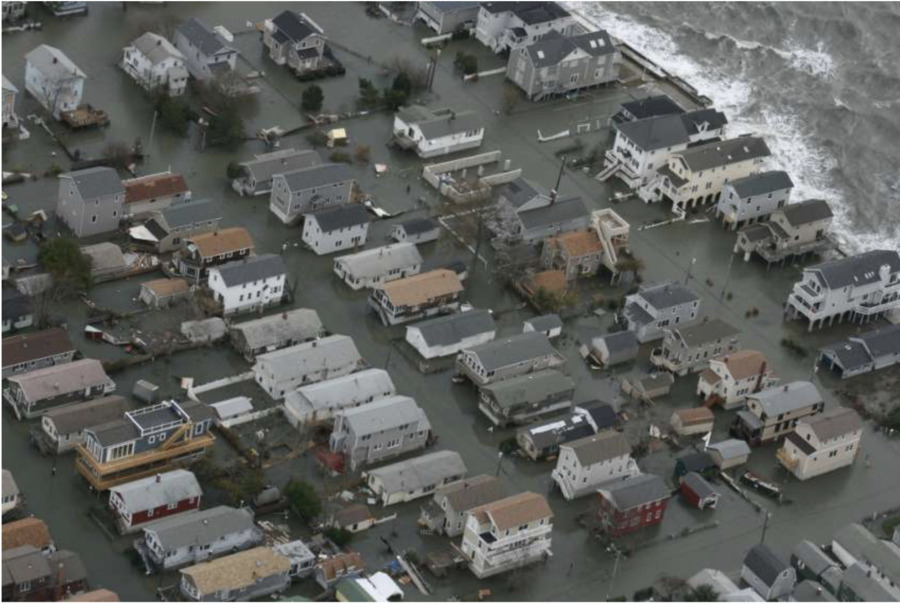 Hurricane Sandy hits Stamford's CoastAlso known as Superstorm Sandy, the category 3 hurricane hit Stamford's coast with 70 mph winds. Between Greenwich and New Haven, the storm surge that reached 9 feet. It was one of the most destructive storms to ever hit Connecticut. 1/3 of the city lost power, and it caused $360 million dollars worth of property damage.
 -
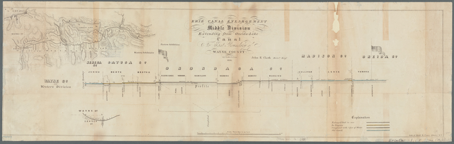 Erie CanalThe Erie Canal started construction in Rome, New York in 1817. This massive infrastructure porject sought to connect Lake Erie with the Hudson River, connecting all of Central New York to the City of New York. This canal opened up trade and allowed for many central New York towns to engage in heavy industry.
 -
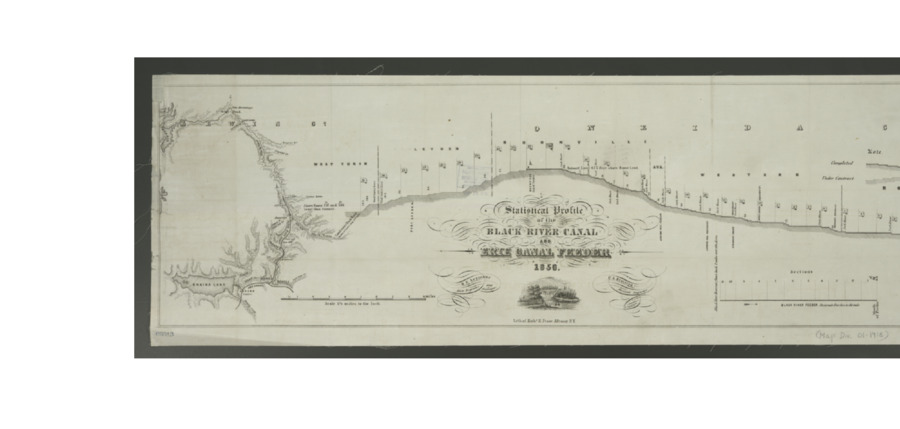 Black River CanalThe Black River Canal was supposed to connect the northern part of New York, west of the Adirondacks to the Eire Canal. This canal was expensive, steep and short, totaling only 35 miles and climbing over a thousand feet. The canal proved fiscally impossible and closed after the railroad opened.
 -
 Clear Air Act of 1970 becomes LawThe Clean Air Act of 1970 was a landmark legislation that for the first time proactively set emissions standards and increased the previous enforcement powers of the federal government. This act was amended in 1977 and again in 1990 to further strengthen the bill to regulate toxic waste and emission that erode the ozone layer.
 -
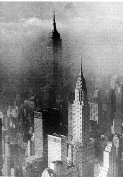 1963 Smog incident in Manhattan kills 300-405 peopleSimilar to the levels in the episode in 1952, in 1963, an unusually warm period forced another stagnant air mass to stay trapped in New York City for two weeks. As seen in an image from the Associated Press, the top and a majority of the upper floors of the Empire State Building were not visible because of the thick smoke. It was reported that, “... an estimated 300–405 people died during a two-week smog episode…” – much longer than the 1952 episode.
 -
 Pollution of Alewife Brook and Mystic River - Arlington, MassachusettsDuring the late 1870s, there was growing concern in the town of Arlington over the frequent polluting of the Alewife Brook, which is located on the Arlington and Cambridge border. The pollution was being caused by the city of Cambridge because of the emptying of sewage into the brook. On November 18, 1879, there was a town meeting held in Arlington where people wanted to see action being taken over the heavy increase in the pollution of the Alewife Brook. Roughly a year later, on December 30, 1880, a committee was selected to protect public health and put an end to the emptying of sewage into the Alewife Brook and the connecting Mystic River.
 -
 Nick Stoner IslandIn the center of Canada Lake lays a small island make up of rocks and trees. In 1952 a group of residents on the lake bought the island form Cy Durey, who owned the Stewart's Landing Dam. To this day you can dock your boat at the island and explore. Due to erosion and natural disasters many trees on the island have died and the size of the island is decreasing.
 -
 Kane Mountain Fire TowerTo keep watch for forest fires due to deforestation of the Adirondack Park a fire tower was constructed. The fire tower provides an amazing view of the surrounding area and brings perspective to the lake's location.
 -
 Lebanon Area Prior to Colonial SettlementPrior to the arrival of European settlers, Lebanon and the nearby Mascoma valley (named after Mascommah, the Chief of the Squakheag) were the hunting territory of the Squakheag, a subgroup of the Abenaki tribe who largely inhabited New England and Canada. The tribe traveled the fishing waters of the Connecticut River and its branches, including the Mascoma River, which was said to be “almost solid with fish". Native Americans had ceased living in this region, however, possibly as early as 1700.
 -
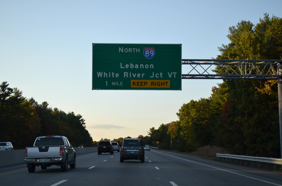 Routing of I-89 and I-91 Through LebanonIn June of 1956, a new Federal-Aid Highway Act was passed that authorized the construction of a 41,000-mile network of interstate highways through the United States with a budget of $26 Billion. Two of these highways, Interstate 89 (Bow, NH-Canadian Border) and Interstate 91 (New Haven, CT- Canadian Border) were routed through Lebanon, and as all odd numbered primary interstates, they both run north-south. The routing of these interstates helped contribute to Lebanon's economic revival following the end of the mill era.
 -
 New DHMC Facility OpensPreviously located in Hanover, NH, In 1991, the Dartmouth–Hitchcock Medical Center moved to a new campus just south of the Lebanon-Hanover town line, along with most departments of Dartmouth Medical School. DHMC is New Hampshire's only Level I Trauma Center and it includes New Hampshire's only air ambulance service. A variety of medical and high-tech firms have since opened facilities near the hospitals new location.
 -
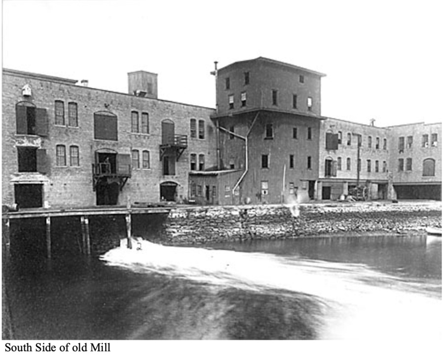
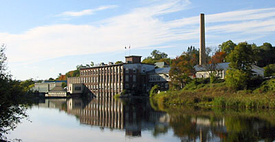 Height of the Mill DistrictA mill district developed at falls on the Mascoma River in the mid 1800s. The various industries that would exist in the district included: a tannery, a clothing factory, furniture mills, several machine shops, and a woolen textile mill. These industries attracted many French workers from the Quebec province, and this district became the center of town As railroads developed up and down the river, as well as to Boston, Lebanon's success in the textiles industry was solidified. In the mid 1900s the mills closed and the nature of the region changed as the textile industry came under attack from foreign imports and other economic changes.
 -
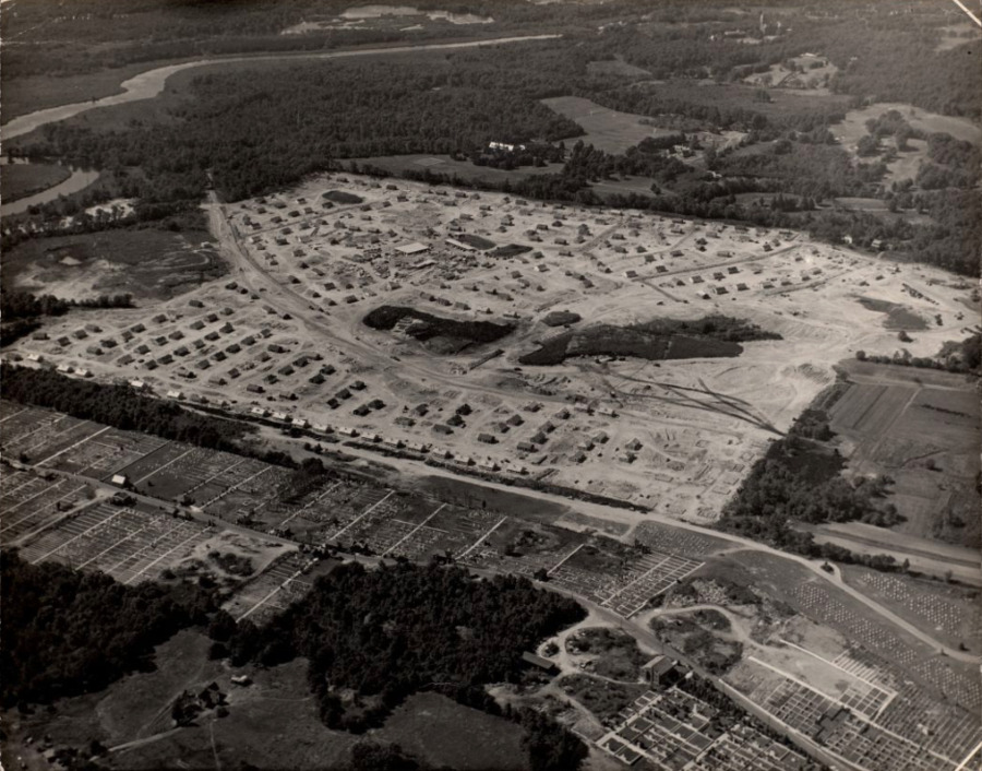 Post World War II Boom in NewtonAfter World War II there was a huge desire for people to move out of the city and into the suburbs. This big rise in population in the late 1940s led to Newton building a new village (Oak Hill Park) full of veteran housing. These houses and neighborhoods were somewhat similar to those in Levittown. Additionally, this area was given a park, shops, a school, and other amenities that a community would need. Newton was working to make this area appealing to families trying to move to the suburbs after the war. As automobiles were also still on the rise during this time, bigger shopping centers were built along the highway only a few miles outside of Newton. All of these new expansions led to the continued growth and success of Newton as a suburb.
 -
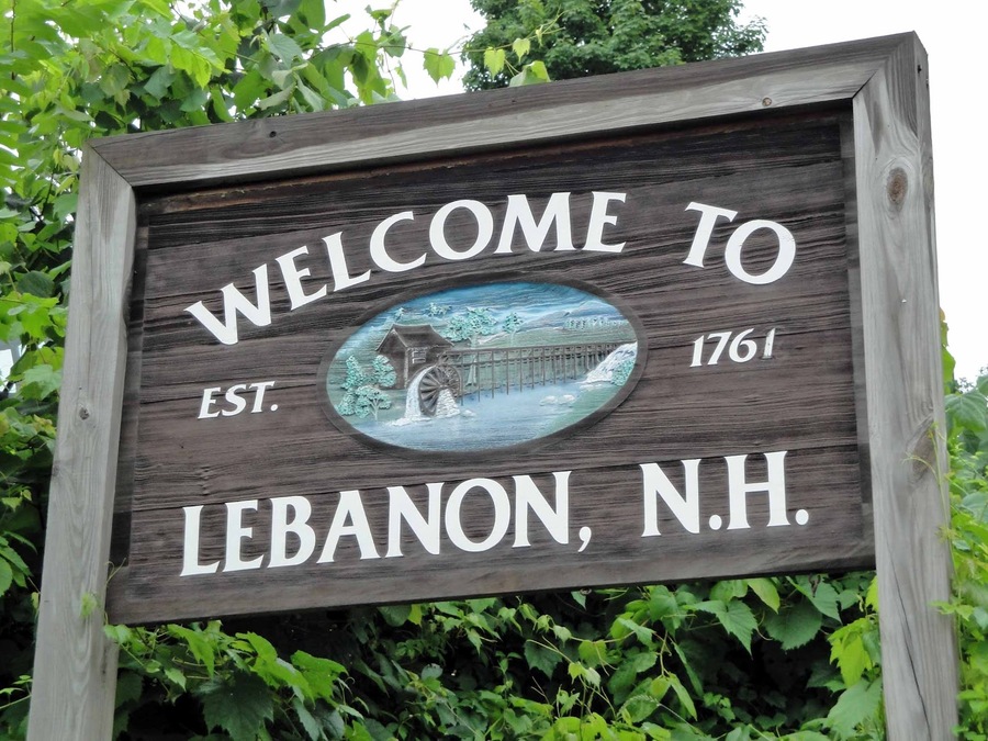 Lebanon Chartered as a TownThe colonial governor Benning Wentworth chartered Lebanon as a town on July 4, 1761. It was named after Lebanon, Connecticut, as many early settlers had come from there. One of whom was Reverend Eleazar Wheelock, who came in 1770 and would go on to found Dartmouth College. Its location at the convergence of the Connecticut River and the Mascoma River made it a good destination for the transport of resources as well as a good energy resource for running mills, and it was 1 of 16 towns that would be chartered along the Connecticut River
 -
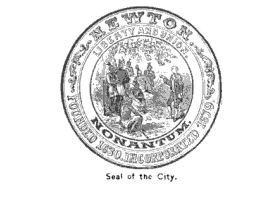 The Land for Newton is Officially Set Apart from CambridgeThe land for Newton was originally settled by Native Americans until the Europeans came in and began to set up more European-like civilizations. The reason the Europeans wanted a “New Town” in the first place was to make it a fortified town to be separated from the Native Americans. While this fortified land did not become Newton, the idea of building new towns is what eventually led to Newton’s creation. Newton was part of Cambridge, but in 1681 the land south of the Charles River was set aside and renamed Cambridge Village. 10 years later this land was named Newtown. Newton was given the name Newton when one day a town clerk decided to leave out the second “w.”
 -
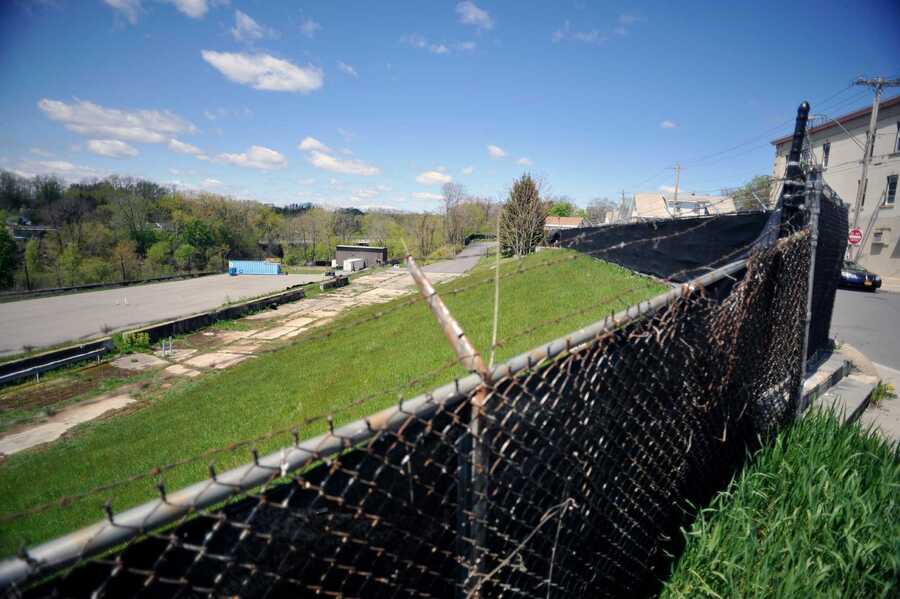 The First Proposed GE Remediation PlanThe first proposed remedial actions for the Schenectady GE plant in 2004 described a remedy preferred by the NYSDEC and NYSDOH to address the hazardous waste contamination found around the plant. Some of these suggested remediations included: “excavation and off-site disposal of PCB-contaminated surface and subsurface soil at various locations in the manufacturing areas and former landfills, soil or asphalt covers over surface soils in portions of the manufacturing area, soil and vegetation cover system for surrounding landfills, shallow groundwater treatment for select areas and periodic review of the effectiveness of the completed remedial actions.” The DEC felt that these were the most important changes that needed to occur after investigating GE’s territory. The 2004 estimated total remediation costs were projected to be $45,800,000. This estimate was severely undermined, we now know that the up to date cost of the remediation is at least $78 million.
 -
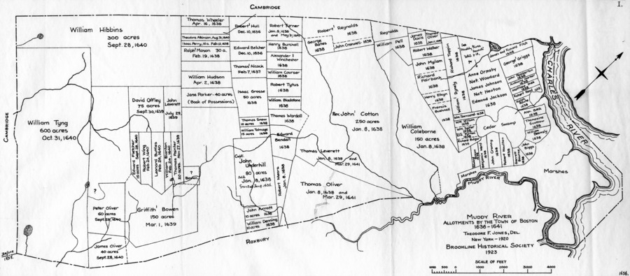 The Founding and Incorporation of BrooklineIn 1636 the selectmen of Boston allowed for 16 grants along the muddy river, though the town didn’t gain its name until January 8th, 1638, and isn’t incorporated till 1705. By the time the town was incorporated, there were around 50 families throughout the area with zero public buildings or churches. The majority were poor farmers.
 -
 GE becomes a Superfund SiteOnce GE signed off on the agreement with NYS for investigating contamination, the plant became a superfund site. Superfund sites in NY are controlled by the NYSDEC, the agreement allowed the state to take control of the project, paying for the investigation and cleanup. When the state suspects or is aware of immense amounts of hazardous waste that may have been improperly disposed of at a specific location they can discuss with the company responsible to start an investigation. Inactive hazardous sites like the Schenectady GE plant go through a process of investigation, evaluation, cleanup and long term monitoring. The investigation period lasted from 1995 to 2003.
 -
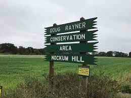 Creation of Nockum HillInterest in land conservation began in the late 1900’s. This was mainly due to the 1938 and 1954 that disturbed the coast's fragility. It was also apart of the national conservation movement. In the 1960's, 70 acres on Nockum Hill was set aside and preserved. It's said that the first shots of King Philip's war were shot near by.
 -
 The Worcester City Council Votes to Support the Green Worcester PlanOn April 27, 2021, the Worcester city council voted to support the Green Worcester Plan. This plan outlines a series of goals designed to make Worcester one of the most sustainable and climate-resilient mid-sized cities in the United States by 2050. The number one goal of the plan is to achieve 100% clean and affordable energy systems within the time frame. Other goals include developing sustainable transportation choices, achieving zero net waste, and developing sustainable local food systems.
 -
 The Asian Longhorned Beetle is Identified in WorcesterThe Asian longhorned beetle (ALB) is an invasive species of insect that feeds on hardwood trees and can cause significant damage to tree populations. In 2008, it was discovered that the ALB had infested trees throughout the city of Worcester. Researchers discovered that the species had arrived over a decade before they realized it was there and had been infesting trees for years. This outbreak was the worst in the country and caused around $24 million in damage in Worcester alone, with over 30,000 trees being removed. Worcester was hit particularly hard by the ALB because the city had a very high amount of tree cover and most of these trees were Norway maples which were a main part of the ALB diet. This crisis changed the way that Worcester managed its forests and changed the landscape of the city dramatically.
 -
 Charles Keeling and the Mauna Loa ObservatoryIn the 1950s Charles Keeling began recording atmospheric levels of carbon dioxide in an attempt to identify its correlation with climate change. In 1958 he received funding from the IGY to establish a research base at Mauna Loa nearly two miles above sea level. Keeling's research revealed a definitive correlation between increases in CO2 and human activity, leading to the trapping of heat in the atmosphere. His findings contributed to the emerging perspective which emphasized the need for immediate political action targeted towards reducing emissions.
 -
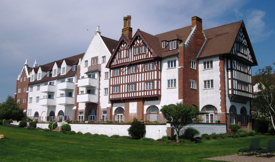 Miami Beach of the NorthIn 1926, Carl G. Fisher purchased a chunk of land in Montauk from the US government after being sold as surplus government property at the end of WW1. He planned on creating an urban Montauk which could serve as “the Miami Beach of the North” where people could travel to the city and save a day's worth of travel. He built the Montauk Improvement Building, which is still the town's tallest occupied structure, the Montauk Manor hotel, and dredged Lake Montauk and opened it to the public. Fisher eventually lost his fortune during the Stock market crash of 1929 and these plans did not pan out.
 -
 LIRR extension to MontaukEast Hampton remained largely undeveloped until 1880 when Austin Corbin extended the Long Island Rail Road from Bridgehampton, New York to Montauk. In 1879, Arthur Benson would force an auction in order to purchase 10,000 acres around Montauk and evict the Montaukett native Americans who resided there.
 -
 Bennington IndustryIn the early 1800s the first of many mills and foundries were built along the Walloomsac River, starting an industrial legacy lasting until the present day.
 -
 Norton Pottery Established, Bennington VT, 1795Capt. John Norton buys a farm and establishes a pottery that continued production until 1984
 -
 Bennington, VT, EstablishedBennington started as a farming settlement. The first Vermont settlement west of the Green Mountains.
 -
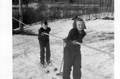 First Rope Tow Installed at Storrs HillIn 1923 the Lebanon Outing Club was founded and they began carving away at an alpine trail on Storrs Hill. Overtime a competitive ski jump was added to the trail and eventually in 1935 a rope tow was added to the lower portion of the trail, as well as a lodge at the base. The 86 years of continuous operation make Storrs Hill potentially the oldest continuously operating lift-served ski area in the United States
 -
 CCC at Fullersburg Woods Forest PreserveThe Civilian Conservation Corps (CCC) was a program implemented as part of Roosevelt’s New Deal. As discussed, Roosevelt was strongly influenced by naturalists during the conservation movement. Created in 1933, this New Deal aimed to help unemployed men get back in the workforce. The CCC program was about improving different natural resources as well as public parks. From 1933 to 1938, one CCC group was stationed at an Army camp in Fullersburg Woods Forest Preserve in DuPage County. Here, they were tasked with making the property more suitable for recreational use. At this point, this forest preserve was in very poor condition and failed to attract visitors and also allow them to connect with nature similar to what Roosevelt did. Over the course of those 5 years, creeks were graded, trails were paved, and many structures were constructed. As a result, thanks to the veterans and young men in CCC, Fullersburg Woods has become a common attraction for visitors who like to hike and boat.
 -
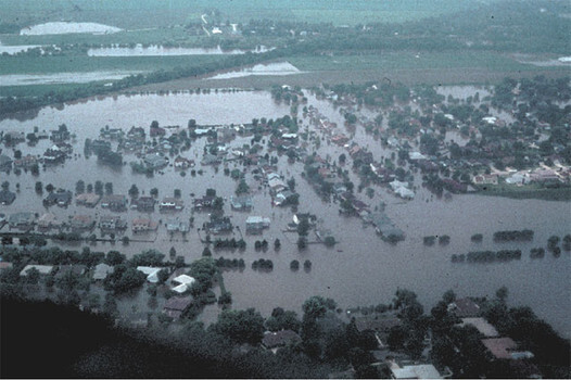 DuPage River Flood of 1996In 1831, Joseph Naper founded Naperville along the DuPage River. The downtown and other amenities were built around the river. Fishing, kayaking, and water boat sports commonly take place. It has been one of the main draws to the city. In 1996, the DuPage River completely flooded. The expected 100-year, 24-hour storm was exceeded. The state-wide record of 16.94 inches in 24 hours poured down upon DuPage county. As a result, a total of six people were killed in the flood More than 35,000 houses were affected by the disaster while $600 million in damages were also caused. Towns in DuPage county were motivated to prevent another future occurrence. A few years later, in 2002, a county-wide Storm water Management ordinance was established.
 -
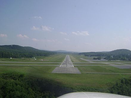 Lebanon Municipal Airport EstablishedIn February 1941, a special town meeting took place to allow for the purchase of up to 750 acres on Slack Hill. This land was turned into an airport, to be operated by the town while owned by the federal government. In February 1941 a special town meeting took place to allow Selectmen to purchase a maximum of 750 acres on Slack Hill. In June 1944 the Federal government turned airport over to the town. The town of Lebanon promised that full rights would remain with the Federal government. Following World War II, many improvements were made to the airports infrastructure, but today it mostly does smaller flights to areas in the northeast due to its proximity to larger airports in Manchester and Boston.
 -
 The Expansion of NapervilleNaperville was founded in 1831 by Vermont native Joseph Naper. By the next decade, many more people began moving from the Northeast. The key to the growth of Naperville can be attributed to its location. The town became a popular stop between the two major crossroads that came from Chicago. Its county was established eight years after the town was founded, and 3 years before Joe Naper made his first town map layout. Farming and agriculture played a huge role in expansion. The seemingly endless farm land helped power the economy and attract more residents. More and more people moved westward after WW2 into the suburbs. Now, Naperville is considered to be the fourth largest city in Illinois. However, due to the current rapid population growth and expansion, the rich 1800+ year old prairie soil has been constantly disappearing beneath the nearly 200 and counting residential subdivisions which are being constructed. This very soil has been the root to the overall growth of the town. In the present day, more and more farmland is being purchased from farmers and turned into residential neighborhoods and sports fields/parks.
 -
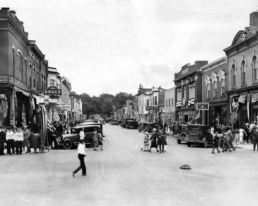
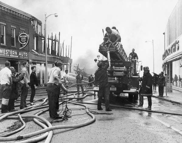 Lebanon Fire of 1964At 4am on June 19th, 1964, Albert Healey set a rug on fire in an abandoned blacksmith shed near downtown Lebanon, NH. Conditions that day were particularly dry and windy, so the flames quickly spread to other buildings in the are, destroying more than 20 businesses and claiming two lives. The city's infrastructure changed considerably after this fire, as the old mill district which had been destroyed was never fully rebuilt
 -
 Stamford Manufacturing CompanyStamford Manufacturing Company, established in 1844 on Cove island, a piece of land separated from the mainland. The area had been used for water mills since the 1790s. Henry J. Sanford and John C. Sanford converted the mills to a chemical industry, producing drugs and dyewood extracts. In later years the company extended to Westport, Port Chester and Rye, holding mills along the coast in those surrounding towns as well. From 1859-1870, Stamford Manufacturing Co Stamford's largest industry and the world's largest dye extract concern. The focus of the mills changed a few times throughout the company's existence, but the mills were almost completely destroyed by a fire in 1919.
 -
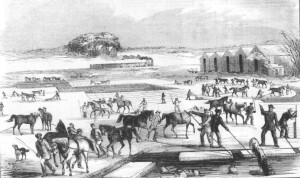 Booming Ice Industry in the Winter- Arlington, MassachusettsBeginning in the 1840s, Spy Pond in Arlington became a popular destination for ice cutting in the wintertime. Many icehouses began to be built surrounding the pond. During the 1840s, the group Gage, Hittenger & Co. began to make great strides in their ice-cutting business. The ice that was being cut from Spy Pond was being sent all over the world and started causing the ice business in Arlington to boom. It was said that "the Spy Pond ice went all over the world- to the southern states of our country, to the East and West Indies, to China, to India, to South America, even to Australia". (Hurd, 198) This booming ice business was crucial for the residents of Arlington and the Greater Boston area because the 1840s was a time before everyone had a refrigerator and freezer. Ice would have been used as a way of keeping food or milk from going bad, similar to how a refrigerator is used today. The fact that the residents of Arlington had this business in their town gave them the ability to always have access to ice. The ice business at Spy Pond was overall very beneficial for Arlington, MA. It is great to see that people were using the resources around them, such as a giant frozen pond, to make ends meet while also benefitting the town, in the 1840s.
 -
 EPA Releases Report on Air Quality in New York City-Based on data from 1999, the EPA called the air in New York State, the second dirtiest in the county, only after California. In an air quality report, it stated, "68 out of every million New Yorkers is at risk for getting cancer just from breathing the air."
 -
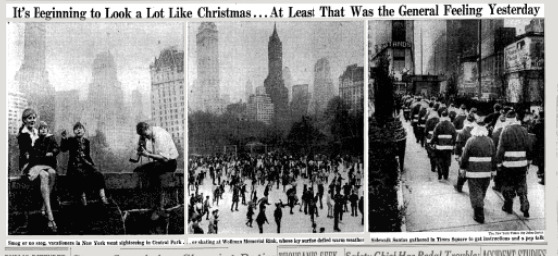 Killer Smog of 1966 hits New York City over ThanksgivingAnother wave of smog impacts the city over Thanksgiving as a result of a warmer than usual fall that trapped air above Manhattan, causing an official air-pollution emergency. Beginning on November 24, a dense smog blanketed the city, not moving until November 27 after a cold air mass swept it away. It was later discovered residents were affected by the smog for the following 4 days. In the end, over 10% of the city's population was harmed or had lasting effects.
 -
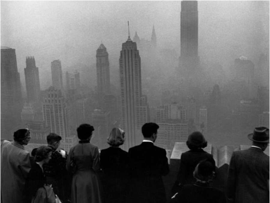 1953 Killer Smog Hits ManhattanOver a 6 day period in New York City, a dense smog lays over the city. This led to roughly 20-30 death a day as a result of lung and respiratory problems as well a automobile accidents due to lack of visibility. Residents suffered from "... dry, wheezing, watery-eyed coughs" that sent many to the hospital. This was even enough to shut down Times Square-- because you could barely see.
 -
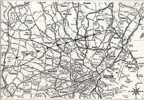 1851 Tornado in Arlington, MassachusettsOn August 22, 1851, a powerful tornado swept through parts of the Greater Boston area, leaving "West Cambridge (Arlington) a devastated swath which was, in most places, from thirty to fifty rods wide". (Hurd, 189) Although the tornado swept through Arlington for only a few minutes, a considerable amount of damage was done to the town. People lost homes, businesses, crop fields, and numerous other things in a matter of minutes. It was said that there was roughly $25,000 of damage in Arlington alone. Luckily, there were no casualties in Arlington as a result of this powerful storm. It was said that the people who witnessed this tornado described it "as a dark cloud sweeping over the surface of the country with frightful speed". (Hurd, 189) The residents of Arlington must have had no idea what this powerful storm was because there had never previously been a tornado in the Boston area prior to 1851. Tornados also do not usually occur in Massachusetts or the New England region. Tornados are likely to occur in the middle region of the United States, in places like Kansas. Following the storm, the residents of Arlington met in the town center and raised money for relief efforts to cover the cost of the damages.
 -
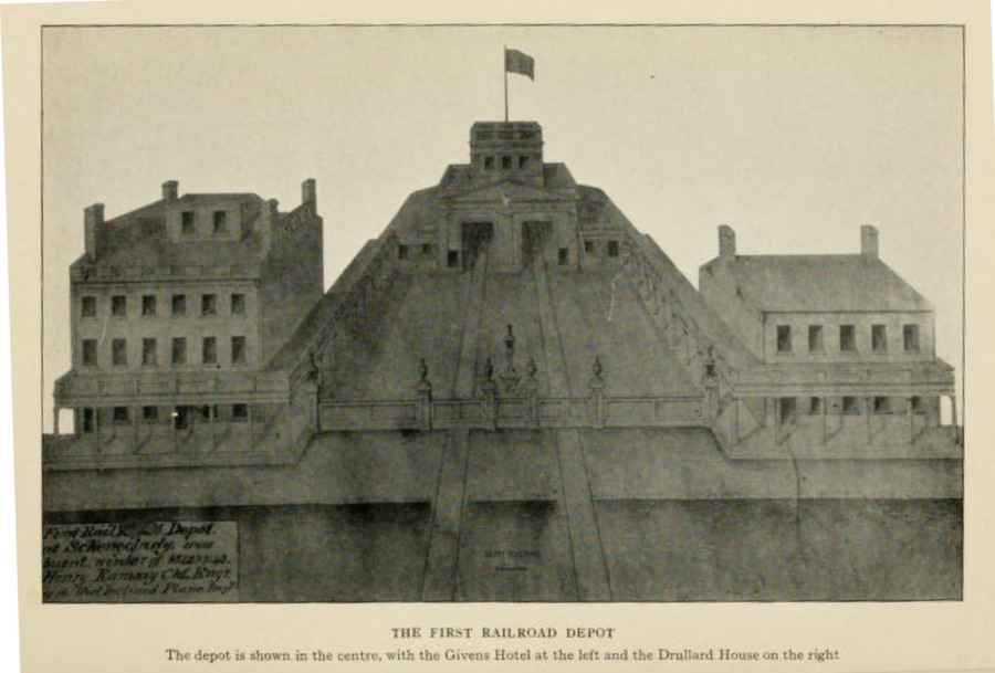 The Creation and Expansion of the Mohawk and Hudson RailroadMohawk and Hudson Railroad was the first built in the state of NY (April 17th, 1826) and is one of the first railroads in the United States. The purpose of the company was to take passengers traveling using the Erie Canal from Schenectady to Albany. The reason was to bypass the Cohoes falls entirely and cut down the time needed to travel in between these two cities from a whole day to under one hour. The company changed to Albany and Schenectady Railroad (1847), then the New York Central Railroad (1853). Just as many parts of the Erie Canal were shut down the railroad companies also shifted throughout the years but many of the tracks still stay in the general area in which they were built many decades ago. These tracks go through the heavy industrial part of Schenectady which creates industrial pollution as a byproduct of the train running and the potential contaminants that it carries. This was another site where I collected dirt samples because of the potential contamination in the soil.
 -
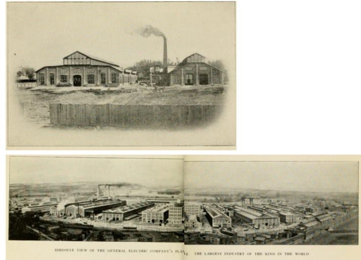 GE company grows in size as the industry revitalizes SchenectadyGeneral Electric Company grows from a small plant in 1886 (Top picture shown) to 1914 plans (Bottom Picture). The business grew to such an extent that offices were established in the principal cities in the US and foreign countries. The original plants at Schenectady, Lynn and Harrison, N. J., were retained and enlarged, while other plants were added. The principal manufacturing plants now are at Schenectady, N. Y., Lynn, Mass., Pittsfield, Mass., and Harrison, N. J. The company also has plants at Erie, Pa., Fort Wayne, Ind., Toledo. Ohio, Cleveland, Ohio, Newark, N. J., and East Boston, Mass. This connects to a new age of manufacturing and a new age of polluting. I myself went to try and grab soil samples for my stats project near the main plant on 1 River Road and the security is airtight and there is no obvious soil samples to take. The company covers the entire building grounds with grass covering and extra soil to keep contaminants out of the eyes of the public. There is a long history of super fund sites that surround this area and the general wealth of surrounding neighborhood that I collected samples from visibly show the deterioration that GE caused in the immediate area.
 -
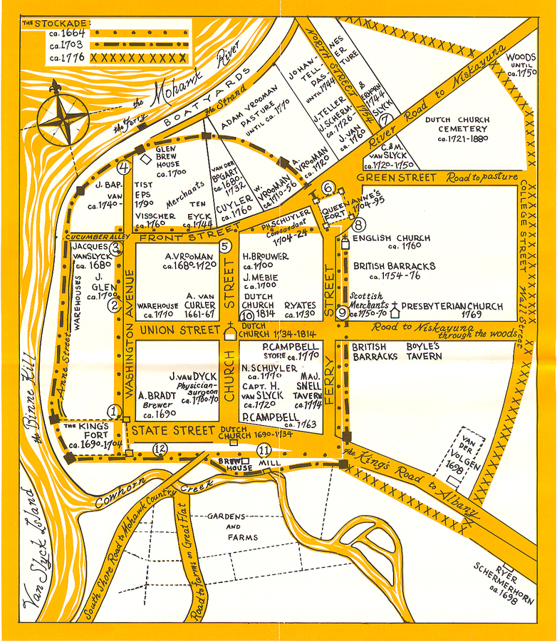 Newly Chartered Schenectady Struggles to maintain order.Schenectady struggles to maintain order as the city was newly built and public land was plentiful. One of the more prominent issues was the stealing of timber. The City Council had problems with individuals just ignoring fees and hired guards would just join in on the stealing of timber as well. All trespassers had to do was to fence off an area and start a farm then years later the city would sell the land to them for a tiny sum of money instead of getting into a costly lawsuit. The city would also try settle these disputes with "delinquents" by fining them to pay for their own prosecution.
 -
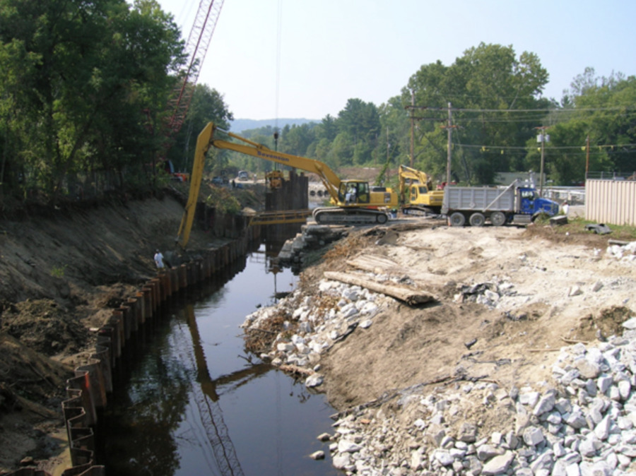 EPA Announces Action Plan for Remediation of PCB Contaminated Housatonic RiverAfter over six months of intense negotiations with GE with no common ground being found, the EPA announced an initial plan to remediate PCB contamination in the Housatonic River. While GE had expressed, "concern whether remedial actions — other than taking no action — are justified in light of engineering feasibility, environmental effectiveness, and cost considerations” , the EPA ordered General Electric to clean up the first two miles (out of the outstanding 12.5 miles of majorly contaminated river) of polluted land. The agency also announced its plans to designate the area a Superfund site. It would take another year of negotiations to produce an agreement on the remediation of the first half-mile of the river, with GE being given until 2005 to complete this initial cleanup.
 -
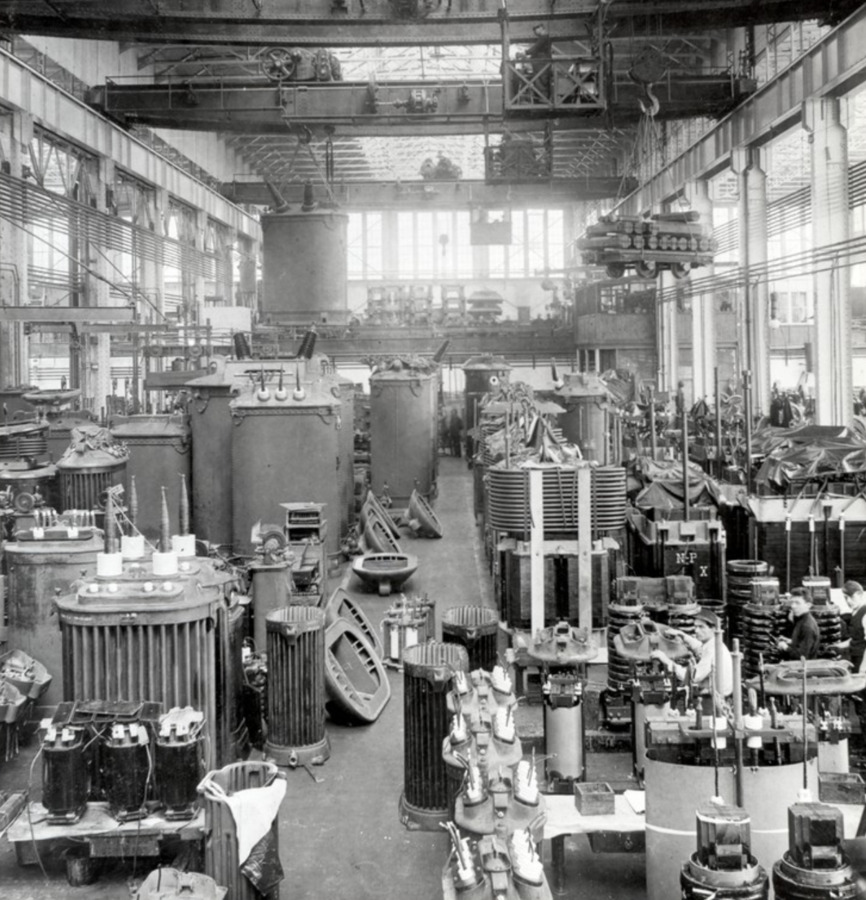 G.E. Contamination of the Housatonic RiverDuring the 1930s General Electric Began using PCBs as a lubricant in their manufacturing process of electric transformers. In 1969, GE began dumping about 1,143 pounds per day of suspended solid waste directly into the Housatonic River which had become a popular waste removal method for local sewage and industry. Between 1932 and 1977, the company released a total of more than a million and a half pounds of PCBs into the Housatonic and the greater Pittsfield area including Silver Lake.
 -
 Martin Nelson Kimbell Buys Jefferson TownshipMartin Nelson Kimbell was the first white colonialist settler of the Logan Square area. He moved there from New York and bought 160 acres of land in 1836. This land is what would later become Logan Square. His buying up the land was important because it led to businesses and roads being built in the area and people began to be more attracted to the town as it developed. It didn’t get annexed into the city until 1889 which is what led to it developing and becoming an important neighborhood in the city. There is a road going through Logan Square named after him but they changed the spelling to Kimball instead of how his last name is actually spelled.
 -
 Post Fire ConstructionThe great Chicago fire that happened in 1871 burned down a lot of the city and so afterwards restrictions on building intensified throughout a lot of the city. Jefferson Township which is what is now Logan Square was outside of the limits of these restrictions so the houses that were built in the neighborhood could be built more inexpensively. This made this place very appealing to immigrants who were looking for affordable housing, which led to the high populations of immigrants throughout the development of the city. This is an important part of Logan Square's history because it led to the array of immigrant populations in Logan Square even up until recent history.
 -
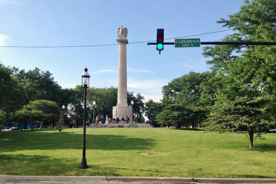 Centennial Monument BuildingThe Centennial monument which sits directly in the middle of Logan square represents the history of Chicago as a whole. It was dedicated in 1918 after World War 1, to mark 100 years since Illinois became a state. The images on the side of the monument represent the history of Chicago. Depicted on one side are Native Americans and a Jesuit Missionary and Pioneers. On the other side are figures that represent fine arts, agriculture, labor, and transportation. The pillar going up from those carvings was inspired by the greek which symbolizes the first true democracy. Finally the eagle on top represents the Illinois flag. This monument represents a lot of different factors of history and is an important spot for people to come together in the center of Logan Square.
 -
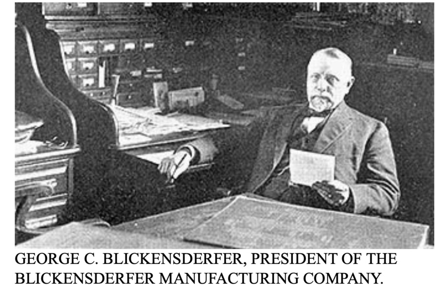 The Blickensderfer Manufacturing CompanyGeorge Canfield Blickensderfer invented the Blickensderfer Typewriter in the 1850s. His model drew huge interest, and he rented a factory on Garden Street, Stamford, CT to manufacture them. Due to international demand, he then opened a more modern factory on Atlantic street. His company became one of the world's largest typewriter manufacturers. It employed about 200 people and produced 10,000 products per year.
 -
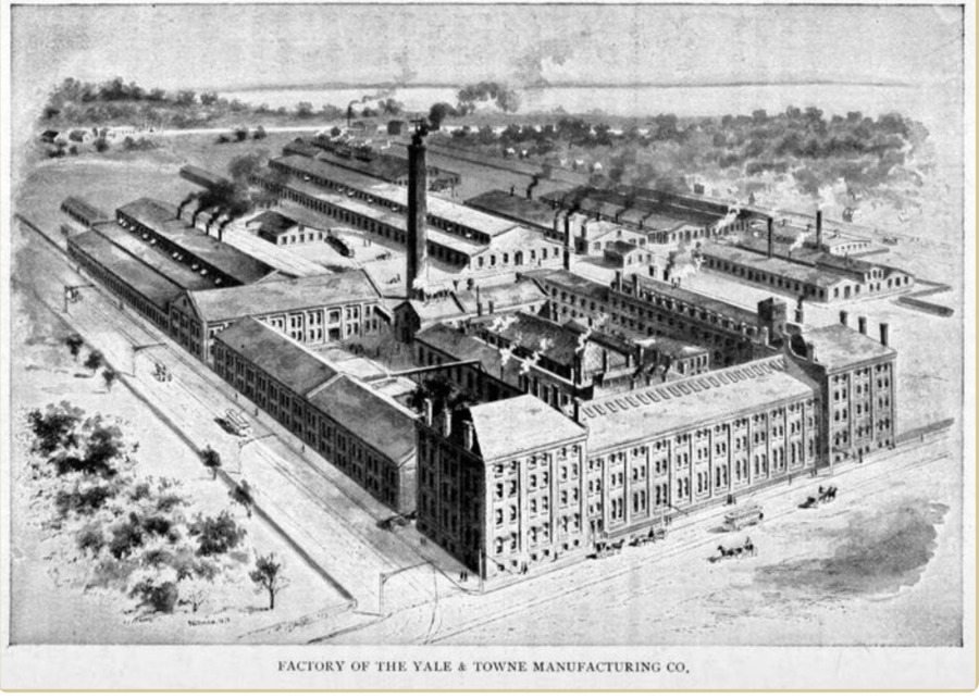 The Yale Lock CompanyEstablished by Linus Yale Jr. and Henry R. Towne. Yale was an inventor of bank locks and Towne was an engineer, the two decided to partner and moved to Stamford to open their business. Their initial success came from the development of this new industry, and the invention of the five-pin tumbler lock. The company grew immensely, employing from 30 to 150 workers within 3 years of opening. Yale Lock dominated Stamford's economy until the 1950s when it closed.
 -
 Leaving the Industrial City - Geauga LakeSimilar to most locations in America, transportation improvements lead the movement of people outside of cities. The large industrial City of Cleveland provided jobs and economic well-being. As much as people enjoyed this economic security of Cleveland, living in its harsh disease ridden conditions were becoming unbearable. Transportation allowed people to escape the city and begin living in open spaces where they could still commute to Cleveland for work. The Geauga Lake rail depot was constructed connecting Geauga lake to the Erie railway. Groups of people began to gather here for recreation; fishing, picnics and hiking. Rather rapidly, establishments were constructed along the lake. Beginning with a 75-room house, Geauga Lake soon became an amusement park. The amusement park grew until it was officially named the Sea World of Ohio in 1970. The infrastructure required to support Sea World destroyed the natural wetlands of the area. Today, the metal and concrete remains can still be seen and the environmental effects still felt. There are currently storm water runoff issues that cause algae blooms and chemical (solvent and herbicide) contamination of the groundwater. Plans are currently being developed to repurpose this site, but for now its graveyard paints a grim picture of what once was.
 -
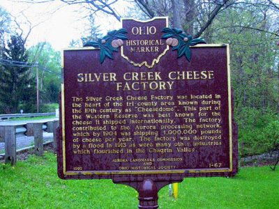 CheesedomAs environmental resources began to deplete, a new market was required to sustain the settlers of Ohio. Fortunately, major scale industrialization was taking place in more Eastern regions like Massachusetts and New York. The previous dairy farms that provided economic prosperity were now seen as a waste compared to the potential gains from industrialization. Similar to people, the market for cheese production began to leave to East. The fertile soil, flat plains and location in respect to transportation routes ultimately sparked the rise of cheese production in Geauga County. Geauga County had access to the Erie Canal (Great Lakes) , Cuyahoga River and the Ohio River which allowed for large scale exporting. The flat plains of Geauga County were seen as industrially useless which made it the perfect location for farms. The first dairy farmers in this area became incredibly rich which drove a mass of people to build their own farms. Cheese leaving Ohio on the Erie Canal achieved numbers of 9,000,000 pounds from Ohio alone. Taking the throne for the highest rate of cheese production in the United States, Geauga County fell into a region nicknamed "Cheesedom." This rapid increase in cheese production led to significant watershed reduction from the run off of chemicals and sewage.
 -
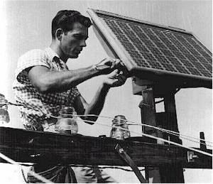 Solar Panels and the Murray Hill Bell Labs FacilityIn April 1954, three scientists at Bell Labs in Murray Hill collaborated to produce the first practical photovoltaic cell, which allowed for the production of solar panels to provide alternative energy in the United States. They were initially used to power phone services for farmers living in rural areas. More than 50 years later, in November of 2010, the facility presented a plan to construct a 1.2-megawatt system of solar panels at the same campus where they were invented. The new system has enough power to supply 200 family homes, and covers almost the entire front lawn of the campus. The plan was part of Alcatel-Lucent's pledge to cut their greenhouse gas emissions in half by 2020, and also was helped by the state of New Jersey and its incentives for the use of solar energy. The original solar panels, which each only provided enough energy for the phone service of one family, are still on display in the facility's technology exhibit.
 -
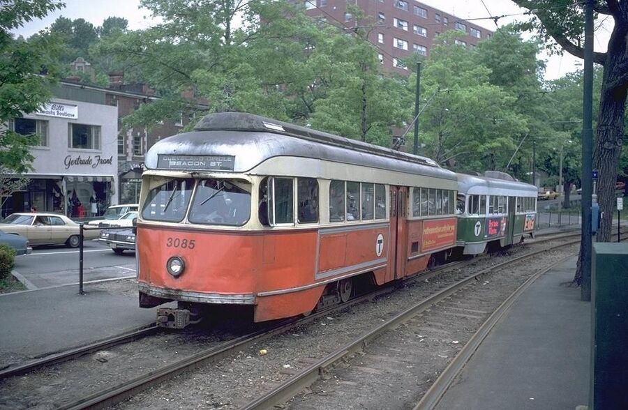 The Early Development of the Urban Ring Project (MBTA)Throughout Boston, there were streetcars to help commuters get from point A to point B easier than the normal walking. Real estate speculators picked up on the usefulness of this and bought up land and secured funding to extend these lines outside of Boston. In fact, Henry Whitney first made the West End line going to Brookline only to use it for promoting his Beacon street developments. On the other hand, tradition helped to push the streetcars further along because every Sunday Thousands of Boston citizens would travel to the outskirts of the city to barely settled land to spend time at the cemeteries or in the parks which made it these trains that are far-reaching profitable.
 -
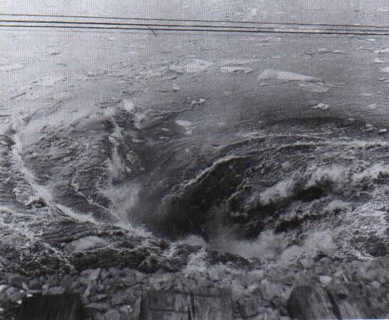 The Knox Mine DisasterThe Knox Mine Disaster serves as a historical reminder of the dangers of greed and corruption and the devastating environmental impacts that are involved. The River Slope Mine, with its walls and ceiling adjacent to the Susquehanna River, had been quarried without the required benefit of surface boreholes to determine the thickness of the rock cover and without proper surveying. This ignorance of safety measures would prove to be deadly and environmentally costly. As the winter ice began to thaw on the Susquehanna raising its waters drastically, Federal, State and County authorities were made aware of safety concerns and ordered all digging in that specific vein to be halted. Unfortunately, the Knox administration ordered its mineworkers to keep digging at an upward angle towards the river bed.In the mining industry, the minimum width of land recommended between the mine and river was 35 feet. Tragically, the walls of the mine had been excavated to an estimated 19 inches from the rising Susquehanna. Millions of gallons of river water crashed into the mines, drowning some men like rats, and forcing others to scramble with all of the energy they could muster. During the first 64 hours, it was estimated that 2.7 million gallons of water per/minute was entering the mine shafts. 33 men were able to catch the last elevator shaft, while 32 men wandered underground looking for escape shafts and tunnels to avoid their deaths. The individuals at the top of the Knox organization were charged along with members of the Pennsylvania Coal Company. This incident serves as an example of ignoring environmental and labor safety procedures for profit and greed.
 -
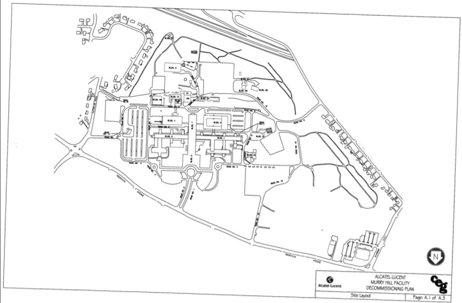 Decommission Plan for Alcatel-Lucent FacilityThe facility in Murray Hill is currently owned by Nokia, but in 2008 it was run by the parent company Alcatel-Lucent. Alcatel-Lucent created a decommissioning plan for the facility in May of 2008 to terminate any activity that involved radioactive material and attempt to clean up the campus. The company enlisted the assistance of Chase Environmental Group, who surveyed the facility in 2007. Alcatel-Lucent terminated two out of their three US NRC (Nuclear Regulatory Commission) licenses at the facility, and decommissioned the facility. About a decade earlier, the company discovered residual radiation around building 16, and the company was forced to demolish the building and excavate the surrounding soil. With the new plan, the company planned to look for any other sources of residual radiation and deal with it in a similar fashion.
 -
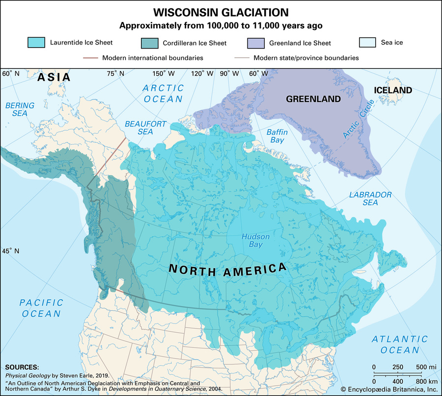 Wisconsin Glacial Stage Promotes Early Hunting and TradeThe Wisconsin Glacial stage significantly influenced the environmental history of Geauga Country Ohio by laying the foundation of environmental conditions and transportation routes. Beginning in 98,000 BC and ending around 13,000 BC, the retreating ice sheets generated environmental prosperity. The glacier deposited fertile top soil and till while carving out Lake Erie and its major tributaries. The rich soil and untouched wilderness allowed trees - hemlock, white pine, maple, black walnut, chestnut and oak - as well as animals - beaver, elk, black bear and racoons - to thrive in significant numbers. The major rivers - Cuyahoga, Grand, and Chagrin - along with their sand ridge deposits provided early transportation routes for New England Euro-American settlers. Depletion of resources in New England forced settlers to expand in search of new resources for economic prosperity. Following these routes created by the glacier, settlers made it to Ohio. The fur and hide trade of black bears, beavers, and racoons skyrocketed due to minimal Native American presence allowing settlers to leave nearby forts. This had a significant impact on species like the beaver and black bear which became nearly extinct in Ohio and are still endangered to this day. The rich environment generated by the Wisconsin Glacial stage set the groundwork for Ohio's first settlers, but as resources depleted what factors kept people there and brought in new settlers?
 -
 Aerial View of Bell Labs facility in Murray Hill, NJ, mid-1960sDuring the 1940s, Bell Labs moved their headquarters from Manhattan to a much more rural area in Murray Hill, NJ. The introduction of a large industry to a more remote location draws parallels to General Electric and Schenectady, but there are certain key differences as well. As opposed to appearing more industrial and dirty like Schenectady industry was, Bell Labs chose a more natural look by incorporating elements like fields, courtyards, and forestation within their new campus. The facility housed buildings that hosted research and development, offices, laboratories, and even an auditorium and the newly designed Anechoic Chamber. The location was near a train station that led to many employees choosing to remain in New York City and commute using public transit rather than moving to a nearby suburb. The facility brought new growth to an area previously host to very little development.
 -
 Laurel Run Mine FireOn December 6, 1915, a miner unintentionally left a carbine lamb attached to a piece of timber. Due to the Red Ash Mine having no positions on night's watch, the fire was able to burn over the entirety of the ensuing weekend. The company was made aware of the fire and began to plug surface opening of the mine with concrete and sand into the area. The company believed it had taken care of the fire, however it continued to burn and in 1921, the fire burned beyond the company's containment area. The company continued to mine resources in certain sections of the mine while building seals to block off other sections. The fire continued to burn in 1957 when the mines below Laurel Run were forced to close. Five years later in 1962, a woman was forced to evacuate her home due to mine gasses from the fire. It was around this time where the community realized that they were facing an uncontrollable mine fire beneath their feet. In April of 1966 a plan to control the fire was adopted and a series of bore-holes were drilled into the mine. The fire did spread into the Stanton-Empire Mine of Scranton as well as the Georgetown mine of Wilkes-Barre.
 -
 Colonial Domination in Barrington, RIIn 1621, the Pokanoket Tribe and and Plymouth colony signed a treaty that resulted in 5 years of peaceful relationships between the groups. After the death of Wampanoag leader Massasoit, chaos broke out and the King Philip War ensued. The colonials won and they took over the Sowams Heritage Area. Over the next 150 years Barrington among other towns was formed.
 -
 Providence, Warren & Bristol RailroadIn 1855, the construction of the Providence, Warren and Bristol Railroad was finished. It was one of the largest organized railways in New England at the time. This railroad was responsible for carrying freight and passengers for about 100 years. It played a crucial part of connecting Barrington to more urban areas. During the 20th century the tracks were covered and turned into a bike path.
 -
 The Impact of An Inconvenient TruthAl Gore's An Inconvenient Truth was a revolutionary documentary that provided visual evidence of the urgency of the environmental crisis the planet currently faces. This form of media was amongst the first that showed viewers the threat human activity has on the global climate. Additionally, this documentary was backed by scientific findings, so not only did the imagery help portray a daunting message, but the evidence gathered from data was quite affective to audiences. Because of the harsh yet accurate cinematography the film displayed, an rise in public awareness was brought upon an international level. The film also stirred up some controversy between different political groups and people, because the idea of what is more important, economics or the environment, became even more relevant. The media has the power to publicize an issue on a mass scale, and this documentary was certainly no exception to that, ultimately adding to the overarching environmental movement.
 -
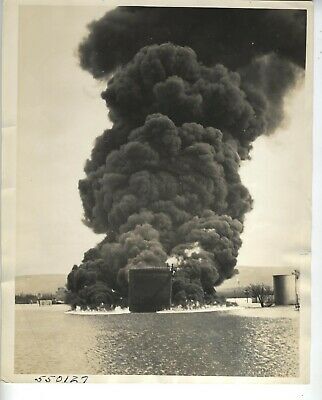 Fire on the Susquehanna After Flood Slams Wilkes-BarreFrom up to twenty miles away, the smoke could be seen from the fire that lit on the Susquehanna River as it ran through Wilkes-Barre, PA. This fire was the result of a section of the river dike breaking causing water to flood the area beneath it. Hours later, a very loud roar would be heard as the American Oil company's tanks exploded. A tsunami of combustion was followed by dark black smoke that hung in the air menacingly. In addition to the fire, the floodwaters that poured through the dike walls flooded homes and businesses alike, causing the displacement of 15,000 people with 9 being confirmed dead.
 -
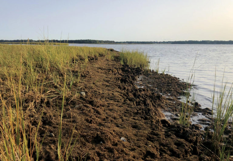 Hundred Acre Cove: Barrington, RIIn recent years, Hundred Acre Cove located in Barrington, RI has been threatened by habitat loss. Salt marshes line the coast of the Cove and with rising sea levels the marshes have been submerged. With the coast rescinding, fiddler crabs have been moving farther inland to burrow. Coincidedly, the banks of Spartina grass are disappearing.
 -
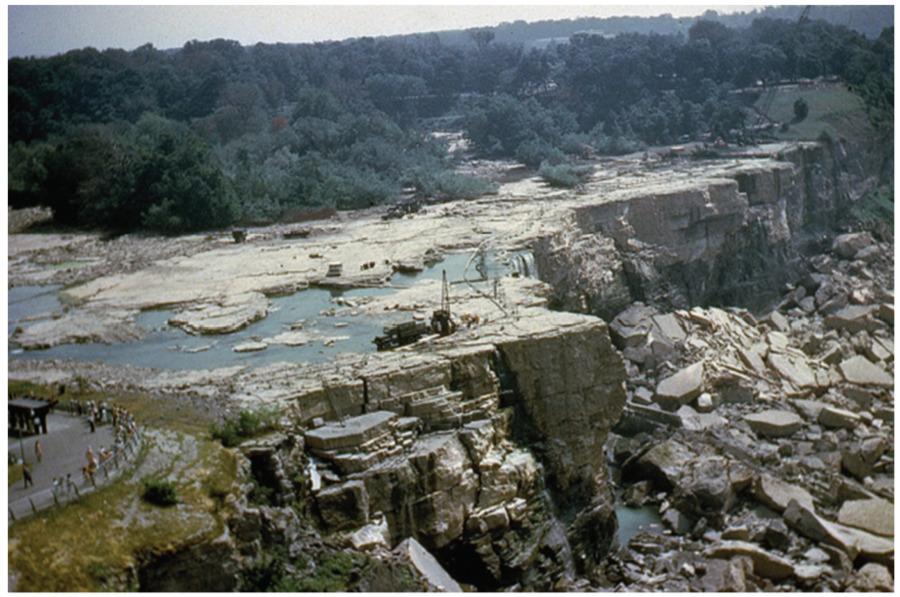 Dewatered American FallsDuring the 1950's a series of rockslides were caused by the natural erosion of Niagara Falls, and sediments and boulders piled up in the basin at the bottom. Along the American portion of the falls, the curtain of water was effectively halved, therefore making it less impactful on viewers. In 1969, the American side of Niagara Falls was dammed and drained, which allowed for Engineers to clean out the basin, fortify the overhang at the top of the cliff, and eliminate any rock outcrops that showed signs of faultiness or future breakage. Science and technology had progressed so far that we began to alter our natural environments and even our natural wonders. With Niagara Falls, we saw Humans enact their views on how the falls should look, instead of appreciating the natural beauty that they offer. The very geologic processes that once created the falls, were now is seen as a threat that challenged the idealized version of Niagara Falls in people's minds.
 -
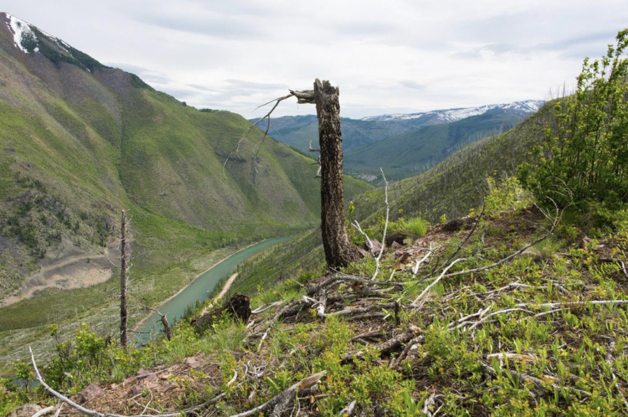 Glacier View Dam DebateIn 1943, the Army Corps of Engineers in Montana proposed to build a 416 foot tall dam in Glacier National Park in the canyon between Glacier View Mountain and Huckleberry mountain. This is on the western border of the park and the state, and the fact that visitors rarely traveled there was one excuse for them to build. The intent of this dam was to make western Montana more industrialized, inspired by the city of Chicago in the 40's. The dam would have created a reservoir 25 miles long providing 977 billion gallons of usable water storage. This would attract industries like aluminum processing plants and airplane manufacturers, which is what the Army Corps of Engineers saw as technological and urban advancements. The park service, which was founded in 1916, strongly opposed, and they won this debate, making sure Hetch Hetchy would not be repeated.
 -
 The Brookline Bird ClubThe Brookline Bird club is a club dedicated to learning, documenting, and watching birds but most importantly to gaining “a fuller appreciation of nature.”. It is the largest bird club but isn't limited to just Brookline. Though it is one of the country's oldest. The forming of the club can be linked to a few things including the outlawing of the plume trade and the growing interest in birds/ the environment in wealthy circles. Though the club also took an active part in protecting through local ordinances and going as far as having a "bird warden". In 1915 they had around 150 feeding stations. Lastly, this club was not only for men but also women and all ages and recognized the role women played in stopping the millinery trade.
 -
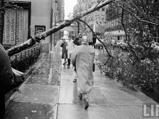 Hurricane Donna, NYCHurricane Donna was similar to Hurricane Sandy in terms of the destruction caused to New York City. The hurricane caused $100 million in damage, and caused the area to be evacuated. There was a lot of damage to the natural environment as well, specifically $200,000 in damage due to uprooted trees.
 -
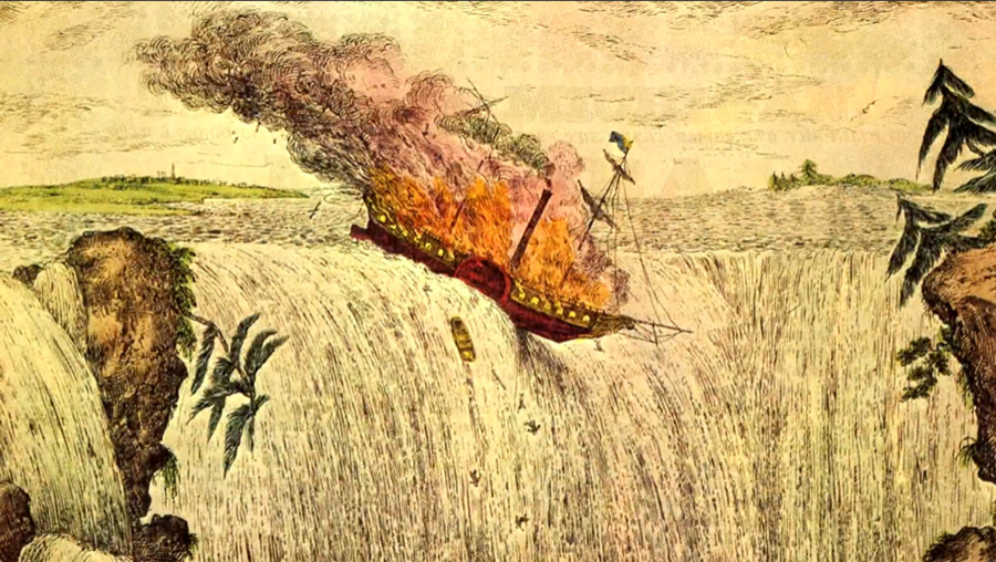 The Michigan Over NiagaraIn 1827, Niagara Falls hotel owners looked to increase visitor interaction with the Falls in order for tourists to stay longer and spend more money. Therefore they organized for an old mercantile vessel named "The Michigan" to be loaded with wild animals, lit on fire, and allowed to float down the Falls so that tourists could watch it smash into a thousand pieces. In total 23 animals were aboard, including two bears and a bison, while 20,000 people spectated. This event illustrated a public view that Niagara Falls wasn't exciting enough on its own, and that more was needed to captivate an audience than just the natural and unique beauty that they offer. Additionally, the animal abuse clearly demonstrated European views on the natural world that the environment, and its wildlife, were created to be dominated by man.
 -
 Use of Radioactive Material at Bell LabsDuring World War II, the Bell Labs facility in Murray Hill, NJ was utilized in research for developing barrier material for the K-25 site in Oak Ridge TN. The K-25 facility was used for developing enriched atomic material for bombs for the Manhattan Project. The Bell Labs facility, although under the oversight of the US government, housed unknown quantities of uranium, and the documentation for this research is very limited for unknown reasons. In 2011, a spokesman for the then-owners of the property, Alcatel-Lucent, stated that, "Although members of Bell Labs may have performed research and development work on behalf of the U.S. government in the 1940's that may have necessitated the use of radioactive materials at its Murray Hill campus, the files of our Radiation Safety Department do not contain records of those years." Although it has been proven that no radioactive material remains in the facility, the lack of knowledge of the research done on the property leaves uncertainty surrounding the possibility of residual radioactive contamination in the area.
 -
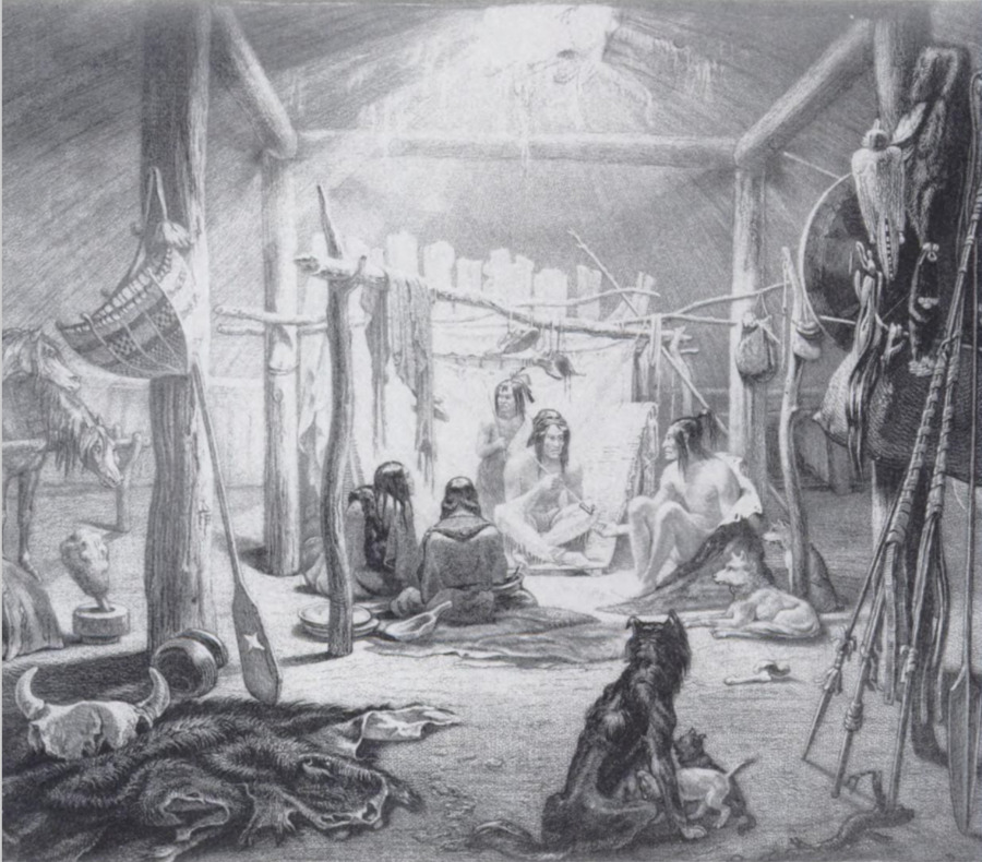 History of Native Americans in MontanaApproximately 500 years ago, when Europeans first settled in the U.S., they had brought technology and diseases, specifically small pox, that killed many Natives. At first they invaded the East, and eventually traveled westward toward the Rocky Mountain states. By the 17th century, many Natives were fleeing the east and resided in Montana. They adopted many European resources, especially horses. These horses allowed for easy trading, and also to efficiently pack their camp and travel. Similarly, they adapted the gun from settlers, and eventually changed their lifestyle, relying on hunting the bison. This was a drastic change from their ancestors, and is more similar to the lifestyle of the Plains Natives today. Today, there are seven native reservations in Montana that decedents live on, including towns and cities across the state. Glacier National Park is directly west of the Blackfeet Reservation.
 -
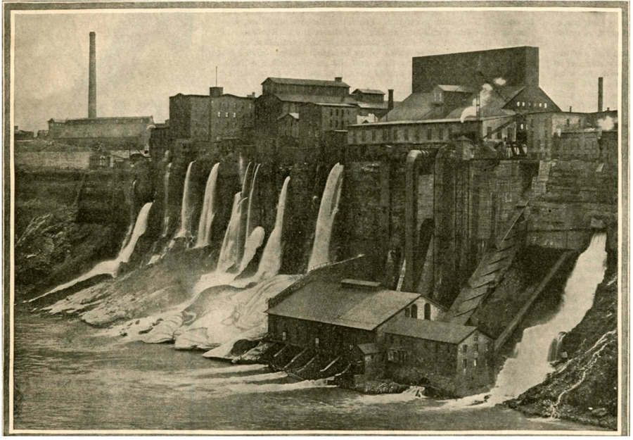 Niagara Falls Power PlantIn 1881 the first hydropower plant was developed in Niagara Falls, making use of the water and elevation drop of the Niagara River. Canals were built through the city that diverted water from the Falls to the power plant. Today up to as much as 75% of the water that would go over the falls is instead diverted and used for hydropower. In 1896 desires to utilize Niagara Falls to power more distant places resulted in the invention and first use of long distance transmission developed by Nikola Tesla, and energy was sent 20 miles south to power Buffalo. Now that Niagara Falls had a value for producing energy, its values of sublimity and grandeur came second to providing energy to the cities of the Northeast. Not only was water over the falls reduced, effectively reducing its impact and power, but the power plants situated themselves along the vista of the Niagara River Gorge, roughly half a mile downstream of the Falls, therefore marring the appearance of the whole area.
 -
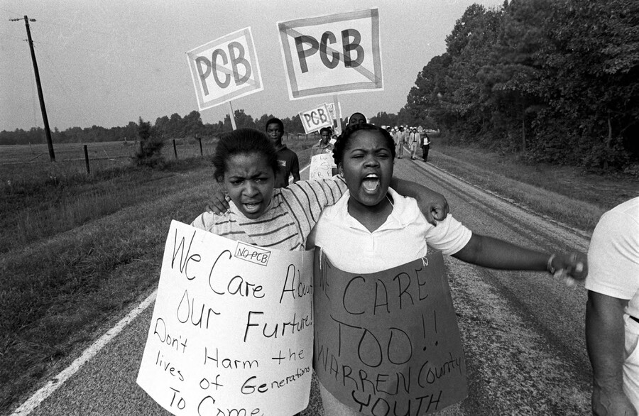 Warren County vs PCB'sIn 1978, two men disguised a tanker truck and dumped 31,000 gallons of PCB's along North Carolina roads using the cover of darkness. The two men were caught and locked away, but the state of North Carolina was now tasked with cleaning up these road shoulders and dumping the chemicals into a remote location. The Toxic Soil Control Act created in response to Love Canal required that the toxic soil be placed into a landfill. The state chose to place this toxic landfill in Warren County, North Carolina, a town that had been politically neglected. A key component in this story was that the town's population was 65% black, forty percent of houses lacked indoor plumbing according to the 1970 census. This town with the third lowest GDP across the state. In January of 1979 a public hearing was held in which an outstanding and outspoken group of 800 protestors showed up, but despite their cries, the governor announced that the construction would persist. Despite years of protest, in 1982, the EPA Superfund allocated $2,500,000 for the construction of the landfill in Warren County. Once construction began, 500 people were arrested in the six-week long protests, majority of which were extremely peaceful. Warren County would come to be symbolic of community members protesting to protect their homes as well as a vivid example of discriminatory state-level action by the government of North Carolina.
 -
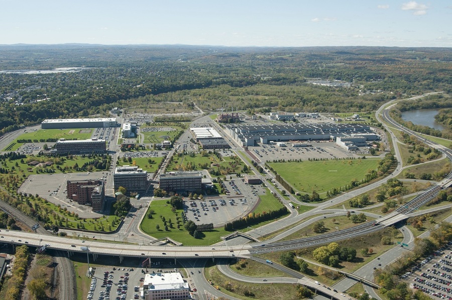 GE Plant Remediation Plans and Actions$78 million has gone into this clean up project so far and it is still incomplete. So far, fencing has been installed around the site to restrict access, the property is locked to prevent trespassing, several underground storage tanks have been removed, contaminated sediments have been removed from drainage ditches, and storm sewers have been sealed to prevent contamination of storm drainage. Contaminated water from the on-site stormwater drainage ditch is treated to meet NYS water standards, and a pipe has been placed at the groundwater surface to collect soil gas and water for cleansing. All of these efforts are aimed at reducing negative human health effects and further environmental impacts.
 -
 Glacier National Park during the Conservation MovementGlacier National Park was signed into law by President Taft on May 11, 1910. It is in northwestern Montana and on the Canadian border on the Rocky Mountains. John Muir wrote about his travels in his collection of essays Our National Parks in 1901, prior to the official designation of the park. He writes“[w]ander here a whole summer, if you can. Thousands of God’s wild blessings will search you and soak you as if you were a sponge, and the big days will go uncounted…you will find yourself in the midst of what you are sure to say is the best care-killing scenery on the continent.” Similar to his perspective on Yosemite, Muirs writing sparked the conservation movement in the early 1900's, along with Roosevelt, Pinchot, and Cole.
 -
 Frederick Law OlmsteadFrederick Law Olmstead was well known for his creation of the Olmsted Park System which includes parks like Boston Common, Boston Public Garden, and Arnold Arboretum. Though his work isn't limited to just Massachusetts he is responsible for the creation of the central park as well. Though he did a lot of work locally in the town of Brookline and in the process created a business where he passed his trade down to his children. His architectural work was so well received that he not only shaped the future development of landscape architecture but two members of the office, one being his son, designed the curriculum of landscape architecture education at Harvard and nationally. This all relates to what we learned in class because his works came to light because of the conservation movement and the more environmentally minded wealthy during the late 1870s-1900s also he did create a fair amount of parks in urban settings.
 -
 Flooding in NYCNew York City has experienced a lot of flooding throughout its history, however, with its old infrastructure, the city isn't well adapted to 21st century storms. For example, Hurricane Sandy devastated the city's subway system, and the city had to recuperate. However, even after putting repairs on the city post-Sandy, Hurricane Ida proved that they weren't entirely prepared for regular hurricanes. New York City once again had to make repair to itself, and they were faced by the multitude of problems given by Ida.
 -
 Hurricane Sandy and NYC InfrastructureMany hurricanes have hit New York City and the general Northeast in the past, but the most recent one, Hurricane Sandy exposed a need to change the city's infrastructure. The hurricane devastated the Manhattan coastline, which meant that it needed to be rebuilt all together, and it needed to be built stronger to make sure that the coastline isn't hit as hard the next time there's a major flood or hurricane. The city's government hosted a contest called Rebuild by Design to bring the people in the city together and help rebuild what was lost.
 -
 GE Contamination InvestigationIn 1995 GE signed an agreement with NYS to start investigating local contamination they have created. The Schenectady plant was seen as a "current and potential significant threat to public health and the environment." In the past, the main campus included 2.6 tons of PCB-laden transformers and liquids, a suspected human carcinogen (polychlorinated biphenyls, banned from the US in 1979), 1 ton of solvents and an unknown quantity of what the state called "organic and inorganic lab wastes." Between 2000 and 2003, 1,000 soil borings and almost 1,500 groundwater samples were tested for contaminants. The final remediation plan agreed to by GE and the DEC took from 2005 to 2014 to negotiate.
 -
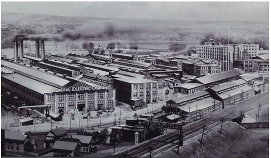 General Electric Hazardous WasteTwo factories were purchased in 1886 by Thomas Edison to create what we now know as the main regional plant for General Electric. Over time the plant produced around 1.3 million pounds of PCBs that were discharged into the Hudson River, contaminating the water and surrounding locations. In 1987 the site was declared an inactive hazardous waste site, with over 40 years worth of unsafe discharges, spills, demolitions and dumpings found in the 640 acre plant.
 -
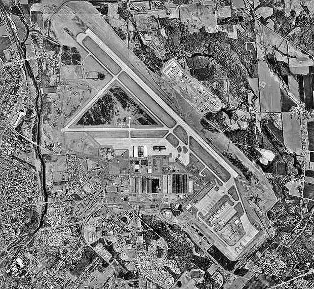 Griffiss Air Force BaseGriffiss Air Force Base (AFB) opened in 1942 in Rome. The base was used as a plane depot for the US military during World War 2 with no stationed planes. This changed into the 1950s as the Cold War came into full bloom. Griffiss slowly became a center for the Northeast Air Defense Sector with many reconnaissance and fighter units stationed here. Griffiss was decommissioned in 1993, 9 years after it was designated as a Superfund site in 1983. Presence of heavy metals and polychlorinated bisphenols (PCBs) were found in ground water.
 -
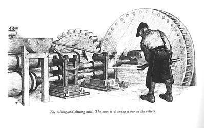 Revere CopperBecause of Rome’s connection to the world through natural waterways, man made waterways, and by this point railroads, the city of Rome became a city focused oh heavy industry. In 1924 Rome produced 10% of all the copper manufactured in the United States. The Revere Copper Company, Rome Manufacturing Company, and Rome Steel and Iron company dominated the industry in the city. Obviously, this had detrimental effects to the landscape, particularly the water quality.
 -
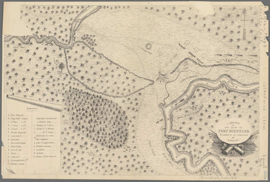 De-o-wain-sta "Carrying Place"The original name for the area to become the city of Rome New York was De-o-wain-sta, translated as “carrying place”. The local American Indians from the Six Nations names the area “carrying place” because the area was used as a portage between the Mohawk River and Wood Creek. The Mohawk River runs through central NY into the Hudson then to the Atlantic Ocean. Wood Creek ran in a different direction instead flowing west ultimately flowing into Lake Ontario. This portage, about a mile long, effectively connected the Great Lakes waterway to the Atlantic Waterway. This strategic importance led to the construction of Fort Stanwix, a canal connecting Woods Creek and the Mohawk, and the modern city.
 -
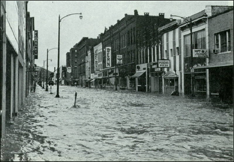 Hurricane Agnes' effect on the NortheastHurricane Agnes hit the northeast, especially New York, hard because of the earlier storms having already affected the area, and then the hurricane made all of the runoff even worse. This led to devastating floods all over the Northeast, with the water levels being the record levels in places like Chemung River and Susquehanna River.
 -
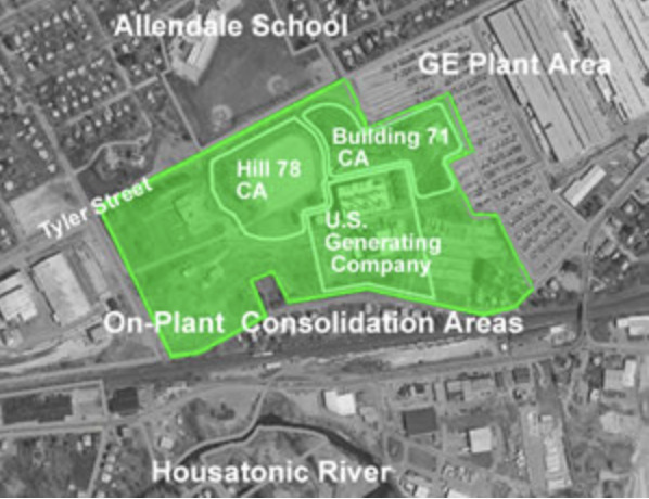 General Electric: Hill 78Hill 78 is an On Plant Consolidation area used by General Electric as a dumpsite for PCB contaminated river sediment. In 1999 General Electric was ordered by the EPA to remediate a small section of the Housatonic River that they had previously contaminated. GE dredged the contaminated sediment from the river bottom and constructed this OPCA for the containment of 134,500 cubic yards of materials. The area encompasses 6 acres which adjoin a high traffic road and Allendale Elementary School.
 -
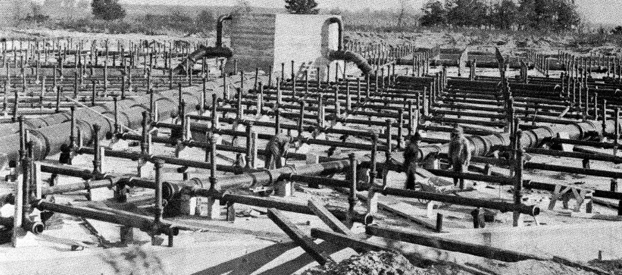 Madison's Lake Monona described as "cesspool" by Clean Lakes Association"The lake has become a cesspool." This was said of Madison's Lake Monona by Alexius Baas of the Clean Lakes association. On a summer night in 1931, citizens gathered at a meeting hosted by the association to demand that Madison clean up Lake Monona, which over the past decades had served as a reservoir for sewage and wastewater effluent. Namely, the Burke sewage treatment plant was blamed for this pollution-- a plant which had been primarily receiving heavily polluted and toxic wastewater from the Oscar Mayer meat packing company and discharging it into the lake. Baas even reported that the city had permitted the plant to pour "raw sewage into Monona without even sending it through the inadequate treatment of the plant" and also claimed that "3,200,000 gallons of effluent is being dumped into Lake Monona daily." The lake was described several times as having a "stench." 80 people attended the meeting, with the purpose of calling on the city to shut down the Burke treatment plant and address the pollution affecting the lake. In 1936, the first addition of a new sewage treatment plant, Nine Springs, was completed, and that development allowed for the Burke plant to be shut down. The picture attached features Burke sewage treatment plant's 'trickling filters,' built in 1916, which were credited as the first to be built in the country.
 -
 Madison considers using DDT to fight Dutch elm diseaseIn 1954, Dutch elm disease was first identified in Madison, WI, after having been introduced to the United States in the 1930s. As the disease continued to spread, more elm trees began to die off, causing Madison to seek out a solution. At the time, most affected areas in the country had instated sanitation programs where DDT was sprayed on the affected acres. However, when this solution was being considered for Madison in 1962, professors at UW-Madison had found in their research that the spraying of DDT caused high levels of bird loss. Additionally, Rachel Carson's "Silent Spring" had just been released. This sparked a lot of public discourse on the issue. On October 28, 1962, a newspaper article was published which highlighted different opinions on the spraying of DDT. One professor of entomology at UW-Madison said, "If elms are lost in our particular neighborhood, they would be more sorely missed than robins, I'm sorry to say." Another professor, one that had participated in the bird study, said "We don't necessarily have to treat between robins and elms." He went on to explain that there are alternatives to spraying and that he hopes will be thoroughly explored before resorting to DDT. In 2018, the disease killed a 140-year-old tree on UW-Madison's campus which had been lovingly nicknamed "Elmer." The picture below is from around the 1950s and shows Elmer on the left.
 -
 19th Century Scarsdale Farming IndustryPrior Scarsdale's role as a suburban neighborhood, it was a rural area in which the majority of the inhabitants worked on farms. However, the farming industry was not too successful, compared to neighboring towns, because Scarsdale was not in close proximity to a navigable water way. Therefore, trading and selling crops to New York City dwellers was a bit challenging for these farmers because the transportation system during this time period was subpar. Many of the Scarsdale farmers would grow and cultivate for themselves, their family and community members.
 -
 Population Growth in Scarsdale, NY, after World War IIAfter the second World War concluded, men finally returned to their wives on the American home front and wanted to start a family. Large cities were crowded with people and there was really a push to move to the suburbs, where the quality of life may be better. As a result, many families from all over, but primarily from New York City, settled Scarsdale, because they were attracted to its close proximity to NYC and its space. Because of the sudden population growth, the town constructed many house and public infrastructure building in order to account for all of the people and future generations. All of the new building created an affluent neighborhood, where upper class individuals could enjoy the luxuries of suburban life, including an esteemed school district and many places to worship.
 -
 Division of State and Private LandThe shoreline of Canada Lake is separated by private and state land. There is a large portion of the shoreline on the west side of the lake and into Lily Lake that is completely untouched. This untouched land is protected under the Forever Wild clause and so nothing can be built on that land. There is no more private land available on the lake, so no new houses can be built, only houses built in existing sites are allowed. There are also some campsites on the state land which are only accessible by boat which bring visitors into the area.
 -
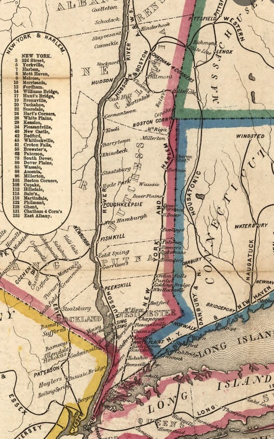 Harlem Rail Road Line to ScarsdaleAt the end of 1844, the construction of the railroad to Scarsdale, NY was finally completed. This crucial development in transportation allowed for New York City dwellers to come to the suburbs more often and efficiently. While Scarsdale was initially a place where New Yorkers had their summer home in, it eventually evolved into an affluent suburban neighborhood where workers would live and commute to the city for employment. The completion of this railroad not only boosted the economy, but it accounted for the success of the growth of Scarsdale.
 -
 Stewart's Landing Dam on State LandThe dam at Stewart's Landing was first built of stone to generate power for a saw mill. It has more widely used to control the water level of Canada Lake and the connecting lakes, which has a history of flooding and wrecking cabins. In 1897, a "flow line" was drawn on a map indicating the height at which the water should not pass. When a large storm is coming the dam can be opened to let water out in preparation. The construction of the dam on state land is a small obstruction of the natural beauty, but it brings people to the lake. Before the dam there was no way to get to Canada Lake directly from the west, but a road was added connecting Stewarts Landing and Stratford. The dam is also accessible by roughly 40 or less horsepower engines after navigating a winding, rocky path. The dam has become a local hot spot during the summer months for those who don't have camps on the lake, who come to swim in the water on the opposite side when the dam is closed.
 -
 The Introduction of Railroads and the impact on Arlington, MassachusettsRailroads were first introduced in Arlington, Massachusetts on March 24, 1845, with the creation of the Lexington and West Cambridge Branch Railroad. (Arlington was originally called West Cambridge until it was changed on April 13, 1867). The railroad was first opened for public travel in August of 1846. With the creation of this railroad, the people of Arlington had transportation to Boston and the other important cities, for the first time. Prior to the building of railroads, the only means of transportation to Boston from suburban towns would have been by stagecoach. The introduction of the railroads allowed for a faster, more efficient, mode of transportation for all people in the Greater Boston area. By this time, numerous other railroads had been built around Boston, and the towns and suburbs surrounding Boston were now interconnected to each other. All the suburban towns around the outskirts of Boston began to have large commuter populations and soon were coined the name "railroad suburbs". (O'Connell, pg 42) The Lexington and West Cambridge Branch Railroad allowed Arlington to become one of the many railroad suburbs in the Boston area. Nowadays, the railroad is no longer in use. However, some of the tracks are still displayed in the same position as they were built in 1845, in the center of town. This railroad will forever be a piece of Arlington's history.
 -
 Creation of the Forever Wild ClauseIn 1894 the "Forever Wild" clause was added to the New York State constitution which protected land owned by the state in the Adirondacks. The Adirondacks, while called a park, is not a national park, it is however divided into private and state land. Out of 6 million acres of land, 3.4 million acres of it is privately owned. The rest of the land was subject to harsh deforestation by the logging and timber industry, so the clause was added to protect against this. The clause states that the cutting and sale of trees within the protected land is strictly prohibited. Unlike many restriction clauses, this clause was strictly enforced where it could be.
 -
 Hurricane of 1938One of the deadliest tropical cyclones to hit New England. A category 5 hurricane that traveled from the coast of Africa and landed on Long Island as a category 4 hurricane on September 21. The estimated property losses were 57,000 homes and around $347 to $410 million in property damage ($4.7 billion by 2018). The effects of this hurricane on nature and the surrounding terrain could still be seen by 1951 in the form of mangled trees and shattered buildings.
 -
 Whaling in East HamptonEast Hampton was originally an agricultural settlement which soon was replaced with whaling around 1652. Settlers discovered beached whales often appeared on the shore and would harvest the oil and meat. Eventually residents would no longer be content with harvesting from beached whales and begin hunting whales that came too close to the shore. At the height of the whaling industry in 1847, around 60 ships would be docked at Sag Harbor which is referenced in Moby Dick. After 1847, the industry fell off due to the rise of fuel products.
 -
 The Purchase and Settlement of East HamptonLion Gardiner purchased Gardiner’s Island in 1639 from the Montaukett people. This would become the first English settlement in NY. In June 12, 1640; nine puritan families from Massachusetts landed in present day Conscience Point and migrated to East Hampton eventually settling in 1649.
 -
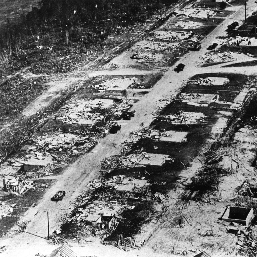 The Worcester Tornado Devastates the City of Worcester and its SuburbsThe Worcester tornado was the strongest tornado to ever hit New England, traveling for nearly 46 miles with wind speeds of almost 300mph. This tornado devastated the city of Worcester, killing 94 people and leaving over $53,000,000 in property damage. The tornado was particularly devastating in newer areas of the city, where postwar suburban expansion led to such a high demand for houses that many neighborhoods were built on slabs without basements.
 -
 Chesapeake Bay Foundation Sues the EPAIn 2020, the Chesapeake Bay Foundation along with the Maryland Watermen's Association, Anne Arundel County, and a few Virginia cattle farmers, sued the EPA for renouncing its responsibilities under the Clean Water Act. Separate lawsuits were also filed by the Attorney Generals of Maryland, Virginia, Delaware, and the District of Columbia. The EPA failed to make sure the Bay jurisdictions were fulfilling their obligations of meeting their pollution reduction commitments by the 2025 deadline. This was found to be a violation of the Clean Water Act, Administrative Procedure Act, and the 2014 Chesapeake Bay Agreement.
 -
 Chesapeake Bay Watershed Agreement SignedIn june of 2014 the Chesapeake Bay Watershed Agreement was signed. Here was the first time New York, West Virginia, and Delaware committed to the Bay program. This agreement established 10 goals and 31 outcomes with regards to habitat restoration, clean water, conservation, and having communities become more engaged. The agreement also contains the Chesapeake Clean Water Blueprint which includes the TMDL and WIP.
 -
 2000 Chesapeake Lawsuit Settled with Historic AgreementIn 2010, the 2000 Chesapeake lawsuit filed against the EPA for not setting science based pollution limits, was settled with an historic agreement. In this agreement the EPA establishes the Chesapeake Bay Total Maximum Daily Load (TMDL). The TMDL sets limits on how much sediment and nutrients can enter the Bay in order to meet the desired water quality. The seven Bay jurisdictions created the Watershed Implementation Plan (WIP) that outlines detailed steps that the jurisdiction will take in order to meet the pollution reductions agreed to by 2025.
 -
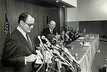 Second Chesapeake Bay AgreementThe 1987 Chesapeake Bay Agreement was the first agreement to set numeric goals in order to reduce pollutants in the bay and restore the ecosystems. More specifically, the agreement was targeted at nitrogen and phosphorus entering the bay, aiming to reduce those pollutants by 40% by 2000. Establishing actual numeric goals was unprecedented so this agreement became a hallmark of the Chesapeake Bay Program.
 -
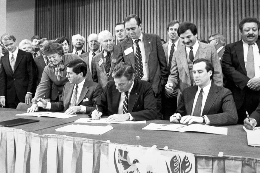 First Chesapeake Bay AgreementThe First Chesapeake Bay Agreement was signed in 1987 by the Environmental Protection Agency, a one page agreement recognizing that there needs to be efforts to address the Chesapeake Bay’s pollution issues. States that signed on were Maryland, Pennsylvania, Virginia, and the District of Columbia. These signatories became the Chesapeake Executive Council. Though this agreement was formed with future general goals, no requirements or timelines were established. The Chesapeake Bay Program was also established before this agreement after studies showed bay pollutants coming from excess nutrients.
 -
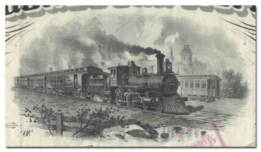 The Providence and Worcester Railroad is IncorporatedThe Providence and Worcester Railroad began operation in 1844 and dramatically decreased shipping time and costs for goods between Worcester and Providence. This form of transportation was much more efficient than the use of waterways, so the Providence and Worcester Railroad was able to replace the recently built Blackstone Canal which was previoudly used to transport goods between the two cities. This railroad allowed for quicker travel between Massachusetts and Rhode Island, but it also led to increased consumption of fossil fuels and contributed to the industrial pollution of New England during this time.
 -
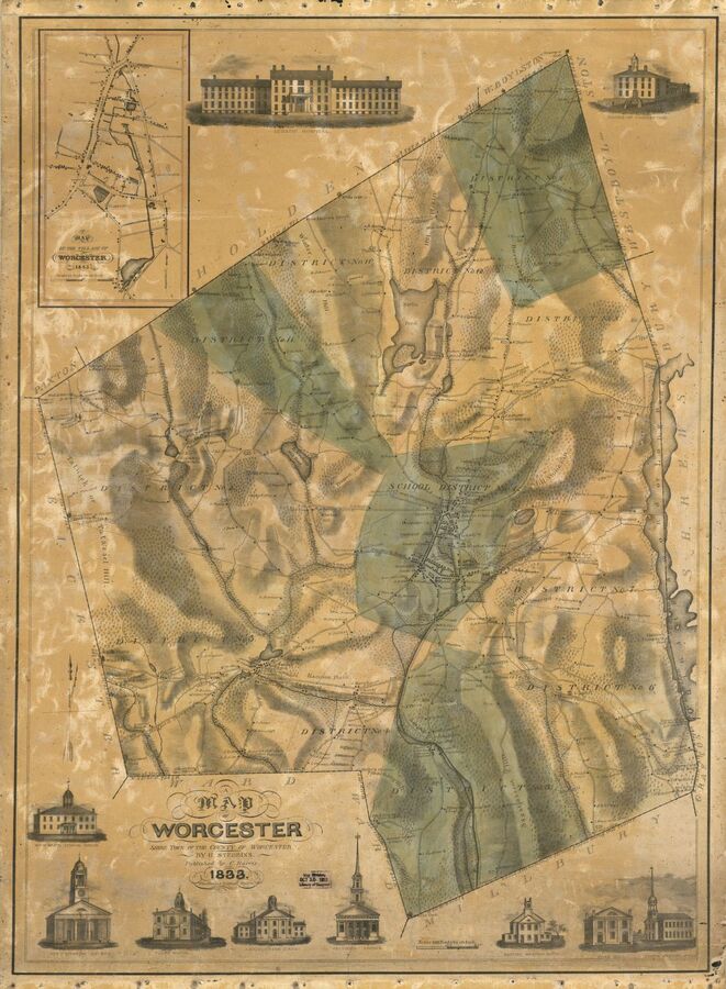 Worcester is First SettledIn 1673, Daniel Gookin purchased eight square miles of land from the Nipmuck tribe living in this area and created the Quinsigamond Plantation. When the Nipmuck became aware that the Europeans were not going to share the land, they attacked and drove the settlers away. This area was then settled and abandoned several times throughout the next 40 years due to conflict with Native tribes and was eventually established as a town in 1722.
 -
 Neighborhoods Like Gilpin are Baking in the Summer Heat, DeliberatelyAs a result of historical practices of red lining, certain neighborhoods in cities are facing the brunt of the effects of climate change. In places like Gilpin in urban Richmond, Virginia, there is less tree cover as well as less access to parks and community resources. Areas like Gilpin were created through racist zoning practices that kept minorities to certain areas that were underdeveloped. As a result of this, residents do not have adequate access to healthy foods or swimming pools
 -
 Mills Began to Operate Along the Charles River in NewtonThe Charles River runs through much of Newton and was vital in helping Newton residents. One way the Charles River was utilized in Newton was through the creation of mills. One of the first mills in Newton on the Charles River was a paper mill created in 1760. Later, in the 19th century, mills of all kinds were being operated in Newton, such as cotton and thread mills and tobacco mills. In Newton they were producing paper, iron, and cotton more than any other materials. Additionally, there were new manufacturing companies such as nail and silk manufacturers in the Upper and Lower Falls of Newton. None of these companies, especially the mills, would have been possible without the support of the Charles River. The mill in the image was taken in 1905.
 -
 The Municipal Forestry Department was Created in NewtonThe Forestry Department was created in Newton to care for and create gardens, parks, playgrounds, and other green spaces for the city. The new parks and playgrounds helped to promote suburbia to the rich families in Boston who wanted to escape the noise of industrialization and provided new recreational spaces for the residents of Newton. Due to all these projects in the early 1900s and the naturally beautiful landscape, Newton is known as the Garden City. These projects were happening around the same time as the conservation movement was gaining momentum from President Roosevelt and Gifford Pinchot.
 -
 Boston and Worcester Railroad is Established and Services NewtonAs railroad production began to boom, the Boston and Worcester Railroad was built, and Newton was one of the first stops created along the railroad. This was a huge advancement for Newton because it allowed commuting to and from the city for work to gain popularity. As the railroad serviced more and more people, Newton was able to develop more as a suburb.
 -
 The First Earth Day in Madison, WisconsinOn April 22nd of 1970, an estimated 20 million people from across the United States participated in demonstrations for the first Earth Day. Championed by Gaylord Nelson, a Wisconsin senator, Earth Day was a celebration that consisted of activities such as teach-ins and protests. In Madison, WI, many students of UW-Madison spent the day marched up and down the streets surrounding the Wisconsin State Capitol. Prior to Earth Day, the mayor, backed by city police, had revoked the permit for the coordinated parade/protest Madisonians had arranged. However, a group of passionate students marched on, confronted with riot-equipped policemen. Eventually, only a group of 30 protestors made it to the capitol, ending their demonstration by picking up litter on the capitol lawn.
 -
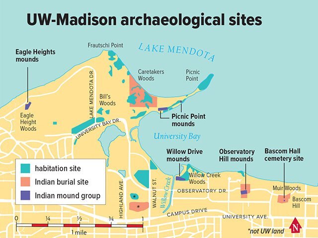 Madison's Forced Removal of the Ho-Chunk NationFollowing the 1830 Indian Removal Act, the state government forcibly removed members of the Ho-Chunk nation from the area in 1832. Prior to this event, the Ho-Chunk had occupied the area for over 12,000 years. The first treaty signed after the Indian Removal Act coerced the Ho-Chunk people into giving up their lands south of Portage Canal, which encompasses where the city of Madison is today. Omar Poler, UW-Madison's American Indian Curriculum Services coordinator, reportedly calls that treaty "Madison's founding document." He says, "without that treaty, there's no Madison."
 -
 Madison Metropolitan Sewerage District Lagoons added to EPA's Superfund listIn April of 1970, 1 of the 2 sludge lagoons belonging to the sewage treatment facilities of south Madison partially collapsed, releasing 85 million gallons of sludge into a nearby ditch. Initially, a management plan suggested reusing the sludge as fertilizer for agricultural land in the area. However, in 1982, it was determined that the sludge had high levels of PCBs, thus leading to the addition of the site to the EPA's Superfund list in 1990. The site achieved the status of "ready for anticipated reuse" in 2010 after the construction of a soil and fabric cover over the lagoons and after waiting long enough for PCB concentrations to adequately decrease. The attached picture shows the installation of a site security fence.
 -
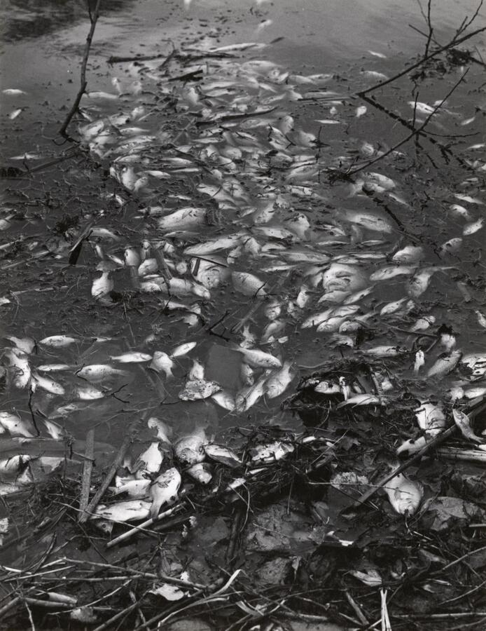 Sewage effluent kills fish in waters of Madison, WIIn the late 1960s, Madison's creeks and streams flowing into Lake Monona were seeing large amounts of pollution and subsequently many fish deaths. Sewage treatment plants in Madison were discharging water containing high nitrogen and phosphorous into nearby rivers, causing algal blooms that deprived the water of oxygen. Aside from 4 sewage treatment plants, meat company Oscar Mayer and Co. was also listed by the Wisconsin DNR as a polluter. After completing a water pollution survey of the area, the DNR issued pollution abatement orders to each of the suspected polluters.
 -
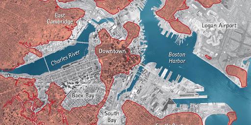 Land Reclamation in Boston, MAThe original city of Boston was just 738 acres on an isthmus. Through countless land reclamation acts Boston has filled in much of the bay adding countless more acers. In 1857 the city took on a project to fill 600 acres of tidal basin with gravel, creating the Back Bay, the most ambitious land reclamation project at the time. Mill pond was originally created to power mills during the 1700s, but it was filled in in 1828 to add 50 acres to the city. The entire 189 acre Logan airport was built by the US Army during World War I on what was more tidal basin. Countless more projects filled in south Boston and the remaining area to create the modern shoreline.
 -
 Ratification of the Montreal ProtocolScientists first noticed global ozone depletion in the late 1970s, and when evidence of the association between ozone depletion and CFC prominence developed, a global effort to curb usage and production of CFCs began. In 1987, representatives from 43 countries signed the Montreal Protocol on Substances that Deplete the Ozone Layer, in which they agreed to freeze production of CFCs at 1986 levels as well as reduce production by 50% by 1999. This protocol went into effect 1989 following a meeting in Finland, and since then it has undergone many revisions and many new countries have joined. The phase-out schedules for developed and developing countries have continuously changed and new compounds have been added to the list of controlled substances. The protocol became the first universally ratified environmental treaty, so it is not only relevant to American environmental history, although America was one of the leading nations to develop the treaty.
 -
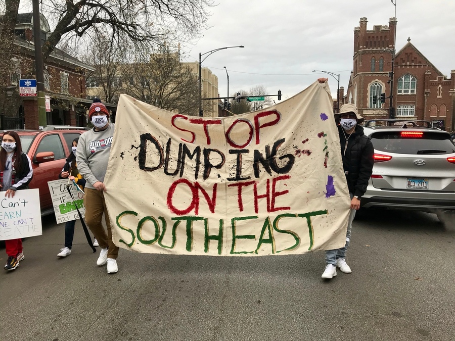 General lron Investigation due to Protests about its RelocationGeneral Iron, a metal shredding company has been attempting to relocate from its Lincoln Park neighborhood to the southeast side of Chicago. The building has already been made and is ready for use but the permit that would allow for the building to be used was delayed due to protests by people living in the neighborhood it was planned to move to. It was protested because of the air pollution that would come with it, these protests were heard by the government and so the permit was denied. The permit will not be approved until the EPA finishes investigating the pollution output that would be being moved to this place. This is relevant to American environmental history because it is very similar to the situations of environmental racism that we discussed in class. The neighborhood General Iron was attempting to move to is predominantly latino and already has been dealing with other environmental hazards. This environmental issue is very similar to the things we have learned about in class and shows how history tends to repeat itself unless we break the cycle.
 -
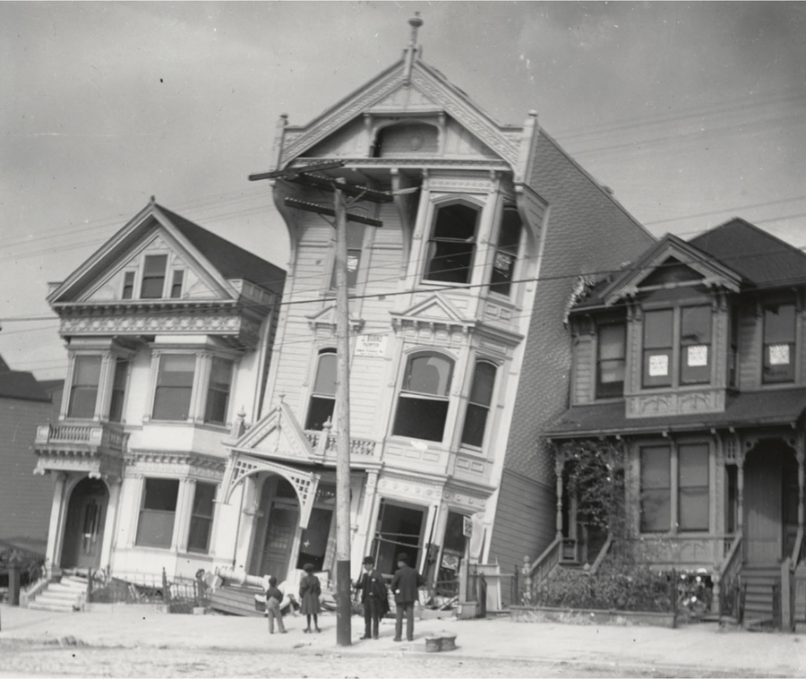 "Liquefaction"- Aftermath of 1906 San Francisco EarthquakeWhen the San Francisco Earthquake hit on April 18, 1906, there was serious damage to many of the homes that were built on non-firm land near the water. Homes were being built on land that was once not solid ground, so this land was not as firm as land needed to be to truly support a house. When the earthquake hit, these homes that were built on non-firm land, began to sink into the ground because the land underneath turned to almost a liquid form, which was unable to support a house and keep it upright. Thousands of homes were damaged in a similar fashion because San Francisco, during this time period, began to build many houses in areas near the water that were built on non-firm land. San Francisco is a place with many hills so it was challenging to find the space to build more homes. That's why homes began to be built near the water, on land that was once not solid.
 -
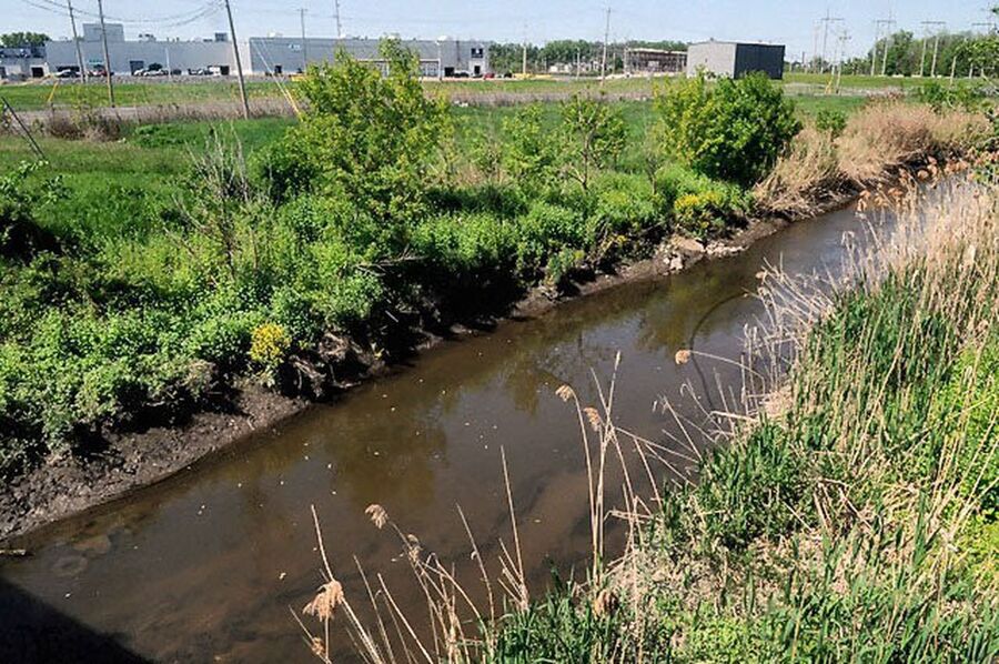 Toxic Waste found in CNY BackyardsToxic waste from the General Motors Inland Fisher Guide plant was found in the backyard of 19 homes in Salina, NY. PCB's were found to have been buried in these backyards, creating a major health risk for those residing on the land. The company that produced these chemicals closed in 1993, leaving behind toxic pollution in Ley Creek, which flows into Onondaga Lake in Syracuse. This trail of waterways allows the PCBs to travel and end up in inconvenient locations such as recreational and household land.
 -
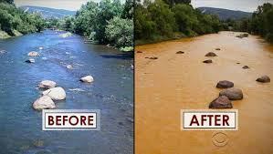 Gold King Mine Waste Water SpillThe Gold King Mine spill occurred when contractors working for EPA opened up a tailings dam which is a sealed embankment to store mining byproduct and wastewater. This opened tailings dam then flooded into the animas river and the Colorado River system and leached heavy metals into the water.
 -
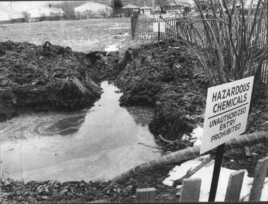 Comprehensive Environmental Response, Compensation, and Liability Act of 1980The Superfund Act was signed in 1980 and sought to target chemical waste management by investigating and cleaning up waste sites as well as label potentially hazardous location created from toxic waste. The Act also attempted to identify and reprimand all parties that release polluters into the environment.
 -
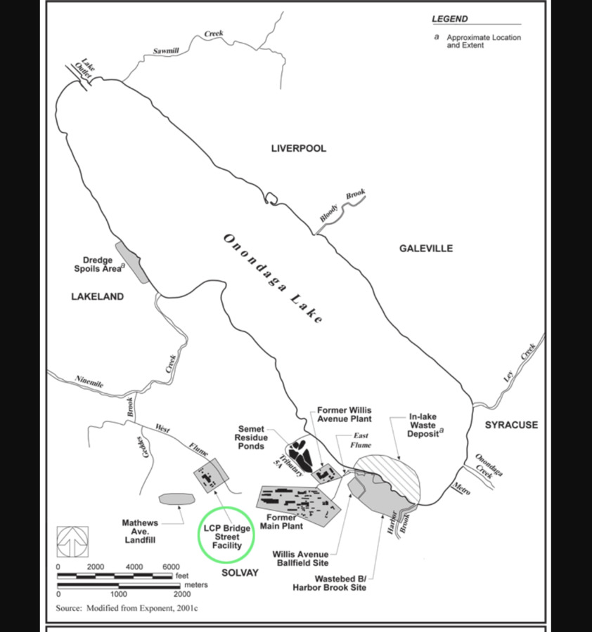 Allied Chemical Company Producing Toxic WasteThe Allied Chemical Company had a chlor-alkali plant in the city of Syracuse located right near Onondaga Lake. It was found that chemicals such as xylene, mercury, and chlorine gas. These toxic chemicals spread through out the air and the ground, contaminating groundwater and eventually ended up in the soil, plants, and fish in the lake. Clean up from this company has still not been completed.
 -
 Love CanalLove Canal came to be after construction was halted on a canal project that branched off of Niagara Falls. Hooker Chemical Company who was located nearby saw this failed project as an opening for removing 21,000 tons of toxic chemicals by simply dumping them in the empty canal and covering it with clay. The disheartening detail involved is that the Government officially sanctioned Hooker granting them the free improper dumping rights. The biggest heartbreak with Love Canal is that the Government then allowed houses, parks, and schools to be constructed on the toxic waste dump. New York Officials and School Board members knew of the dangers, but instead chose to publicly hide them because of the cheap cost of the land. Not much was said or done until 1978 when a mother began to connect the dots between the buried canal and all the sicknesses involved in the small community. Her small, grass-roots door-to-door lobbying was difficult and small at first, but eventually grew to the national level after getting past unhelpful officials. Finally, in 1978 a state of emergency was declared and 200 families were removed. Nature is always changing and the altered water columns surrounding the Niagara caused these toxins to leak. Removing 200 residents was not enough; everyone had to go. In 1981 Regan declared another state of emergency and all remaining families were removed. Clean up projects were activated in attempts to fix the damage. In 2004, Love Canal was finally fenced in and allowed to grow naturally without the impact of humans due to the 82 horrible toxins and carcinogens that lay below the ground.
 -
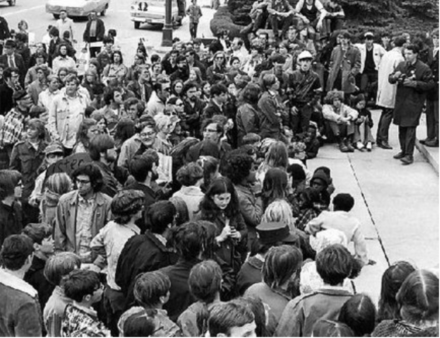 The First Earth Day in Syracuse NYOn the very first Earth Day ever observed, protestors in the city of Syracuse organized a "sludge trudge," touring the parts of the city contributing the most to the pollution problem. Onondaga Lake was the most polluted lake in the country due to all of the industrial pollution factories in the city created. Swimming in the lake was banned in 1940 lasting up until a few years ago when they declared it was "safe" to enter.
 -
 The First Earth DayEarth Day was the result of the environmental movement of post war America, Senator Gaylord Nelson was the person who came up with the idea. The event was meant to raise awareness about the present environmental issues, and it quickly became popular around the USA, with over 20 million participating in the various programs. Earth Day also led to some important environmental legislation getting passed.
 -
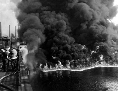 Cuyahoga River FireThe past century, Cleveland Ohio was a major industrial manufacturing hub. Near the end of the 1960s, waste and sewer disposal lacked any major regulations. All of these pollutants were constantly littered into the Cuyahoga River near Cleveland. This river was considered one of the most polluted rivers in the U.S. because of these conditions. Beginning in 1868, the river caught fire multiple times. The latest occurrence happened in 1969, when a train sped by igniting oil covered debris. There were no major damages and injuries like previous occurrences, but there was a lot more media coverage due to the timing this took place in; right around environmentalism was taking off. Because of this fire, congress was inspired to prevent future events like this again by passing the National Environmental Policy Act on the first day of the very next year in 1970. This act was crucial in establishing the Environmental Protection Agency. So, overall, this event was more impactful legislative wise in comparison to the lasting damage/fatalities caused by the Cuyahoga River fire.
 -
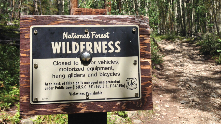 President Johnson Signs the Wilderness ActThe Wilderness Act was signed by President Johnson to set aside land that would be completely uninhabited by humans. This land was public land that the government said would remain completely untouched by roads, motor vehicles, or development of any kind. The Wilderness Act was an important turning point in American environmental history. The act helped to represent some of the new values of the American people, one of which was enjoying untouched nature.
 -
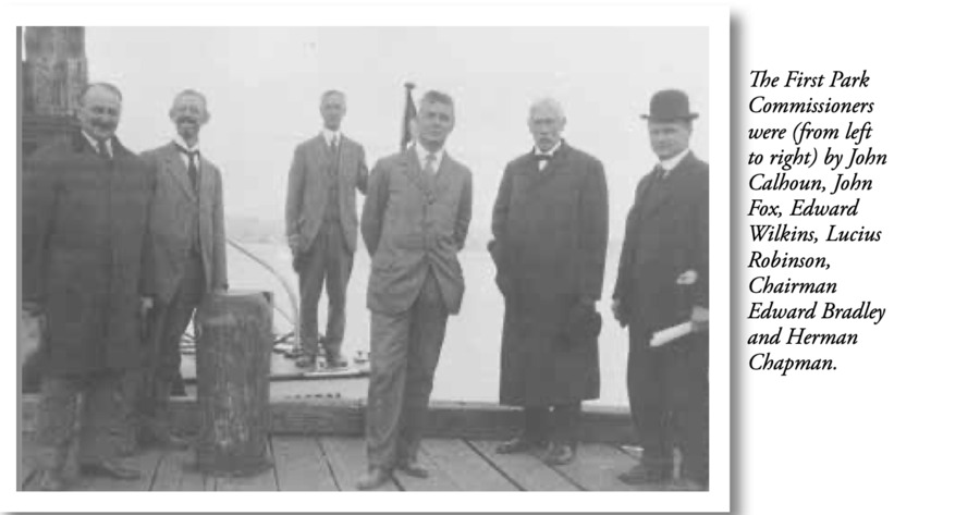 The Connecticut State Parks and Forest Commission was established.Connecticut was becoming very highly populated, specifically congesting in cities, causing many residents of the state to seek out relief from the packed city life. The first meeting was held on September 29th, 1913 where the general assembly wrote "there was the need, desire and opportunity to begin a State Park Commission in Connecticut". A systematic examination of Connecticut's landscape was made by a man names Albert M. Turner who traveled the 254 mile Connecticut coast to determine what land had state park potential. Upon return, he established Bluff Point in Groton, Hammonasset Beach in Madison, and Sherwood Island in Westport to be the first Connecticut State Parks.
 -
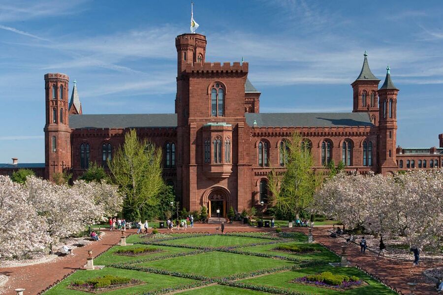 The Smithsonian Institution creates a list of over 3,000 endangered speciesThe Endangered Species Act, signed by President Nixon in 1973, provided the framework for the conservation of endangered species and their habitats. For this act to fulfill its goal, it was essential to have a comprehensive understanding of what species could be considered endangered and what species needed protecting. In 1975, the Smithsonian Institution proposed a list of over 3,000 species that could be considered endangered or threatened and should be protected by the Endangered Species Act.
 -
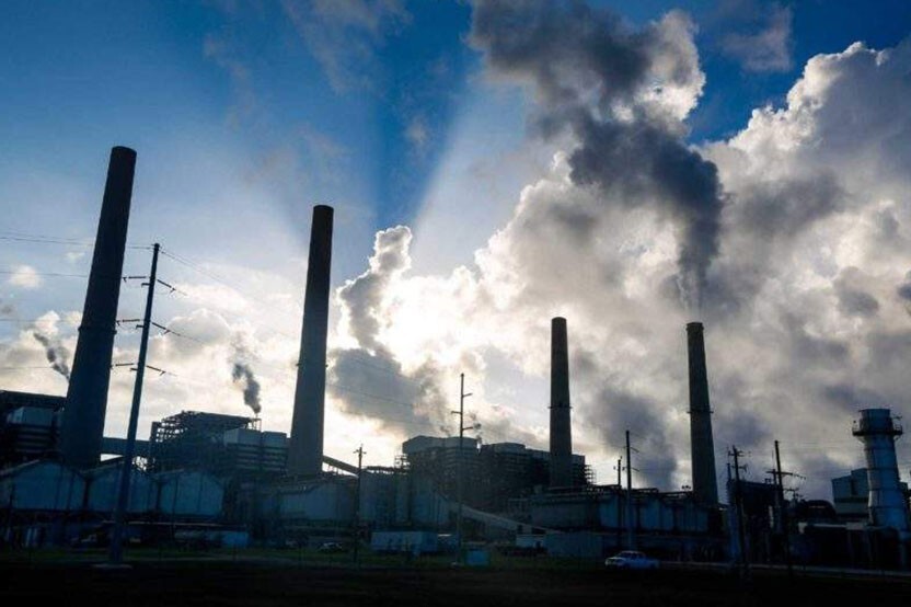 Exxon mobil uses big tobacco skeptism to fight against climate scienceExxon Mobil used the same "playbook" as big tobacco to fight climate science. This was done to create a divide between people usually for the benefit of the business and fighting climate regulation. This relates to what we learned in class (or what we will learn) because as environmentalism becomes more prominent and science comes to light businesses will have to front costs of being more environmentally friendly which takes away from their profit. Also, it is important to mention that with the science of climate change becoming more common knowledge people will begin to realize just how much damage these industries have done and will make them obsolete and force them to pay. Lastly just like the article we read criticising air and water protection legislation this company would go on to not blame itself but consumers for climate change. Though with this being the case we now have politized the environment to the point that these industries will continue to go on unlike the movements of the 70s where environmentalism was somewhat bipartisan.
 -
 Earth Day Activities Cross BordersIn joining activism in the United States about environmental activism and conservation, organizers in Canada organized an anti-pollution fashion show. Taking place at the Place Bonaventure hotel in downtown Montreal, the activity was highlighted with women dressed in "jump suits, heavy vinyl gloves, and plastic face masks."
 -
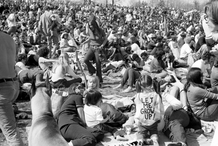 Earth Day 1970 Demonstration at Belmont PlateauEarth Day demonstrations were extremely widespread during its inception in April 1970, and one of the more notable events took place at Belmont Plateau in Philadelphia. The area celebrated the new holiday for an entire week, hosting numerous speakers and events throughout the course of the week. These were headlined by the cast of "Hair" on Broadway, beat poet Allen Ginsberg, and Maine Senator Edmund Muskie. By including so many popular celebrities in their events, the organizers of this Earth Day celebration were able to spread their ideas throughout American society. The organizers were assisted by CBS news show host Walter Kronkite, who put the Philadelphia Earth Day logo behind him during the show. The event left a lasting impact on American culture, expanding the reach of Earth Day for decades to follow.
 -
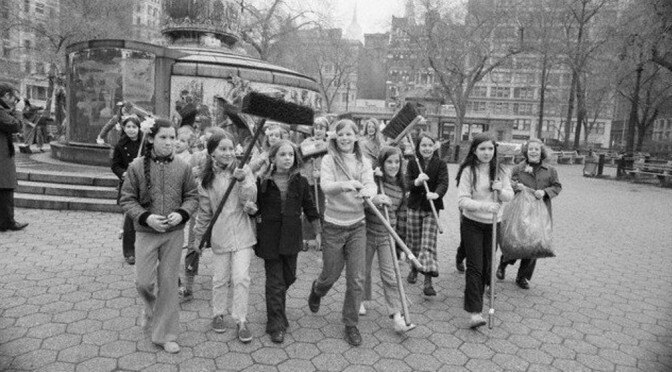 Earth Day, Washington Square Park, 1970April 22, 1970 was the Earth Day where people in major cities all around the United States united outside and protested. They fought against air pollution, oil extraction and spill, and cleaned up trash. Many protesters were college students and younger advocating for future generations. They were frustrated that government policies weren't focusing on saving the environment, and were fighting for an overall quality of life. Earth Day was a national phenomenon, and since there had already been anti war protests, the concept of marching in the streets with signs was popular and effective. This photo shows young girls in Washington Square Park cleaning up trash.
 -
 DDT and the Pennsalt Chemicals CorporationThe Pennsylvania Salt Manufacturing company was founded in 1850 by five Philadelphia Quakers. In the 1950s the company changed its name to Pennsalt Chemicals Corporation and began manufacturing a plethora of chemicals for industrial, agricultural, and household use. During the 50s Pennsalt was one of the largest producers of DDT. During World War Two, DDT had been found to be effective at limiting the spread of malaria and typhus to civilians and military troops. After the war, DDT was made available to farmers for use as an agricultural insecticide, being produced by companies like Pennsalt. These companies would go on to advertise DDT as a safe and effective insecticide for residential and household use in the elimination of mosquitos, ants, and other pests. The chemical was quickly found to be harmful to both humans and the environment, however, the movement to ban it would take over 25 years with its use finally being regulated in 1972 by the EPA. Despite the awareness of the chemical's many harms, Pennsalt continued advertising their product until production was banned.
 -
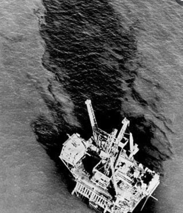 The Santa Barbara Oil SpillOn January 28, 1969, the Union Oil Company was drilling in the Pacific coast of Santa Barbara and spilled 3 million of gallons of crude oil into the beautiful Santa Barbara Channel. This body of water has crystal clear waters, is home to countless species of wildlife, has white sand beaches and it a great economic hub for the state of California. The tragic, man-create oil spill covered miles of the coastline and killed thousands of fish, birds, seaweed and other organisms. The cleanup of this oil spill was not only extremely expensive, but there was no clear, effective way to do it. Hundreds of men were sent to Santa Barbara to scatter hay along the beaches, because it is good with absorption. That hay was discarded after the oil was soaked up, and thrown into dumpsters or other bodies of water, which defeated the whole purpose of the clean up efforts. Because of this catastrophic event, President Nixon ended oil drilling and extraction in Santa Barbara. Additionally, he signed the National Environmental Policy Act (1969), which requires companies to file environmental impact reports. The Santa Barbara Oil Spill was a significant oil spill in US history and held severe impacts on the economy and the environment. This event opened the eyes of so many Americans and revealed the horrors of human activity on the environment.
 -
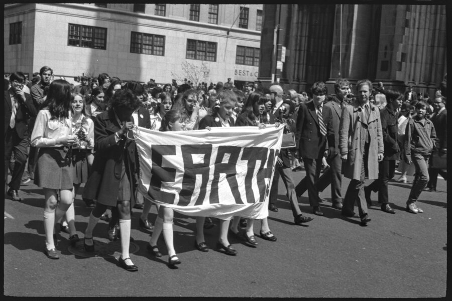 Creation of Earth DayBefore 1970, there were little to no environmental regulations. There was no Clean Water Act, Clean Air Act, EPA, etc. Senator Gaylord Nelson saw this as an issue and created Earth Day in the Spring of 1970 as a way to push this problem into the national agenda. This method worked as congress created the U.S Environmental Protection Agency in the following December to tackle any and all environmental issues and start implementing policy throughout the country. Now, every year on April 22nd, millions gather to express their passion for the environment.
 -
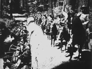 Buffalo SoldiersIn 1886 Congress created six segregated regiments which were later turned into four regiments (two cavalry units and two infantry units). These African American soldier regiments were known as "Buffalo Soldiers" supposedly because the Native Americans they encountered compared them to buffalo because they fought with honor as did the buffalo. These soldiers are important to environmental history because they were some of the first park rangers. 500 buffalo soldiers served in Yosemite National Park. Their main duties were kicking out poachers, timber thieves, and even putting our forest fires.
 -
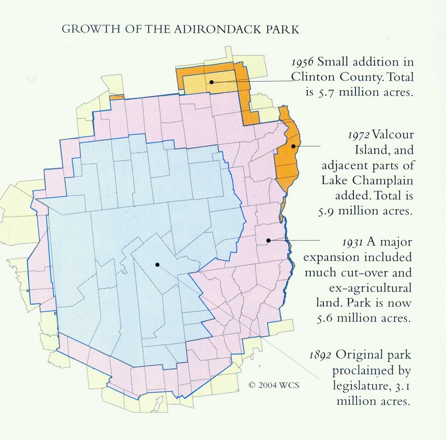 Founding of Adirondack ParkNew York state officially adopted the Adirondack Park as a region where no land "shall be leased, sold or exchanged, or be taken by any corporation, public or private, nor shall the timber thereon be sold, removed or destroyed." (Article VII, Section 7 of the New York Constitution). In 1902, The boundaries of the park were defined for the first time in a bill passed by New York.
 -
 Solar Housing Is The Way Of The Future... Or Maybe NotFor the first time in about ten years, America was finally booming again. The world wars combined with the great depression left many dead, cold, starving and sick. The post war market economy brought money and jobs back to Americans. For once, people had more money than they needed and they had a large urge to spend it. During this boom, fossil fuel usage and the potential for solar housing became a minuscule discussion. For ten years, prestigious Universities funneled research into solar housing. This new method of heating was going to change the world. Scientists at this time didn't even have a grasp on photovoltaic effects; this increased solar research was solely led by heating purposes. Scientists like Maria Telkes who conducted research at MIT led this field for its short run until it died in the mid 1950's. Big businesses had a different plan for the future which did not include solar housing. They wanted cheap housing produced on a large scale so that they would generate more profits. Their actions combined with essentially no government funding created a mechanism bound to fail. After 1955, solar energy would not receive serious research for another twenty-five years.
 -
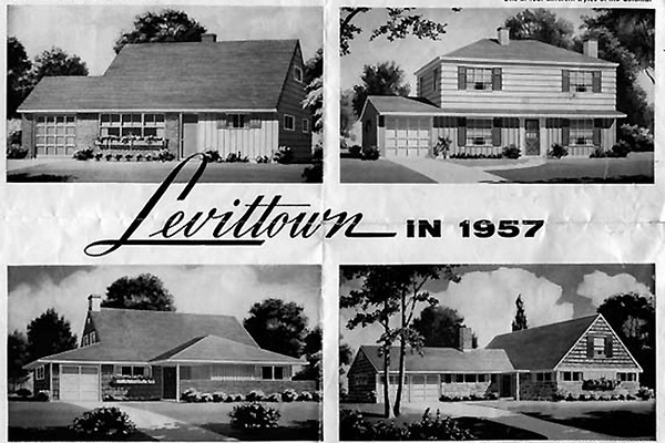 Levittown, PennsylvaniaLevittown, Pennsylvania is one of the best examples we have of the transformation of suburban America. Levittown had two locations in the United Sates, the first being on Long Island, New York. William J. Levitt utilized a twenty-six step method in order to most efficiently mass produce cookie-cutter suburban homes as quickly as possible on a given land acreage. His assembly-line like production methods resulted in a finished house being produced roughly every 16 minutes, an absolute engineering marvel at the time. When all was said and done with original constructions, there were over 17,000 homes built in this Pennsylvanian town. Its relationship to our class and environmental history involves the town's ignorance of solar technologies and energy-efficient homes and its embracement of 100% electric homes. Levittown, Pennsylvania revolutionized the housing market, home construction, and most importantly the American suburb.
 -
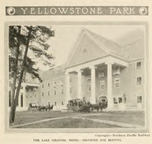 Lake Hotel at Yellowstone National ParkLake Hotel was the first hotel to be built in Yellowstone National park in 1891. Construction of the hotel was financed by the Northern Pacific Railroad company. The hotel was built to look sophisticated and grand, earning the nickname "Lake Colonial Hotel". This is marketing indicates that Yellowstone National Park was originally marketed toward the wealthy. The park was a way for the rich to get away from the city and enjoy nature like real transcendentalists. The fact that the hotel was built by a railroad company underscores the intent to bring people from the city to the park for vacation. The construction also shows the level of acceptable infrastructure allowed in the park. The goal, it seems, was to keep the park as minimal as possible while also being able to offer the greatest amount of amenities possible without losing the natural ascetic.
 -
 Automobiles and Sequoia National ParkSequoia National Park was the second national park recognized by the United States government and the first part to protect a living organism, sequoiadendron giganteum. Originally, there was one small path that lead to the giant forest but in 1903 the first road was constructed allowing vehicles to access the area. The rise of the automobile industry resulted in the creation of Generals Highway in 1926 proving the park to be more accessible than ever before. It was even said that the check-in station at the entrance of the park experienced traffic from the influx of visitors.
 -
 Sequoia National Park is establishedOn September 25, 1890, President Benjamin Harrison established Sequoia National Park, making it the second national park in America. Situated in the middle of California, this large area of mountainous land is famous for its groves of giant sequoia (Sequoiadendron giganteum) trees, which includes a subsection known as the Giant Forest, named for the fact that it contains 5 out of 10 largest trees in the world by volume. As the park was created to protect these giant sequoias from logging, it made history as the first national park formed to protect a living organism. Because it was established so early in the national park process, U.S. Army Cavalry troops were assigned to protect the park for its first twenty years, and it didn’t become a popular destination to visit until national automobile travel increased in the late 1920s. A century later, Sequoia is one of the most well known national parks and it has successfully preserved a landscape that resembles the pre-colonial Southern Sierra Nevada.
 -
 Invention and Implementation of the Air ConditioningThe idea of air conditioning was created by Willis Carrier, it started with the need to cool down printers for the ease of producing newspapers. From this invention even more complex models of air conditioning that could be used to keep larger spaces cool started to come about. As these came about people were not the most accepting at first but once they began to realize the possible benefits of having air conditioning it became a marketable product. Post war, the 1950s was the boom of popularity of having air conditioning in homes. This revolution of homes became so prevalent that now homes are more likely to have air conditioning than garages. This invention of the air conditioning competed with the solar home and eventually won the race allowing for the U.S to be the only place that uses air conditioning at such a high level, the amount of energy used for air conditioning here is greater than anywhere else. Though solar energy may have been more environmentally friendly in the economic race it lost.
 -
 Shrinking of Glaciers in Glacier National Park"In 1850, there were about 150 documented glaciers in this area of the Rocky Mountains. Most were still there when the national park was established in 1910. Maps of the glaciers in 1968—surveyed by airplane by the USGS—counted 83 ice-and-snow bodies with areas greater than 0.1 square kilometers. Today the number of ice bodies is 25." -https://earthobservatory.nasa.gov/world-of-change/Glacier This connects really well with Cole's Essay on American Scenery as it showcases another issue we now have with the "sublime" disappearing.
 -
 Lacey Act of 1900This law was introduced by Representative John F. Lacey before it was signed into law by President William McKinley. The main purpose was to implement civil and criminal penalties for those who violate the new violations. It aimed to protect wildlife and plants by prohibiting imports, exports, sale, and purchase of illegally hunted animals or acquired plants. This also tried to prevent introduction of foreign species of plants and animals into federally protected areas. Later in 2008, timber protection was added to this act with an amendment which targeted illegal logging and products being made from those materials. This ties in because we discussed Roosevelt and others seeing nature for its beauty. And, how they wanted it to be appreciated and protected. Here is where actions began to take place. Although timber and forest protection was not added until the next century, I thought that these acts were better than nothing regarding preservation efforts in order to scare people away from over-consumption and hunting in America. In my opinion, penalties are the most effective way in discouraging deforestation and other behaviors many people do for money.
 -
 Pre-Industrial BostonBoston was founded in 1630 by English Puritans fleeing religious persecution. The settlers originally lived in Charlestown but moved to the Trimountaine peninsula due to the lack of freshwater near Charlestown. The settlers then renamed this area Boston after the area they came from in England. On top of this, some of the preindustrial industries of Boston were shipbuilding, whaling, and fishing. As with most early established towns, these places relied heavily on what was available locally.
 -
 St. John Wood Working CompanyThe St. John Wood Working Company, originally named Fox and St. John, opening in 1853 to match the heavy demand of the fast-building city of Stamford. The name was changed to Hoyt and St. John, then Hoyt, Getman & Judd. The company was stationed at the canal dock where they were able to load boats with their productions for transport around the city. As owners changed and the company got bigger, the manufacturing and mercantile segments of the business were separated, the name Hoyt was dropped, and St. John Wood Working Company was the last name to apply, run by Getman & Judd until 1965. The company was so large that it employed 150-200 men and supplied wood all over New England, and largely into New York City.
 -
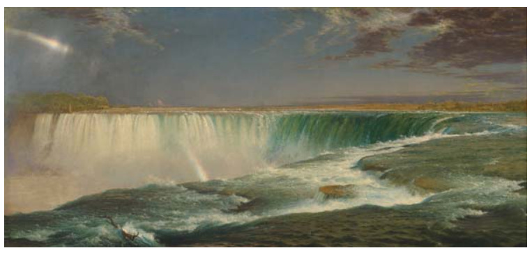 "Niagara" by Frederic Edwin ChurchFrederic Edwin Church was a 19th century painter who participated in, and was a major contributor to, the Hudson River School movement of art. Church was Thomas Cole's star student and he led a second generation of the movement following Cole's death. In his painting we see the iconic Niagara Falls, which were regarded as one of the greatest natural wonders in the United States at the time. We can see a visual representation of the beauty and splendor of the falls, for which Thomas Cole valued them. Not only is the magnificence of this wonder depicted in its size and the power of surging water, but so too is its beauty in the vibrant colors, the refreshing mists, and the unifying structure of the horseshoe shape. Lastly, the brightness of this painting exemplifies the transcendental-like offshoot of the Hudson River School known as luminism. The illuminated wonder suggests that this natural example of splendor is a heavenly oasis for one to be closer to God.
 -
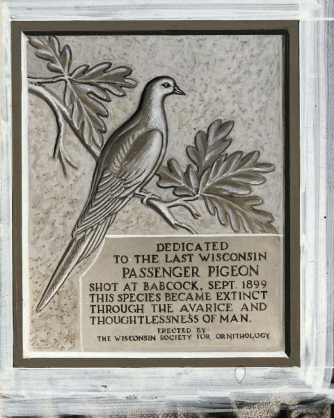 The Largest Nesting of Passenger PigeonsIn 1871, the largest nesting of Passenger Pigeons ever recorded in the United States took place in central Wisconsin. An estimated 136 million pigeons gathered over a 850-square-mile area. It was reported that there were so many in the trees-- sometimes 100 nests in one tree-- that entire trees would collapse due to the weight. Pigeon hunters would storm breeding grounds and cut down trees in order to capture the birds. In 1947, a monument celebrating the Passenger Pigeon was erected in Wisconsin's Wyalusing State Park. The monument's plaque reads "This species became extinct through the avarice and thoughtlessness of man." Aldo Leopold spoke at its dedication, saying "We have erected a monument to commemorate the funeral of a species. It symbolizes our sorrow. We grieve because no living man will see again the onrushing phalanx of victorious birds, sweeping a path for spring across the March skies, chasing the defeated winter from all the woods and prairies of Wisconsin. Men still live who, in their youth, remember pigeons. Trees still live who, in their youth, were shaken by a living wind. But a decade hence only the oldest oaks will remember, and at long last only the hills will know."
 -
 Yellowstone National Park is EstablishedYellowstone was the first National Park to be created in the United States. This park marked the first of its kind to persevere nature in such a way where people could enjoy it. Yellowstone was a way to preserve the amazing features of nature from being destroyed without keeping people away. This was an important stage in environmental history because it showed how nature and be saved and enjoyed for more than a commodity.
 -
 The Fruitland's Transcendentalist Society is CreatedDeveloped by Amos Bronson Alcott and Charles Lane, the Fruitlands Transcendental Center was a commune in Harvard, Massachusetts where transcendentalists lived and gathered to share their ideas. Residents of this community engaged in a vegetarian lifestyle, used no artificial lighting at night, bathed in unheated water, and lived their lives with as little man-made technologies as they could. Ralph Waldo Emerson visited this community when it was established and predicted that it would not last very long. This prediction was correct, the center closed down after its first winter due to difficulty producing enough food for the community without the use of farm animals.
 -
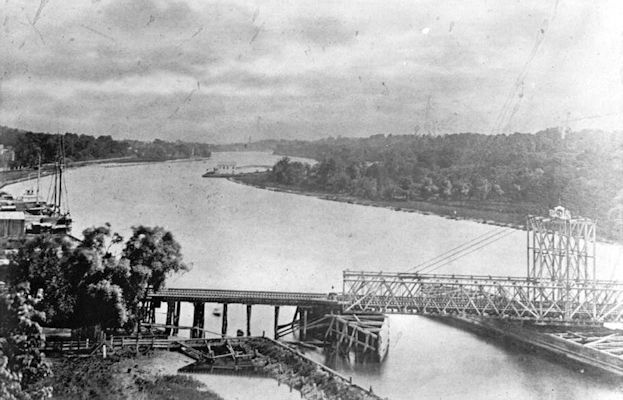 City of Newark first steps to protect drinking water sources prove unsuccessfulIn an effort to limit the contamination of the source of the city of Newark's drinking water, the city restricted any upstream disposal of industrial or animal waste. However as the city's industries took off towards the 1880s, the pollution into the Passaic River could not be stopped. Like other cities we have studied, as a result, the city had to find another source of clean drinking water due to unchecked industrial practices.
 -
 Birds in FashionDuring the late 1800s and early 1900s, birds became a pinnacle in fashion as wealthy women would have bird feathers and taxidermied birds on their hats. The popularity of the hats led to many bird populations reaching extinction or near extinction. This forced politicians to pass laws for bird conservation, and many environmental groups also pushed for the conservation of these birds. This is still relevant today because the relentless mass hunting of exotic bird species shows society's desire to do something, and worry about the consequences later. This is because of the mindset that natural resources were inexhaustible.
 -
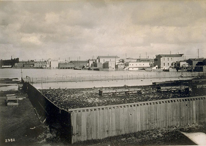 San Francisco Slaughterhouses - ButchertownToward's the end of the 19th century, the slaughterhouses that were stationed throughout San Francisco began to receive backlash over how close they were to large residential areas and the environmental harms they were causing. People did not want to live anywhere near slaughterhouses because of the terrible stench that was caused by the constant slaughtering of animals. People believed that the slaughterhouses that were close to residential areas were a contributing factor in the variety of diseases that were plaguing large, overpopulated cities in the 19th century. For these reasons, government intervention soon followed to answer the calls for change. In the late 1860s, "San Francisco passed a series of laws that first banned slaughter from certain parts of the city, and ultimately established a particular, finite space for killing and keeping of animals that would become known as Butchertown" (Robichaud,4)
 -
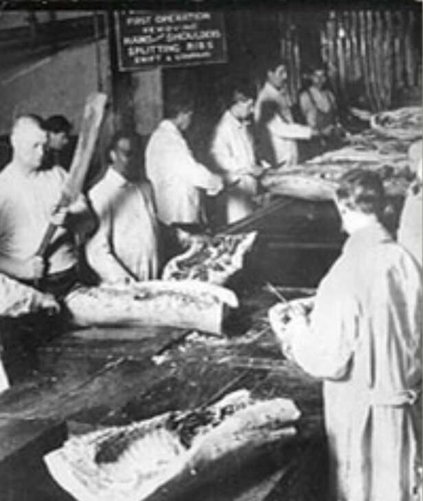 The Slaughterhouse CasesIn 1869, the Louisiana Legislature passed a law that essentially monopolized New Orleans slaughtering companies under one corporation. As a result, hundreds of small, private butcher shops were driven out of business. The new monopolization was alleged to improve the quality of production and meat of these butcher shops, because they were previously deemed unsanitary. The local butchers were rightfully furious with this new law, because they were prevented from making earnings, and they believed the law went against the privileges and immunity clause of the Constitution. This case was ultimately brought to the Supreme Court claiming it was a violation of the 14th Amendment; the Court, however, ruled against the slaughterhouse. This case proved that the United States was shifting toward an increasing centralized government. The case also indirectly accounted for an improved food regulation process because having the slaughterhouses under one company would allow for a more thorough, safe food inspection.
 -
 Construction of Golden Gate Park's Recycled Water PlantDubbed the McQueen Plant, the Golden Gate Recycled Water Plant was the first of its kind in the state of California. It irrigated the park, and created lakes, brooks, and other artificial water features. Prior to the construction of the facility, the city used raw sewage to irrigate the park, and residents began to complain about the smell. A central location for the plant was chosen in order to make it easier to transport the water to the entire parkland. Production of the plant peaked at 750,000 gallons per day in its initial years, which was less than its goal of 1 million per day. The plant remained in commission until 1982 due to high expenses, and the park was left to rely on groundwater. The facility has since been repurposed as the Urban Forestry Center for the Recreation and Park Department, and in 2018 a new facility was scheduled to be built, and its completion is scheduled for this year.
 -
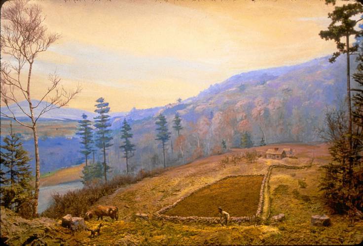 Firewood Shortage in the NortheastBeginning in the 16th century, Europe had experienced a firewood shortage, causing them to lose warmth, food, and their homes. These struggles were enough to drive the poorer class of England to travel to the Northeast of America to what, at the time, seemed like an endless supply of forest. Although they were new and terrifying, the forests of Connecticut, New York, Massachusetts, and Vermont had eventually been cut down in half. This firewood was a necessity, and the settlers were participating in strenuous amounts of work, especially compared to farming in England. Between 1500 and approximately 1850, they had gotten comfortable with cutting down trees, and started their new lives as farmers. They transformed the dark, untouched, virgin forests to bare farming land, and used it to build homes and raise other resourceful species of animals. The North American Forest Commission estimates that today, there are two thirds the amount of trees as there were in 1600, however, the expansion of the english farmers to the northeast allowed for one of the most significant farming advancements in American history.
 -
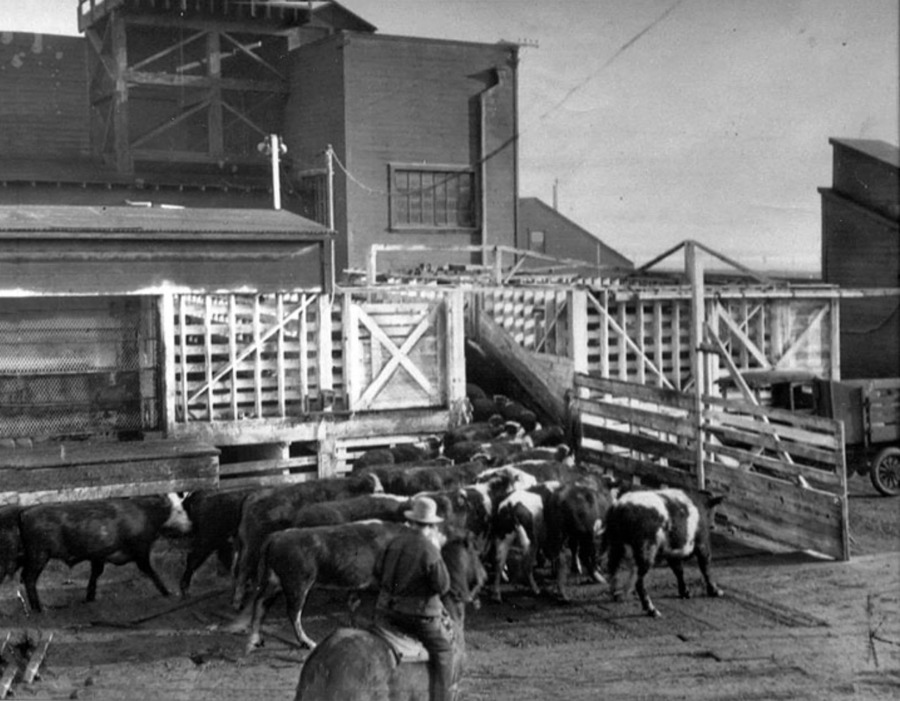 The Rise of ButchertownFrom 1860 to 1870, San Francisco's population grew exponentially causing an increased concern over the city's sanitary situation. By the mid 1860s, slaughterhouses in San Francisco began to be pushed from the city center by residents and local government agencies such as the SF Department of Health due to their foul stench and new scientific evidence suggesting that environmental factors might be a source of disease. In 1868, a group of butchers purchased land along mission creek, far from the city center. The creek and ocean tide underneath these slaughterhouses acted as a natural sink that would carry away offal, blood, and other byproducts of the butchering process, into the San Fancisco Bay causing a great deal of pollution.
 -
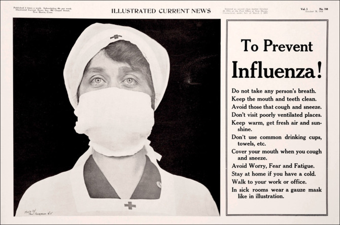 1918 Pandemic InfluenzaIn 1918 a new deadly flu arose that was eventually labeled a pandemic. This flu caused by an H1N1 virus, was first seen in the spring of 1918 in military personal. As WW1 was occurring, the crowded military camps and constant traveling acted as the perfect environment for this flu to develop and spread. An estimated 600,000 deaths were recorded in the U.S., with 50 million deaths worldwide.
 -
 Buffaloes Near ExtinctionHundreds of years ago buffaloes roamed all parts of the country in great numbers. As explained in The Ecological Indian, extreme overhunting of hurds led by Euro-Americans and Native Americans occurred, dropping the buffalo population significantly. By 1833, buffaloes no longer roamed the land to the east of the Mississippi River. Mass killings occurred to obtain enough meat and fur to keep up with the demand brought by the capitalistic society of Euro-Americans. Now, buffalo and bison can only be found in western states like Colorado, frequently roaming on protected land in efforts to protect the species.
 -
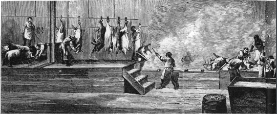 Birthplace of Cincinnati Pork Disassembly LineIn the early 1830s, there was evidence of mass production lines in Cincinnati where teams of men would systematical disassemble a hog corpse for its pork meat. By 1837, a team of 20 men could sufficiently slaughter 620 pigs in 8 hours. Cincinnati was dubbed "Porkopolis" until Chicago took the lead in pork production in 1862.
 -
 Hog Butcher of the World (Chicago Meatpacking Industry)With the rise of meatpacking, Chicago quickly came to the forefront in terms of the major meatpacking industry. Chicago was a perfect place for the meatpacking industry because of its central location and easy access to other major cities through the train systems going through the city. Three major companies took over the industry, Nelson Morris created the Union Stockyards (a major meatpacking plant), Philip Armour, whose system was an inspiration for Ford’s assembly line, and Gustavus Swift, who invented the refrigerated railcar. Each of these inventions or innovations paved the way for Chicago to take over the meatpacking industry. They processed more than 13 million livestock a year in the years leading up to the depression. Not only did this revolutionize the meatpacking industry it also created a lot of jobs. This all relates back to the environmental history aspect because of how harmful the rapid growth of the meatpacking industry was for the way we consume meat.
 -
 Recipes for Passenger PigeonIn 1883, Mrs. D.A. Lincoln's cookbook "Boston Cook Book What to do and what not to do in cooking" is published. On pages 262-263 Mrs. Lincoln describes several ways to cook pigeon, most likely passenger pigeon. Obviously, this cookbook did not really contribute to the extinction of the passenger pigeon, but it is interesting to see exactly how this food item was prepared in everyday homes. This cookbook seems targeted to the common cook, not fine establishments, and its recipes were probably employed well before the publishing year of 1883. These recipes illuminate the place passenger pigeon had on the common man’s table as a vital source of food, not just for sport.
 -
 European Settlement Impact on Chesapeake Bay RegionDuring the 1700's the Chesapeake Bay Region became heavily settled by Europeans. Before their arrival, 95% of the region was covered in forest growth but by 1775 this growth had dropped down to 70%. The main cause of this deforestation was due to the introduction of the plow. There was also ecosystem consequences such as extinction of beavers because they were heavily sought out by traders for their fur.
 -
 Head-Smashed-In-Buffalo-JumpHead-Smashed-In-Buffalo-Jump is a historic site that was used by indigenous people of the plains region, specifically the Blackfoot. The Blackfoot would drive herds of buffalo from a nearby grazing area 2 miles away over nearby cliffs in one of their most successful forms of hunting. The tribe had "runners" who, dressed as wolves and coyotes, would chase and direct large buffalo herds towards a geographic trap. The cliff(s) are not extraordinarily deep, but the weight and force of the entire herd falling on its own members was enough to guarantee injury to many of the buffalo in the herd. These injured buffalo would collect at the bottom of the cliffs where they would be dressed and consumed by the Blackfoot. The site gets its name from a young Indian brave who wanted to watch his people successfully hunt from a different perspective. The boy put his back to the cliffs and, covered by a small rock ledge, was able to witness scores of buffalo driven from the cliffs above him fall like rain in front of him, from the perspective of someone hiding behind a waterfall looking out through the water. This hunt was unusually successful and bodies of buffalo continued to pile atop of one another until the boy was pinned between rock and beast. The young Indian brave was not discovered until enough of the buffalo were butchered to reveal the brave's body and his crushed head. The site is significant because it serves as a constant reminder of environmental history when buffalo were unbelievably abundant and dominated the western side of our nation, specifically in the Plains and Midwest region. The site reminds us of a time when nature flourished before American Indians and eastern game hunters decimated the buffalo population. The site was designated as a National Historic Site in 1968 as well as a World Heritage Site in 1981. The site and its exhibit/museum attachment have attracted over 2.5 million visitors from around the globe since its "opening" in 1987. The site is additionally significant to environmental history because the site was utilized for hundreds upon hundreds of years before the introduction of horses and firearms, which ultimately were a death sentence to the buffalo in the Midwest. (Not sure what is going on with the date range but the time frame was 5800B.C. - 1850 A.D.)
 -
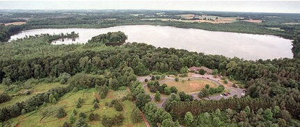 Protecting Species at Beaver Lake Nature CenterBeaver Lake started off as a natural landing spot for many animals during their migration periods. Additionally, the land surrounding the lake was used for growing tobacco, potatoes and corn. Cows often grazed the land and other animal life was very obviously present. In the 1920s hunting was permitted on this land, this changed in 1963 when Onondaga County acquired all but 10 acres of the property in attempt to protect and preserve it along with the species within. The lake is currently a popular hiking spot in Central New York with 9 miles of trails, there are also informational programs for kids as well as adults who want to learn the history of the lake.
 -
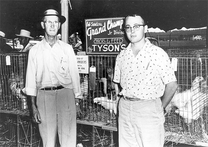 John W. Tyson begins selling chickens in Springdale, ArkansasJohn Tyson and his family moved to Arkansas during the Great Depression with the goal of finding better economic opportunities. Food rationing brought about by WWII had seriously increased the demand for certain products, one of which was poultry, Tyson saw this opportunity and began raising chicks and as well as selling chickens and feed to local farmers. Over the following decades Tyson would expand his business and it quickly grew into one of the world's largest producers of a variety of different types of meats. Despite the economic success of Tyson Foods Inc. a variety of scandals involving animal welfare and environmental degradation have plagued the business. There have been a handful of lawsuits involving water and air pollution, and Tyson is currently the global food industry's second largest emitter of greenhouse gasses, making it one of the worlds worst greenhouse gas emitters.
 -
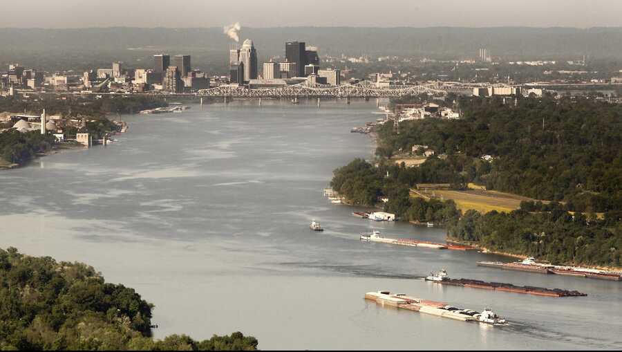 Contamination of Ohio RiverSince 2010, when 32 million pounds (according to the U.S. Environmental Protection Agency) of toxic waste was discharged into the Ohio River, pollution has only increased. These chemicals have contaminated drinking water and have been absorbed by the fish being consumed. This mainly began in the 1750s during the industrial revolution which we mentioned in class. As the years progressed; acid mine drains, raw sewage waste, and toxins with nitrate compounds have been dumped and found in the Ohio River. More limits on pollutants are being bent and broken by industries along the river which are owned by big corporations like Shell. Now species of fish and mussels are gradually going extinct due to the poor river quality. Now major efforts are needed to save the river and its inhabitants rather than the poor past attempts and corruption going on within the industries.
 -
 Dust Bowl farm in the Coldwater District, north of Dalhart, Texas.The dust bowl can be described as severe dust storms from farmers lacking ecological understanding of the way the grasslands worked. The result was 100,000,000 acres of grassland topsoil turning into dust from excessive deep plowing and over farming. Very reminiscent of the readings from Wednesday as this is a good example why capitalist efficiency and growth is not always an improvement to the land and the peoples wellbeing. This unregulated growth without any semblance of sustainability compares it self really well with production of meats in how waste of massive industry was not yet a component in consideration when expanding growing industries from the boom of new available technologies.
 -
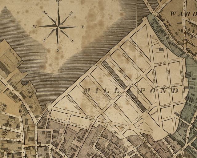 Bulfinch TriangleIn the 1640s, a group of businesspeople received permission from the city of Boston to build a dam across a cove on the northern end of the peninsula (across from Charlestown). So, it can use the tide to power the flour mill. This then created Mill Pond. Unfortunately, the mills weren't very productive and were sold off by the 18th century. In turn, the new owners decided to close the floodgates resulting in a reduced flow. This allowed garbage and dead animals to pile up in the waterway. After this, the owners began asking the town for the right to fill it in. Finally In 1807 permission was granted which began the process of filling in Mill Pond now known as the Bulfinch Triangle. Once this was completed it added around 50 acres of land to the Boston area by 1826 creating the Boston we know today.
 -
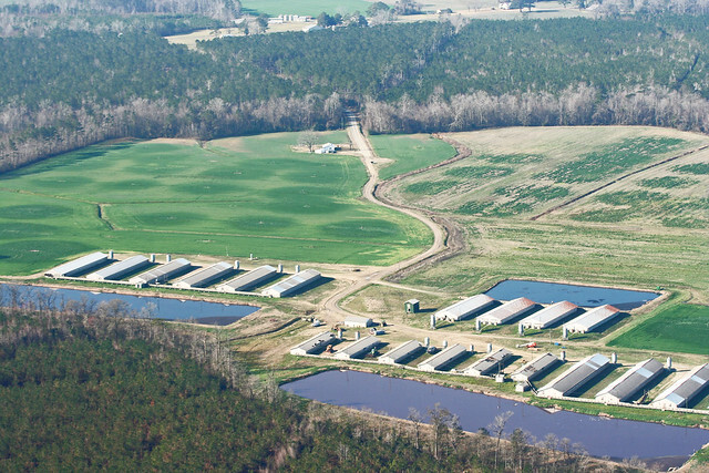 The Beginnings of CAFOs: Murphy Family FarmsIn the early 1990s, Mr. Murphy adapted his already successful hog farming enterprise, Murphy Family Farms, to a Concentrated Animal Feeding Operation (CAFO) model. Being one of the first farmers to do so, his hog-fattening technique set a nation-wide standard, with the number of hogs per farm increasing by 60% across the United States from 1989-1994. Murphy Family Farms worked to perfect hog raising, and by the late 1990s the farming operation was more efficient than any in the country. They produced 22 piglets per sow annually— compared to the national average of 15— and they were able to feed their pigs substantially less than other farms while obtaining the same amount of fat.
 -
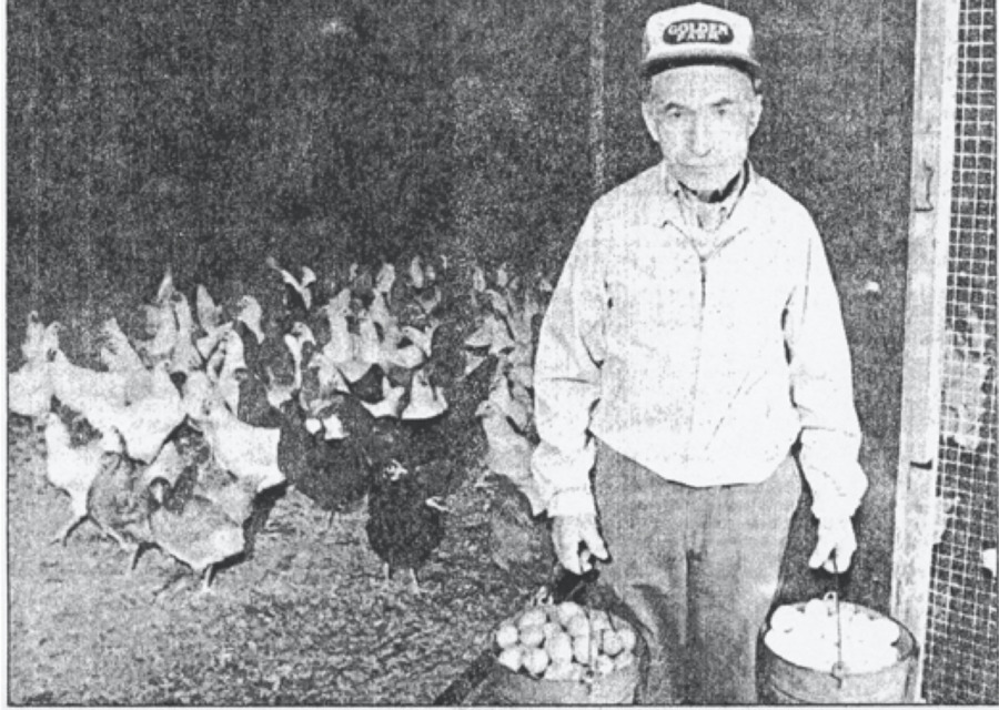 The opening of the last working dairy farm in StamfordStarted by a Mr. Wesley Sawyer, then bought by Walter Golden in the 1940s. This was the last working dairy farm in Stamford, CT. In the 1940s, there were about 4 or 5 left, but when the 90s hit, Golden's was the last one standing. When settlers first arrived in the area, they built farms around the seashore and along rivers. But as land became valuable, they continued to cut down forests. Then the farmland was seen as too valuable to not be converted into real estate and less and less of the area was dedicated to farming. Golden began farming poultry and eggs as they became more popular than dairy farms at the time, and continued work on his farm until retirement, selling his eggs to smaller grocery stores and from his own home.
 -
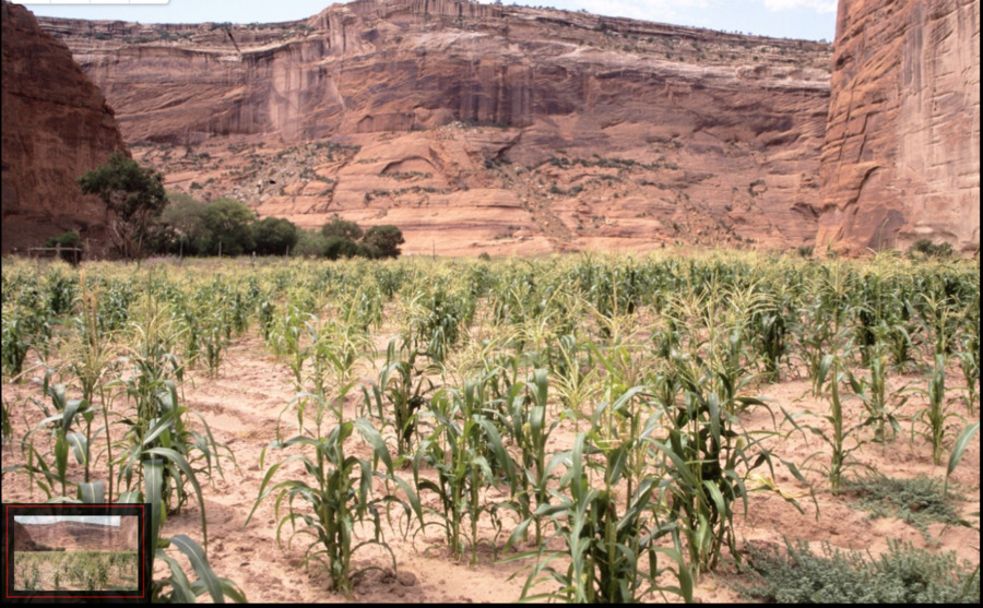 Navajo Corn Field, Canyon del MuertoThis photo highlights the extreme conditions that corn can tolerate, which is one of the many reasons that it became a staple in American agriculture and food. In a place called the "Canyon of Death" it is impressive that anything is able to survive the harsh climate.
 -
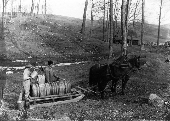 The Settlement of BenningtonThe first settlers arrive in Bennington, the first Vermont town west of the Green Mountains. By 1765 1500 people lived in the town, each house feeding it self from its own lands and herds. Primary harvests were of Corn, Maple Sugar, Wheat and Dairy products. They also built a dam at Benton Pond to provide power for several mills, potteries and furnaces, being built along the Walloomsac river. Over by the 1800s Bennington had become a local political and economic power making use of the country side to prosper. (Pictured Maple Sugar being collected by horse drawn sledge)
 -
 The New River in North Carolina is Polluted with Animal WasteAs Steinberg mentions, this event took place when animal waste flowed out of the animal farm/feedlot into the New River in North Carolina. This event wreaked havoc on the river. Not only did it hurt the river but the waste disrupted and killed many fish populations as well as eventually making its way to the ocean. This one instance of waste overflow speaks to a much larger environmental issues of the meat industry which is water pollution.
 -
 The Market for Meat Booms with the Invention of the RefrigeratorThe Industry for meat within America had been growing at a substantial rate ever since the first livestock arrived with European settlers. As population exponentially grew, so did the need for more livestock to support the new masses of people. The major issue that stood in the way was shipping the meat without it going bad. Previous methods were successful, but none more successful and impactful than the refrigerator. The first refrigeration system used in the meat packing industry was in Chicago during the year 1900. Within fifteen years, every meat packing company had refrigerators. This invention provided the ability to store meat safely for much longer which gave the packing companies security if they overhauled production to much. Unfortunately, it did not and the horrifying 1900's Chicago meat packing industry took off. This required more trains, more livestock, more workers, more fossil fuels, and more chemicals. All of these factors lead to significant environmental damage of water, the soil, and the atmosphere.
 -
 The Blackstone Canal Connects Worcester to ProvidenceThe Blackstone Canal, constructed in 1828, connected Worcester to Providence along the Blackstone River and allowed for faster and cheaper transportation of goods between the two cities. This canal opened up a wide range of industrial opportunities for Worcester, making it a crossroads city with access to more distant trade markets. In 1835, soon after the canal was built, railroads connecting Worcester and Boston were constructed to further improve trade routes and allow for more rapid industrial expansion in Worcester.
 -
Test titleBrief description of what occurred.